DRAFT. Street & Number: West of SR 18, approximately 3 miles North of Central Not for publication:
|
|
|
- Baldwin Atkins
- 5 years ago
- Views:
Transcription
1 MOUNTAIN MEADOWS MASSACRE SITE Page 1 1. NAME OF PROPERTY Historic Name: Mountain Meadows Massacre Site Other Name/Site Number: 2. LOCATION Street & Number: West of SR 18, approximately 3 miles North of Central Not for publication: City/Town: Central Vicinity: X State: Utah County: Washington Code: 053 Zip Code: CLASSIFICATION Ownership of Property Category of Property Private: X Building(s): Public-Local: District: _X_ Public-State: Site: Public-Federal: Structure: Object: Number of Resources within Property Contributing Noncontributing 1 buildings 2 sites 1 4 structures 2 objects 3 7 Total Number of Contributing Resources Previously Listed in the National Register: 1 Name of Related Multiple Property Listing: N/A
2 MOUNTAIN MEADOWS MASSACRE SITE Page 2 4. STATE/FEDERAL AGENCY CERTIFICATION As the designated authority under the National Historic Preservation Act of 1966, as amended, I hereby certify that this nomination request for determination of eligibility meets the documentation standards for registering properties in the National Register of Historic Places and meets the procedural and professional requirements set forth in 36 CFR Part 60. In my opinion, the property meets does not meet the National Register Criteria. Signature of Certifying Official State or Federal Agency and Bureau Date In my opinion, the property meets does not meet the National Register criteria. Signature of Commenting or Other Official State or Federal Agency and Bureau 5. NATIONAL PARK SERVICE CERTIFICATION I hereby certify that this property is: Entered in the National Register Determined eligible for the National Register Determined not eligible for the National Register Removed from the National Register Other (explain): Signature of Keeper Date Date of Action
3 MOUNTAIN MEADOWS MASSACRE SITE Page 3 6. FUNCTION OR USE Historic: Transportation Sub: road-related Domestic camp Defense battle site Funerary graves/burials Current: Recreation and Culture Sub: monument/marker Landscape unoccupied land natural feature Agriculture/Subsistence agricultural 7. DESCRIPTION ARCHITECTURAL CLASSIFICATION: MATERIALS: Foundation: Walls: Roof: Other: Stone N/A
4 MOUNTAIN MEADOWS MASSACRE SITE Page 4 Describe Present and Historic Physical Appearance. This National Historic Landmark historic district documentation is for significant portions of the Mountain Meadows Massacre Site in Washington County in southwestern Utah where on September 11, 1857, 120 emigrants, most of them from Arkansas, were massacred by Mormon militiamen. It is a discontiguous district made up of two parcels, capturing two known locations of the events that occurred from September 7-11, 1857, and later burial, commemoration, and memorialization efforts that continue to the present. The two parcels include approximately 760 acres of the existing approximately 3,000-acre National Register of Historic Places historic district listed in The landscape remains remarkably intact with an encircling range of mountains confining an upland valley covered with native vegetation, primarily sage and short grass. Much of the Mountain Meadows is used as pasture and range lands. Some land is irrigated for hay crops. Drainages in the form of gullies, arroyos, and ravines cross the meadows, fed by occasional springs. Visible on the landscape is the trace of the California Trail/Old Spanish Trail. The natural features of the landscape are largely unchanged, providing extraordinary integrity of location, setting, association, and feeling. The massacre site s physical features and environment provide strong and evocative linkages to the events of Location and Setting Location and setting refer to the current placement and environment of the Mountain Meadows Massacre Site, and also to the ability of these two definers of visual integrity to convey the historic character of the property being nominated through retention of physical features that were present at the time of the event. Amid the mountainous landscape of southwest Utah lies an upland valley known as Mountain Meadows. Several springs and small tributaries running down from the surrounding ridges form Magotsu Creek, which drains Mountain Meadows at its southern end. Small ridges and hillocks punctuate the relatively level terrain. A barely perceptible ridge, called the rim of the Great Basin, bisects the Meadows (in Section 10, T 38 S, R 16 W) and appears only as a slight rise when viewed from the south. The rim divides drainage. That to the north flows into the Escalante Desert, and drainage south of the rim flows into the Mojave Desert. Utah State Route 18 crosses the Mountain Meadows from southeast to northwest, heading in a north-northwest direction. The surrounding mountains form a cove encircling the Meadows. In addition to the modern state highway is a trace of the Old Spanish Trail, established in 1829, which ran through the Mountain Meadows, keeping above the creeks but away from steep slopes. (The Old Spanish Trail was designated as a National Historic Trail in 2002.) This trail later became part of the southern route of the California Trail established in It crossed present-day SR 18 in the SE quarter of Section 10. Traces of this historic route are still visible on the landscape and in aerial photographs, although the trail no longer functions as an active roadway in this location. The Mountain Meadows sandy, reddish soil bristles with clumps of sage, short grass, and juniper. Deep gullies, arroyos, and ravines cut through the landscape, providing drainage, but they have widened and deepened as the result of years of grazing. Cottonwoods line the creek beds where there is moisture in the soil. Much of the valley s land is used today for pasture and range, with some portions under cultivation with irrigation, producing hay. Historically Mountain Meadows provided fresh water and good pasture for travelers passing southwest to California. It became a rest stop for man and beast, a place to replenish before entering upon the unforgiving deserts of southern Nevada and California. According to historical accounts, the 19 th -century landscape of Mountain Meadows was much more lush than today, with grasslands dominating, and less deeply eroded with
5 MOUNTAIN MEADOWS MASSACRE SITE Page 5 ravines and gullies. John C. Fremont, passing through the Mountain Meadows in 1844, described the high valley as an extensive mountain meadow, rich in bunch grass, and fresh with numerous springs of clear water, all refreshing and delightful to look upon. 1 In May of 1859, Major Henry Prince, recording the encampment and siege site for the U.S. Army, described the site as covered with turf or scrub turf - There are but few bushes, of small sage, and, in the distance, due north, some scattering of trees, visible. 2 Today s landscape shows the effects of long-term human occupation. The land is divided into mile-square sections, parceled into ranches with fenced fields and house lots. About three miles south of Mountain Meadows is the town of Central, and about nine miles north is the town of Enterprise. Near the upper end of Mountain Meadows, a county road cuts to the northeast to Pinto and Cedar City. This is a part of the southern California Trail, constructed in 1855 and known as Leach s Cutoff. The Old Spanish Trail looped from near Cedar City through Iron Springs and north of the mountains before dropping south into the Mountain Meadows. The wagon train of Arkansas emigrants followed Leach s Cutoff. West of State Route 18, the trail appears only as a trace on the land, but is clearly visible in aerial photographs, especially where the land is not cultivated. The paths of the old California Trail/Spanish Trail and modern State Route 18 pass through several farms and ranches. Association and Feeling Association refers to the direct link between past and present when the property is the place where the event took place and is sufficiently intact to convey that relationship. The massacre site s physical features when taken together combine to evoke the feeling of this upland valley on the California Trail in the 1850s. In September 1857, a wagon train with some 140 emigrants in family groups, most of them from Arkansas (the Arkansas company ), along with their substantial herd of cattle, entered Mountain Meadows on the road from Cedar City and Pinto, following Leach s Cutoff. 3 They pulled up over the rim of the basin and rolled down into the southern end of the Meadows on the trail which now appears as a trace. Needing a place to rest themselves and their animals before embarking on the arduous trek through the Mojave Desert to California, they camped near a spring in a sheltering cove of the hills at the narrow south end of the Mountain Meadows. The Arkansas Company made camp just west of a spring and ravine in what today is the southeast corner of Section 16, T 38 S, R 16 W. Much of their stock probably grazed to the west of their camp. On Monday morning, September 7, an unknown number of Indians and territorial militiamen led by Major John D. Lee, made a ragged attack on the encampment, mostly from the ravine. The emigrants repulsed the attack, hurriedly encircled their wagons, chained the wheels together, and dug earthworks. While most of the emigrants survived the initial attack, they were pinned down in their camp by their attackers who hid behind nearby rocks and ridges and in the ravine near the emigrants wagon fort. The standoff continued until September 11, when a cohort of Mormon militia and Indians massacred and killed all of the emigrants except for 17 small children. On that day, under pretense of rescue, the Mormon militiamen convinced the emigrants to leave their wagons and stock behind and walk back up the road toward Mormon settlements. Two wagons carrying wounded and some small children led the procession, followed by women and children on foot. Men and older boys walked some distance behind, each with an armed militia escort at his right side. When the men had traveled a little 1 Mountain Meadows Historic Site, National Register of Historic Places documentation, January, Maj. Prince Map. 3 Though nineteenth-century sources show that the wagon train was known as the Arkansas Company, today it is sometimes called the Baker-Fancher party or the Fancher-Baker party in reference to prominent members of two trains that combined to form the company.
6 MOUNTAIN MEADOWS MASSACRE SITE Page 6 over a mile, the militiamen opened fire at them, while Indians and militiamen killed the women and children just over the rim of the basin. The militiamen buried the bodies in shallow graves near the killing sites, but wolves and other scavengers soon unearthed them. In May of 1859, U.S. Army Brevet Major J. H. Carleton investigated the scene of the siege and massacre. With his command, he collected and reburied some of the victims skeletal remains at the encampment site and built a stone cairn over the mass grave as a monument and memorial. Prior to his arrival, there had been other reburial attempts, including Dr. Charles Brewer s of U.S. Army Captain Reuben Campbell s command two weeks earlier. Carleton reported numerous remains still scattered about the Mountain Meadows. Ultimately, there were three major burial sites, one at the encampment, one where the men were killed, and another where the women and children were killed. Dr. Brewer made detailed accounts of where he found the victims. The historic district includes two discontiguous parcels of land, containing together approximately 760 acres. One parcel with approximately 745 acres includes the encampment/siege/monument site, with its mass grave, two modern monuments, and much of the surrounding viewshed. This parcel also includes the Paiute Indians camp site during the siege (the militiamen camped at a site further northeast, outside the boundary of the nomination), the militia s immediate approach route, and the final exit route from the encampment. The second, smaller, tract encompasses the site of the massacre of the men and a grave or graves containing a portion of their remains. The nominated area lies in Sections 15 and 16, T 38 S, R 16 W. Both parcels retain a high degree of visual integrity, having been left mostly as rangeland. The forces of nature have altered the landscape by deepening and enlarging the ravine at the encampment site, and the taller grasses that were in the Meadows in the mid-19th century are now absent. However, the nominated land has not been substantially altered by residential or farming activities and thus conveys association with and the feeling of the events of Description of Encampment/Siege Site The larger of the two parcels contains all of Section 16, plus the adjoining S1/2 SW1/4 of Section 15, and extends eastward for approximately 600 feet into the SW1/4 SE1/4 of Section 15 to include the summit of Dan Sill Hill, an overlook of the encampment and massacre sites where a monument memorializing the victims was placed in This portion of the district contains the viewshed, the emigrants encampment and siege site, the site occupied by the attackers who pinned them down for four days, Major Carleton s mass grave and a modern stone cairn monument reminiscent of the one his command constructed in 1859, an additional grave site (exact location unknown) containing burials made by Dr. Brewer just prior to Major Carleton s arrival, small ridges which provided observation and vantage points for the perpetrators, and a portion of the route the emigrants took to and from their encampment site. Also in the boundary is an area of rangeland where the emigrants guarded their grazing cattle prior to the attack. Bullet-pocked boulders add to the scene. One bulletmarked rock noted on Major Prince s 1859 map remains in place on a ridge just northwest of the encampment site. The land rises sharply in mountain ridges to the west and east, rimming the meadow site and creating a backdrop for the drama of the September events. A dirt road accessing the site, constructed ca. 1950, leads in a westerly direction from State Route 18 and meanders along the line that divides Section 15 and Section 22. Parts of this access road lie within the district. The road terminates at a parking area located east of the encampment/siege site. This site and its attendant parking area are enclosed with split-rail fencing. Bisecting the encampment/siege site is a ravine, which natural forces have caused to deepen and widen since the events of The parking area lies on the east side of the ravine; the emigrants encampment/siege/monument site is on the west. Visitors walk to the monument and
7 MOUNTAIN MEADOWS MASSACRE SITE Page 7 encampment site on a poured concrete walkway, crossing a wooden bridge over the creek. The walkway is ramped to allow for ADA access. In the parking area is a bench overlooking the encampment site and an interpretive kiosk. Across the ravine near its west edge stands the stone cairn monument, a 1999 version of the one placed by Major Carleton s troops in According to Carleton, he placed the cairn which he described as 12-feet high and 50 feet in circumference, with a tall cedar cross at its center over a mass burial of skeletal remains he collected from the massacre and siege sites in May of The original monument was reportedly dismantled in 1861 and rebuilt in By 1899 the cairn was just a low mound of stone. In 1932, Utahns repaired the crumbling cairn, built a stone wall around it with a one-foot deep footer, and constructed a retaining wall along the edge of the ravine. In 1999, the LDS Church reconstructed the stone cairn and wall and placed a concrete pad and iron fence around the perimeter. As footers were being dug for the 1999 stone wall, workers discovered skeletal remains of 28 victims of the massacre, collected and buried at the site by Carleton s men in These remains were reburied beneath the concrete pad in 1999, with a tablet noting the location of the reburial. 4 The present cairn is made of rounded local stones, as is the wall, which is topped with cut, red sandstone coping. The reconstruction of the monument, using original stones from Carleton s initial construction in 1859, and repair and restoration of the surrounding wall are part of an overall plan developed by the LDS Church to preserve the Mountain Meadows Massacre site and to restore the appearance of the original monument. Just north of the monument is a metal flag pole with the American flag. A second poured concrete pathway leads to the northeast from the monument providing access to a toilet in a small gable-roofed stone and metal building constructed in Directly to the east of the encampment/siege site, approximately ¾ mile away, is a rise known as Dan Sill Hill. The hill affords a vista over the site, as well as a view to the north, up the Mountain Meadows, of the trail route and the massacre sites. A walkway winds to a point near the summit of Dan Sill Hill where there is another monument, placed in It is a contiguous series of large, gray, granite tablets. The names of the known victims as of 1990 are engraved on the vertical face of the monument. A pair of granite benches sits on a brickpaved area in front of the monument, along with three tablets with maps depicting the events. There are also waysides along the path from the parking lot to the monument site. The nominated area includes the summit of Dan Sill Hill and the monument and surrounding associated features, but excludes the parking lot and land to the east of the hill s summit, which is visually separated from the encampment/siege and massacre sites. Dan Sill Hill, along with the other surrounding hills, forms the visual and physical border of the Meadows, creating the bowl which was the setting for, and the environment of, the siege and massacre of the Arkansas company in It was an important promontory visible to all of the participants in the event and perhaps used by some because of the vista it affords over Mountain Meadows. Description of Men s Massacre Site The second parcel in the historic district is located in the northwest quarter of the northeast quarter of Section 15, a little over a mile northeast of the encampment/siege site. This second, smaller area encompasses the site of the massacre of the men and older boys of the Arkansas company. Although no archaeology has been done on the property, there are several compelling indications that part of the massacre occurred here. Oral history from the Burgess family, who owned the property from 1921 to 2007 (Deed Reference: Patent N-1/282), holds that this was the men s massacre site, and consequently the family did not disturb the land by cultivation. It has been used only as pasture. The trace of the Old Spanish/California Trail passes through this property, and because the land has not been cultivated, the trace is clearly visible. A cluster of rocks that appears to be man- 4 Shannon A. Novak, House of Mourning (Salt Lake City: University of Utah Press, 2008), 10. Some forensic anthropological investigation took place before the remains were reburied.
8 MOUNTAIN MEADOWS MASSACRE SITE Page 8 made may mark a mass or multiple grave site from Dr. Brewer s burial effort, as reported by the family that owned the land since the early 20th century. Additionally, Major Carleton plotted the distance along the trail from the encampment to the men s massacre site and to the women s massacre site. The distances were also plotted by Dr. Charles Brewer, the U.S. Army Assistant Surgeon who buried remains of men on May 6, 1859, in a ravine near the road and marked the site with a mound of stone. 5 Carleton s measurement was 1 mile, 565 yards from the siege site to the location of the men s massacre, based on the concentration of remains and graves he found there. This location is within the boundary of this parcel of land, as was Dr. Brewer s measurement. (Figure 2 route plotted on aerial) According to nineteenth-century accounts, the initial burial of the dead began on September 12, the day following the massacre. Since the ground was rocky and hard, the burials were shallow and concentrated in areas where there were already natural depressions in the land, such as washes and gullies. The victims were buried near where they fell, along the road, but natural erosion and predators disinterred many of the bodies. With the old trail trace clearly visible through this tract, and with the natural drainage bisecting the parcel as well, the property is very likely the site of the men s massacre, the initial burials, and the Brewer reburial. The Men s Massacre Site portion of the district is a 16-acre parcel of land, rectangular in shape and lying on the west side of SR 18. It is enclosed in part with a wood-post and barbed-wire fence. Its north boundary is the border between Section 10 and Section 15, and the west edge is the quarter section dividing line. Aerial views show the old trail trace clearly running diagonally, southwest to northeast from approximately the midpoint of the southern boundary of the parcel. The trace runs in a straight line, angling toward SR 18 and crossing it just north of the north property line. The land slopes gradually upward to the north, gaining approximately 20 feet in elevation from the tract s south to north borders. A dry creek bed winds across the parcel, east to west, near the southern boundary. Today the land is covered with sage and short grass, and is used for pasture. The site s proximity to the gully/streambed and the trail route, the assertions of the Burgess family, the collection of rocks, the measurements by Carleton and Brewer, and the 19 th -century descriptions of the scene during and after the massacre all provide evidence that the Men s Massacre Site is located on this parcel. Integrity Assessment The two parcels included in this district retain high levels of historical and visual integrity. They encompass lands where key events of the Mountain Meadows Massacre took place. Since the nominated lands retain their natural features, vegetation patterns, and vistas, they possess an extraordinary ability to convey association with the past and specifically with the events of September 1857 and the immediate aftermath. The appearance of the location and setting remain largely unchanged, evoking the feeling and the emotion of the Mountain Meadows Massacre more than a century later. Resource Count Southern parcel, the Encampment/Siege Site: 1 contributing site (encampment of emigrants, encampment of Indians, siege site, burials) 1 non-contributing building (privy) 4 non-contributing structures (access road, parking lot, concrete path, wooden bridge) 2 non-contributing objects (monuments, 1990, 1999) 5 Government Reports,
9 MOUNTAIN MEADOWS MASSACRE SITE Page 9 Not counted: Small-scale features, wayside plaques, fence, trash receptacles, directional signs. Northern Parcel, Men s Massacre Site: 1 contributing site (men s massacre, burials) 1 contributing structure (trail trace)
10 MOUNTAIN MEADOWS MASSACRE SITE Page STATEMENT OF SIGNIFICANCE Certifying official has considered the significance of this property in relation to other properties: Nationally: X Statewide: Locally: Applicable National Register Criteria: A X B C D Criteria Considerations (Exceptions): A X B C X D X E F G NHL Criteria: 1, Exceptions 1, 4, and 5 NHL Theme(s): Area(s) of Significance: Period(s) of Significance: Significant Dates: September 7-11, 1857 Significant Person(s): Cultural Affiliation: Architect/Builder: I. Peopling Places 3. migration from outside and within 6. encounters, conflicts, and colonization IV. Shaping the Political Landscape 4. political ideas, cultures, and theories Conservation; Exploration/Settlement; Politics/Government; Transportation Social History N/A N/A N/A Historic Context: V. Political and Military Affairs, H. Manifest Destiny, X. Westward Expansion of the British Colonies and the United States, D. Westward Trails and Travelers 5. Mormon Migration and Settlement of the Great Basin
11 MOUNTAIN MEADOWS MASSACRE SITE Page 11 State Significance of Property, and Justify Criteria, Criteria Considerations, and Areas and Periods of Significance Noted Above. Summary of Significance The Mountain Meadows Massacre Site is nationally significant as the location of the September 11, 1857 massacre of 120 emigrants, most of them from Arkansas, at the hands of Mormon militiamen in southern Utah. The site represents the apex of the long and often violent journey of the pioneers of The Church of Jesus Christ of Latter-day Saints (LDS), commonly called Mormons, who faced cultural conflicts in their settlements in Ohio, Missouri, and Illinois. The Mormons were repeatedly forced to move westward towards Utah, following trails shared with a growing stream of other American emigrants. United States policy governing western territorial expansion conflicted with the independent vision of the LDS leadership in Utah Territory, where the Mormons ultimately settled. The conflict climaxed in 1857 with the events of the Utah War, events that set the stage for the violent outburst at Mountain Meadows. The Mountain Meadows Massacre Site is singular in that it recalls the historic tragedies of the Mormon migration that brought them eventually to Utah, and it embodies the horrific outcome of the resulting climate of violence which proved deadly to 120 Arkansas emigrants. Statement of Significance The Mountain Meadows Massacre Site is nationally significant under NHL Criterion 1 as an exceptional event that occurred within the larger context of the period of American westward expansion through the mid-19 th century. The district meets the requirements of NHL Criteria Exception 1, relating to property owned by a religious institution. The majority of the property in this district is currently owned by the Corporation of the Presiding Bishop of The Church of Jesus Christ of Latter-day Saints, which is affiliated with the unincorporated ecclesiastical denomination of The Church of Jesus Christ of Latter-day Saints (collectively, LDS Church ). However, members of the LDS Church comprise a cultural group whose activities are significant in areas broader than religious history. This nomination demonstrates that the Mountain Meadows district is nationally significant not for an association with religious doctrine, but rather is significant for important historic events. The district does meet NHL Criteria Exception 4 for graves because its significance is derived from a nationally significant historic event that illustrates broad patterns of history and not because of the importance of the persons buried there. The mass grave and individual scattered graves of the massacre victims meet the requirements for NHL Criteria Exception 5 regarding cemeteries because the graves are associated with the massacre, the nationally significant event. The massacre event in which approximately 120 members of an emigrant wagon train called the Arkansas company 6 were murdered by local Latter-day Saint (Mormon) militiamen and an undetermined number of Paiute accomplices 7 had its roots in several national historical themes: The ongoing friction experienced by Mormons with the larger, dominant society resulting in their flight from New York, Ohio, Missouri and Illinois and with the federal government and non-mormon emigrants as the Mormons settled the Utah Territory (NHL Theme I: Peopling Places); 8 and the United States political policies on territorial expansion 6 See footnote 3 of this document. 7 The Paiute Indian Tribe of Utah has been informed regarding the National Historic Landmark nomination. 8 The national significance of this pattern of friction has been established in National Historic Landmark designations such as the
12 MOUNTAIN MEADOWS MASSACRE SITE Page 12 (NHL Theme IV: Shaping the Political Landscape) The site of the Mountain Meadows Massacre exemplifies a moment in American history in which territorial expansion met head-on with human frailty. The nominated area, located on two discontiguous parcels owned by the LDS Church and the US Forest Service, encompasses the Arkansas wagon train encampment and siege site (September 7-11, 1857) where, in 1859, many of the massacre victims were reburied under a stone cairn built by Maj. Carleton s First Dragoons. The cairn, destroyed and reconstructed once in the 1860s, then worn down by time and weather, was rebuilt most recently in 1999 by the LDS Church in consultation with Mountain Meadows Massacre descendants using the 1859 dimensions and many original stones. The Encampment/Siege Site parcel of approximately 745 acres includes the emigrant encampment and siege site, the Carleton burial site, and part of the wagon route variously called the Old Spanish Trail, the Los Angeles to Santa Fe Trail, the California Trail, the Southern Trail, or the Old California Trail over which the emigrants first traveled southward and later walked back northward to their deaths, and includes the surrounding hills as setting. The second parcel of approximately 16 acres encompasses a section of the Old Spanish Trail along which the men of the Arkansas train were massacred on September 11, 1857, and later buried. The Mountain Meadows Massacre Site period of significance begins September 7, 1857 with the encampment, siege, and massacre of the Arkansas emigrant train, through 1859 when many of the massacre victims were buried in several mass graves and memorialized by Maj. Carleton s stone cairn. Context and Resource History Westward territorial expansion of the United States officially began in 1783 with the Treaty of Paris, which ceded all of the British land east of the Mississippi (except Spanish Florida) to the new United States government. In 1803, President Thomas Jefferson s Louisiana Purchase added a vast territory covering nearly one-third of the continent, purchased from the French. The lucrative fur trade fueled early expansion as much as lust for land and pioneering settlements. Begun in 1804, the Lewis and Clark expedition to the northwest, not only documented the territories and blazed new trails, but also encouraged the exploitation of the wild lands by fur trappers. While the trappers and traders explored the far west, westward migration of American farmer-settlers worked its way into the Louisiana Territory through the first decades of the 19 th century, eventually crossing the Mississippi River. Burgeoning populations along the east coast pushed settlers west across the Mississippi following the path of Eastern Native American groups. 9 Two important forces in American history shaped the events at Mountain Meadows in September of One is the Second Great Awakening, a wave of religious enthusiasm and revival that greatly enhanced the growth of new and existing evangelical sects in the first half of the nineteenth century. The other force is the belief in Manifest Destiny, a term first used in the 1840s to refer to European Americans belief that their superior institutions and culture presented a mission or entitlement to spread their civilization throughout the continent. Westward expansion and development with overland emigration flourished in the mid-nineteenth century, fueled by Americans desire to start anew, to better their lot and increase their material wealth, and to fulfill the ideal of an American or religious mission. Nauvoo Historic District in Hancock County, Illinois; the Emigration Canyon, Fort Douglas, Salt Lake City s Old City Hall, and Temple Square Historic Landmarks in Salt Lake County, Utah; the Reed Smoot House National Historic Landmark in Utah County, Utah; and the Mormon National Historic Trail. 9 Shannon A. Novak, House of Mourning, (Salt Lake City: University of Utah Press, 2008), 16.
13 MOUNTAIN MEADOWS MASSACRE SITE Page 13 New England and New York State were particularly prominent in the nineteenth-century religious revivalism called the Second Great Awakening, which takes its name from the 18 th -century Great Awakening that swept the American colonies. Religious fervor, conversion and emotional belief in personal salvation characterized the Second Great Awakening. Strongly emotional religious expression came in part as a response to industrialization and socioeconomic changes taking place in the early nineteenth century. Organization of separatist communal and utopian societies, such as the Oneida community, Shakers, and Harmonists, was part of the Second Great Awakening, 10 The Church of Jesus Christ of Latter-day Saints was founded and grew in this environment, in the face of persecution. A pattern of constant friction developed between the Latter-day Saints and their neighbors, first in New York, where the Church was founded in 1830, then in Missouri and Ohio. This friction arose not only out of religious differences, but also from the competition for land, resources, and political power. In Missouri, the tension led to serious violence: In less than two years some twelve hundred Mormons had moved into Jackson County, set about clearing land and building homes and towns, talked too freely of God s promises to them, and voted as a unit on civic matters. Tensions grew. Skirmishes became minor battles, and both sides made appeals to state officers to defend them. 11 In 1838, the dispute ended with the massacre of seventeen Mormons at Haun s Mill and the state militia s capture of the Mormon settlement of Far West. Missouri Governor Boggs ordered the Mormon settlers to leave the state, or be exterminated for the public peace. 12 Church founder and prophet Joseph Smith was jailed, along with several other leaders, while the Latter-day Saints prepared to move out of Missouri. They settled in a sparsely inhabited area in Illinois they named Nauvoo. 13 There the Mormons met similar success and a similar fate, when nearby residents, jealous of their success and fearful of their political power attacked their community. Again, Joseph Smith was imprisoned, along with his brother Hyrum. Both were murdered in the Carthage Jail by an angry mob in Beginning in the winter of , Mormon settlers were again forced to move westward. Under the guidance of Brigham Young, who filled the leadership void left by the death of Joseph Smith, Mormon wagons crossed the Mississippi River. In Iowa they began making preparations to travel 1,300 miles, across what would later become the Nebraska Territory and into the western lands still claimed by Mexico. They chose to make their new home in the Great Basin, which was occupied by Native peoples, including the Utes, Shoshone, Goshutes, and Paiutes. 14 Much of the southwestern territory, previously traversed only by Indians, fur trappers, and traders, came under Mexican authority after However, a miscalculation by the Mexican government, encouraging the settlement of large numbers of U.S. citizens in Texas territory then part of Mexico set in motion decades of strife. In 1845, with tensions rising over American and Mexican boundaries and relations, the United States government annexed the Republic of Texas. In 1846, Congress declared war with Mexico. The still sparsely populated southwest territories were placed under the protection of the Army of the West, commanded by Colonel Stephen Watts Kearny. 10 Donald Scott, Evangelicalism, Revivalism and the Second Great Awakening, National Humanities Center, online resource. 11 Juanita Brooks, The Mountain Meadows Massacre (Norman: University of Oklahoma Press, 1970 edition), Brooks, The Nauvoo Historic District National Historic Landmark is located in Hancock County, Illinois. 14 Brooks, 6-9. See Ned Blackhawk, Violence over the Land, (Cambridge, MA: Harvard University Press, 2006) for a good discussion of the relations between Great Basin American Indians, Mormons, emigrants, and the federal government.
14 MOUNTAIN MEADOWS MASSACRE SITE Page 14 Drawn from the ranks of the still-homeless membership of the LDS Church, a Mormon Battalion of some 500 Latter-day Saints was enlisted and placed under Kearny s command. Brigham Young viewed it as an opportunity to transport this number [west] at government expense, and their advance pay would help purchase necessities for needy families. 15 Pioneering trails became lines-of-march and supply routes as the army moved to control the region during the Mexican War. The Treaty of Guadalupe Hidalgo in 1848 ended the war and the United States added the California and New Mexico territories including the Great Salt Lake Valley and surrounding areas by then occupied by the Mormon settlers to the list of acquisitions. With the purchase of the Oregon Territory from Great Britain in 1846 and the addition of California and the southwest territories, the United States government had annexed or acquired land as far as the Pacific Coast by Manifest Destiny, the perceived superiority of white American culture and industry, buoyed United States government policy in the west, including its war with Mexico. More than just a vision of cultural superiority, Manifest Destiny served the American vision of economic expansion as well. In the seaport cities of the Atlantic coast, a desire to expand American trade in the Pacific led to a demand for ports and harbors along the West coast of North America. Manifest destiny, which reached its peak of expression in the 1840s, may be considered, in part, both cause and consequence of the new interest in American expansion to the West. 16 Many who migrated west carried with them the idea of their own Manifest Destiny, the inalienable right to the pursuit of happiness, generally in the form of financial gain. But the primary impetus for the thousands of farm families who took the pioneering trails west was the search for new land: They viewed the new and fabled lands of Oregon and California as regions of rebirth and hope, where upward mobility was not merely possible but virtually certain. 17 That vision propelled a surprisingly large number of pioneering families across hundreds of miles of prairie, mountain, and desert through the middle of the 19 th century. The discovery of gold in California in 1848 accelerated the spread of that view and pushed the rush westward to a near frenzy. Much of the route the emigrants followed was the same as that taken by the Mormon emigrants. Crossing the Missouri River at Council Bluffs, Iowa, the Mormon Trail or Council Bluffs road followed the north side of the Platte River to the Rockies (across the later Nebraska Territory), crossing South Pass to Fort Bridger, and from there to the Great Salt Lake Valley. Emigrant groups hailing from middle and southern states joined the trail following numerous feeder routes that resembled the roots of a tree. The emigrants trail from the Missouri River to the Willamette valley [Oregon], a distance of almost two thousand miles, started from any number of outfitting or jumping off points. The earliest, and most popular, were the Missouri towns of Independence and Westport, located on the south bank of the Missouri River just east of the elbow where the river turns abruptly north. As the migrations increased in size, and especially after the Forty-Niners joined the Oregon-bound emigrants, other towns became important as starting points for the trail. Moving up the Missouri River, many emigrants crossed at Weston, others at St. Joseph. In Iowa, the Mormon town of Kanesville became popular with immigrants who had traveled across Iowa in their wagons, while some crossed the Missouri River further south at what is now Nebraska City, the site of the original Fort Kearny Brooks, Dr. Robert W. Johannsen, Nat. Survey of Historic Sites and Buildings, Theme XV: Westward Expansion and the Extension of the National Boundaries to the Pacific, , Overland Migrations West of the Mississippi (sub-theme), (Washington, DC: U.S. Dept. of Interior, NPS, 1959), John D. Unruh, Jr. The Plains Across: The Overland Emigrants and the Trans-Mississippi West (Chicago: University of Illinois Press, 1979), Johanssen, 16.
15 MOUNTAIN MEADOWS MASSACRE SITE Page 15 The Oregon-California Trail also followed the Platte River to the Rockies and across South Pass to Fort Bridger or to shortcuts known as cutoffs, between South Pass and Fort Bridger. The Oregon Trail continued northwest into present-day Idaho and then Oregon. The California Trail traversed present-day southern Idaho before crossing what is today Nevada and finally reaching California. 19 Many of the westbound emigrants detoured southward following the Mormon Trail to Great Salt Lake City (later Salt Lake City). This Mormon city, laid out by Brigham Young in 1847, quickly became a popular stopover on the Oregon-California Trail, where emigrants could rest, recuperate, reprovision, and reoutfit before continuing their journey westward. 20 Throughout the gold rush year of 1849, as many as 10,000 travelers passed through Great Salt Lake City to purchase supplies, fueling the growth of the Mormon capital and surrounding settlements. 21 After stopping in Salt Lake City most California-bound emigrants took the Salt Lake Cutoff north out of the city to the main California Trail which led west to California. However, some took the southern route that joined the Old Spanish Trail south of Great Salt Lake City. Popularized particularly during the gold rush years, it was considered a year-round route because it avoided the Sierra Nevada Mountains, made virtually impassable by snow in winter. The first group of forty-niners to follow the route south and southwest from Salt Lake City was guided by a Mormon, Jefferson Hunt, who had followed the trail the winter before with members of the Mormon Battalion. This and subsequent parties over the trail moved south from Salt Lake City to the newly-established Fort Utah and the settlement along the Provo River, east of Utah Lake. There final preparations for the journey ahead were made. The trail led southward into the southern part of Utah State, the trip over this segment usually being accomplished without incident. In later years, the area was built up with Mormon settlements, so that this portion of the journey was made with ease and convenience. By 1853, when Thomas Flint followed this route, Parowan, in present Iron County, was the most southerly of the Mormon communities. Near the present town of Paragonah, north of Parowan, the trail merged with the Old Spanish Trail from Santa Fe, and from this point westward, the emigrants passed over a well-defined route. Skirting the Escalante Desert and climbing into the highlands of southwestern Utah, the Great Basin Rim, the travelers reached Mountain Meadows, a favorite camping and resting place From Mountain Meadows to Cajon Pass, in southern California, the trail crossed bleak and inhospitable desert country. A welcome oasis in the desert was encountered at Las Vegas, a large meadow with natural springs Passing south of Death Valley and crossing the Mojave Desert, the trail reached the Mojave River just west of the present city of Barstow, California. Descending the slopes of Cajon Pass, the emigrants left behind them the trails and ardors of desert travel, and entered the beautiful San Bernardino Valley 22 The Old Spanish Trail ended at the Pueblo of Los Angeles. It was a rough but well-used mule trail, originally blazed about 1829 by Mexican and American traders moving goods between Santa Fe and Los Angeles Johanssen, 16; Michael Landon, LDS Archivist, personal communication, November Unruh, Unruh, Johanssen, History of the Old Spanish Trail,
16 MOUNTAIN MEADOWS MASSACRE SITE Page 16 The south branch trail from the Great Salt Lake to California appeared on Capt. John Fremont s 1844 exploration map, joining the Trail from Pueblo de los Angelos to Santa Fe at St. Joseph s Spring near Little Salt Lake (Figure 5). By the time Fremont s map was published in Washington, D.C., in 1848, the earliest Mormon settlements in the Salt Lake Valley were added (Figure 6). LDS Church president and spiritual leader Brigham Young had led the Mormon migration west toward the Great Basin in order to establish a new Zion where there would be a minimum of interaction with other settlers. On viewing the Great Salt Lake Valley for the first time in July 1847, Young recalled, The Spirit of the Lord rested upon me and hovered over the valley, and I felt that there the Saints would find protection and safety. 24 However, the proximity of the Great Salt Lake Valley to the westward trails would preclude the isolation sought by the Mormons. As the Mormon settlements grew in the valley of the Great Salt Lake, Young named their new Zion the state of Deseret, to be governed by and for the Latter-day Saints. He hoped to avoid the troubles of Missouri and Illinois in which they had experienced non-mormon government officials failing to protect Church members and property. 25 Although his attempts at statehood failed, his settlement strategy did prove successful. As new companies [of Mormon emigrants] arrived each year, Brigham Young began to establish towns and villages wherever there was water. Timber was an advantage but not a necessity; crops would grow wherever water could be obtained. It was good strategy, too, for the Saints to have possession of every spring and stream, thus closing the land to colonization by the Gentiles [white non-mormons], who might later become numerous enough to begin again the troubles so lately experienced. Thus, within a few years, little settlements began to dot the valleys to the north and to march in a thin line south along the Old Spanish Trail to the sea. 26 Spurred by the arrival of thousands of Mormon emigrants, the settlements grew quickly. Salt Lake City benefited from a thriving trade with the stream of other emigrant trains passing through to California. In 1850 the U.S. government officially established Utah Territory, appointing Brigham Young as territorial governor. Other appointed federal officials, including judges, surveyors, and Indian agents, were a mix of both local Mormons and non-mormon men sent from the eastern states. It was an uncomfortable arrangement from the start, with lingering resentments, mistrust, and a deepening cultural divide. 27 Through much of the 1850s, tensions between Washington, D.C., and Utah Territory grew as non-mormon government officials complained bitterly to Washington about their treatment in Utah. Utah s territorial legislature complained, too, sending Washington a memorial demanding their right to elect their own leaders and insisting they would send packing any future appointees who did not seek to identify with Utah s people. This action and other reports led U.S. President James Buchanan to declare the territory in a state of rebellion. 28 In the spring of 1857, Buchanan sent an entire new set of territorial appointees to Utah. Additionally, the President ordered 2,500 federal troops to Utah in support of his appointees and to bring the Mormons into compliance. In response, Young prepared his territorial militia, the Nauvoo Legion, for what he perceived as an invasion by federal troops. 24 Brigham Young manuscript history, as cited in Eugene E. Campbell, Establishing Zion: The Mormon Church in the American West, , (Salt Lake City, Utah: Signature Books, 1988), Ronald W. Walker, Richard E. Turley, Jr., & Glen M. Leonard, Massacre at Mountain Meadows, (New York, NY: Oxford University Press, 2008), Brooks, Walker et al., See Walker et al., 20-24; also William P. MacKinnon, Lonely Bones : Leadership and Utah War Violence, The Journal of Mormon 2007). History, 33 (Spring
17 MOUNTAIN MEADOWS MASSACRE SITE Page 17 Buchanan and Young were accomplished but militarily inexperienced, flawed, and seriously ill leaders when this long-festering Mormon-federal crisis came to a head during the spring of Their ineffective response was to mobilize large groups of armed men whose highly motivated commanders received ambiguous, brutal, and sometimes conflicting instructions as well as leadership by example that enabled, if not encouraged, violence. 29 It was an unfortunate escalation of the conflict on both sides. As the federal troops made their long march across the country, Young instructed his regional leaders to enlist the support of local Indian bands in the event of war with the Americans, or Mericats as Paiutes called them. Additionally, trade with emigrant trains in grain and ammunition was to stop, a move intended to ensure Mormon survival in the event of a siege. This trade embargo increased tensions between Mormon settlers and passing gentiles. 30 The storm of fear that swept through the Mormon settlements in the late summer of 1857 set the stage for the drama that would unfold in the Mountain Meadows in early September of that year. Into this climate of fear, violence, and rumors surrounding what became known as the Utah War came several groups of California-bound emigrants, hailing primarily from Arkansas and Missouri. They chose to follow the southern route from the Salt Lake Valley to the Old Spanish Trail, taking them directly through the line of Mormon settlements south and west of Salt Lake City. Unlike the mostly single, male gold rush Forty-niners that preceded them nearly a decade earlier along the southern route, the Arkansas company consisted of mostly entire households moving to California. These emigrants also drove a large herd of cattle, eager to cash in on the reportedly rich market for fresh beef in the mining camps. 31 Attached to the party were a number of single men hired as drovers, as well as a fluid number of smaller groups. The Arkansas Company was typical of the California-bound emigrant trains of the late 1850s. Included in this company were Jack Baker and Alexander Fancher, whose wealth or prior trail experience established the two men as de-facto leaders of the loosely affiliated train of wagons. The combined company consisted primarily of two extended kinship groups from the Ozark region of northern Arkansas. 32 Anthropologist Shannon Novak described the people making up the core of the Arkansas Company: Most of the travelers intended to relocate permanently and had spent months selling off their lands, purchasing supplies for the journey, and saying their goodbyes. Some of the men had purchased cattle with the intention of selling the animals in California and then returning to Arkansas with the profits. And a number of young men, like the Fancher brothers before them, were planning to scout out the land so as to relay word back to family who might follow. 33 Many of the adults were part of the earlier migrations into the Midwest from the Mid-Atlantic and Southern states, a mixture of yeoman farmers, wealthier slave-owning farmers, and town merchants: Each of these categories is well represented by several families on the wagon train. The Dunlaps and Tackitts, for example, came to Arkansas as relatively poor yeoman farmers from Tennessee and North Carolina. The Bakers were wealthier slave owners from Alabama.Meanwhile, Jesse Dunlap Jr. went into business on the river, eventually becoming a 29 MacKinnon, Walker et al., Walker et al., See also Will Bagley, Blood of the Prophets, Brigham Young and the Massacre at Mountain Meadows, (Norman: University of Oklahoma Press, 2002), Novak, 36-45; Bagley, Novak,
18 MOUNTAIN MEADOWS MASSACRE SITE Page 18 townsperson engaged in commercial manufacture and trade. Yet there is a fourth category that must be considered herdsmen were not only at the forefront of migration but remained more mobile than the farmers and townspersons who flooded in behind them. The Fancher family is an exemplary case of this herding pattern. Relocating every few years in search of open public land for grazing, the Fanchers were also quick to capitalize on new and distant markets. In the process, they tended to become long-distance specialists, eminently qualified to organize friends and family for the next exodus. 34 Taking the Cherokee Trail from Arkansas through Oklahoma northwest to Fort Bridger where they joined the Oregon-California Trail, the diverse emigrant family groups did not solidify into the one party until reaching Salt Lake City. By early September 1857, the Arkansas Company arrived at the Mountain Meadows. There they set up a loose grouping of camps near a spring, known then as the Big Spring or Cane Spring (today part of Mogatsu Creek), intending to take several days to fatten their herd on the rich meadow grasses and prepare for the long trek ahead across the Mojave Desert. (Figure 7) The trip south through the Mormon settlements had been an uneasy one with a number of rumored incidents between the residents and passing emigrants. Repeatedly denied the supplies they had assumed they would be able to acquire before their trip into the desert, the emigrant families were likely anxious. Rumors spread among the Mormon settlers of both verbal and physical threats, which followed the Arkansas company as they moved south through the settlements. An incident at Corn Creek near the Fillmore settlement, in which several Indians died after eating a dead ox left behind by the wagon train, exacerbated the waves of rumor and tension among the settlements. Settler reports accused the emigrants of lacing the ox and creek with arsenic and strychnine to kill the Indians. 35 The rumor was never substantiated. Some historians assert that it was perpetuated by the influential and passionate preacher George A. Smith. 36 A more likely culprit in the death of the ox and Indians at Corn Creek was naturally-occurring anthrax spores, a deadly disease yet unidentified in mid-nineteenth century American medicine. 37 Like the Corn Creek poisoning, the rumored depredations attributed to the emigrant party were passed on among the Mormon settlements within the climate of extreme agitation over the coming Utah War. Perhaps believing themselves to be operating within the general parameters of the war set by Brigham Young, southern Utah militia and church leaders hatched a plan of violence against the Arkansas company, whose reputation was now tarnished by unsubstantiated rumors. By the time the company reached the Mountain Meadows their fate was being sealed. Although initially the plan envisioned the killing of only some of the men and the theft of their cattle, it evolved into an all-out massacre. Exaggeration, misrepresentation, ungrounded fears, unreasoning hate, desire for revenge, yes, even the lust for the property of the emigrants, all combined to give justification which, once the crime was done, looked inadequate and flimsy indeed. 38 The massacre became, in effect, the apex of the violence and misunderstanding that followed the Latter-day Saints along their trail of migration from New York to Utah. Similar to other incidents of mass killing, whether historic or contemporary, the Mountain Meadows Massacre occurred within an us versus them context. To many Mormons of the Utah Territory from those in leadership down to hardscrabble farmers the approaching U.S. Army represented the dominant American society threatening their survival as a cultural community. 39 It was a view that Brigham Young hoped would 34 Novak, Walker et al., Bagley, Walker et al., Brooks, 59; Walker et al., Walker et al., 191.
19 MOUNTAIN MEADOWS MASSACRE SITE Page 19 resonate with local Indian groups as he tried to enlist their aid in the coming war, noting, they [the Indians] must learn that they have either got to help us or the United States will kill us both. 40 Although the Indian leaders who met with Young in early September 1857 declined to commit to any alliance with the Mormons against the Mericats, they were surely aware of the threat of American expansion. The Indians in the western territories occupied what had been called the permanent frontier. This had been established by the U.S. government in the 1820s to solve the Indian problem in the Eastern and Mississippi regions. The permanent frontier formed a line beyond which all tribes could enjoy security from invasion. 41 In the 1840 s the western trails breached the permanent frontier and bore streams of travelers across it. They demanded protection. By 1850 the permanent frontier had vanished and the Federal Government had moved west to confront the Indian. Along the trails and among the settlements at trail s end, the Army built forts. The Indians met new types of men soldiers, agents, peace commissioners who turned out to be not nearly so agreeable as the trappers and traders. Only dimly did the Indians perceive the implications of the first, seemingly harmless, requests of the Government s emissaries. The latter asked the guarantee of safe passage to emigrants and withdrawal from the trails. In return, once a year the Great Father in Washington would send generous presents. The Treaty of Fort Laramie (1851), with the Sioux, Cheyenne, Arapaho, Crow, and other tribes of the northern Plains, and the Treaty of Fort Atkinson (1853), with the Kiowas and Comanches of the southern Plains, set the pattern for others that followed. The treaty system contained serious flaws that doomed it as an instrument for regulating relations between the two races. The signatory chiefs seldom represented all the groups whose interests were affected and could not enforce compliance by those they did represent. The white emissaries did represent the United States, but no less than the chiefs could they compel emigrants and settlers to respect the pacts. Moreover, because of cultural and language barriers, the two sides usually had sharply different understandings of what had been agreed upon. Sometimes, one or both sides lacked any serious intention to abide by a compact anyway. 42 This flawed system not only continued the conflict between Europeans and Native Americans, it set the stage for a number of later Indian massacres at the hands of U.S. troops, some even more devastating than the Mountain Meadows Massacre in terms of numbers killed and horrific details. Although the Mormon settlements in Utah Territory severely impacted the traditional living patterns of local Paiute bands, their presence there did provide some protection for the Paiutes from their Ute enemies. 43 With Brigham Young as the U.S. government-appointed Superintendent of Indian Affairs, the Mormons gained some influence with the local bands through their mission and the government-funded Indian farms. The farms, established around the outlying settlements to teach European agricultural methods to the Indians, aided in the survival of the smaller bands who were threatened, not only by European westward migrations, but also by enslavement by Ute raiding parties. 44 The relatively close relationship among local Mormon officials and Indians helped in the Mormon mediation between Indians and emigrants on the trails through Utah. In August 1857, Young threatened to loose the Indians against emigrants as a way to stop the approaching U.S. army, declaring: 40 As cited in Brooks, Soldier and Brave: Historic Places Associated with Indian Affairs and the Indian Wars in the Trans-Mississippi West, Robert G. Ferris, Ed., online edition, updated from National Survey of Historic Sites and Buildings, Theme XV: Westward Expansion and Extension of the National Boundaries, , Military and Indian Affairs (sub-theme), Soldier and Brave, online edition. 43 Blackhawk, Ibid.
20 MOUNTAIN MEADOWS MASSACRE SITE Page 20 If the United States send their army here and war commences, the travel must stop; your trains must not cross this continent back and forth. To accomplish this I need only say a word to the [tribes,] for the Indians will use them up unless I continually strive to restrain them. I will say no more to the Indians, let them alone, but do as you please. And what is that? It is to use them up; and they will do it. 45 The threat of Indian violence played into the particular fears of overland emigrants who, according to Luzen Wilson writing in 1849, had read and heard whole volumes of their bloody deeds. 46 Although some accounts of violence were based in truth, most were not. 47 Yet the fear was ever-present, as Wilson observed: The Indians were friendly, of course but I, in the most tragic-comic manner, sheltered my babies with my own body, and felt imaginary arrows pierce my flesh a hundred times during the night. 48 Perhaps hoping that pervasive fear of Indian attacks would give pause to the government response in Utah, Young issued another warning on September 7: If the issue comes, you may tell the government to stop all emigration across the continent, for the Indians will kill all who attempt it. 49 For the Arkansas Company, already encamped at the Mountain Meadows by September 7, 1857, the warning was too late. Accumulated historical evidence seems to show that a number of Southern Paiutes participated in the massacre, although the number reported to be involved varied significantly. Utah historians, Gary Tom and Ronald Humbolt point out, it is important to note that many Paiute leaders (among others) believe and claim that, contrary to most published accounts, Indians did not participate in the initial attack on the wagon train nor in the subsequent murder of its inhabitants. 50 The original plan, as reported later by Mormon perpetrator John D. Lee, was to make it an Indian massacre no whites to be known in the matter. 51 Although intended to appear as a solely Indian affair, the initial attack and eventual massacre of approximately 120 men, women, and children in the Arkansas company was planned by Mormon leaders from the southern Utah settlements, including Col. William Dame (Parowan, Iron Military District), Maj. Isaac Haight (Cedar City, 2 nd Battalion, Iron Military District, local LDS stake president, and Cedar City mayor), Maj. John Higbee (Cedar City, 3 rd Battalion, Iron Military District), Maj. John D. Lee (Harmony, 4 th Battalion, Iron Military District, and Indian Farmer ), and Bishop Philip Klingensmith (Cedar City, Private, Co. D, 1 st Platoon, Iron Military District, and local LDS bishop). 52 While Dame and Haight were not present at the massacre, Higbee, Lee, Klingensmith, and local Mormon militiamen participated in the killing, either willingly or by coercion. In the early morning of September 7, 1857, as some members of the Arkansas train went about their camp duties, they were surprised by an apparent Indian attack. As many as fifteen men were killed or wounded in this initial attack. 53 Quickly responding with rifle fire, the emigrants shot some Indians, prompting the attackers withdrawal out of rifle range to the surrounding hills. The emigrant wagons were drawn into a protective circle and trenches dug, while the Paiutes camped nearby behind a low hill to the east. A standoff emerged. The siege of the emigrant wagon fort continued through the week during which two more attempts at attack were made. Later reports said that John D. Lee and other white men, disguised as Indians, led one of these attacks. 54 Separated from the freshwater spring, the besieged families were soon in a desperate state. The emigrants sent 45 As cited in Bagley, Novak, Unruh, As cited in Novak, As cited in Brooks, A History of Utah s American Indians, Forrest S. Cuch, ed., (Utah State Div. of Indian Affairs: Salt Lake City, 2000), John D. Lee, as cited in Walker et al., Walker et al., Appendix C. 53 Bagley, Walker et al.,
21 MOUNTAIN MEADOWS MASSACRE SITE Page 21 out three men by cover of night; these men heading towards California with a petition for help. Mormon militiamen eventually tracked and murdered all three believing these murders were by then a necessity to avoid any implication of the white perpetrators. Another incident occurred on the same day as the initial attack on the emigrants, and this was probably pivotal in the evolution of the massacre plan. Prior to the September 7 attack, two men of the Arkansas Company had left the group to bring in stray cattle. One, William Aden, was killed on the trail by Cedar City militia leader William Stewart while the second, known only as the Dutchman, escaped. The Dutchman, who now knew that white men were involved, returned to the Arkansas company by then under siege in the Meadows. 55 Later in the week, as the siege continued, Maj. Higbee used the incident, according to Lee, to convince his men that the massacre of all of the emigrants was necessary: White men have interposed and the emigrants know it and there lies the danger in letting them go. 56 With the memory of Haun s Mill and Nauvoo still fresh in their minds, Higbee and other LDS Church leaders feared murderous reprisals against the Mormon settlers. On Friday, September 11, the besieged travelers then entered their fifth day without water or outside medical aid. During the night, militia and Indian leaders gathered at Jacob Hamblin s ranch at the north end of the Meadows. There they learned the strategy reportedly devised by Haight and Dame the emigrants were to be decoyed out and destroyed with the exception of the small children. 57 Shortly before the massacre, the militiamen moved into position: we halted, probably between a quarter and a half a mile this side [east] of the encampment of these emigrants in sight recalled Philip Klingensmith. 58 They watched as John D. Lee and William Bateman approached the wagons carrying a white flag of truce. Lee coaxed the desperate families out of their fort, the emigrants apparently unaware or unwilling to believe that the Mormons were in fact the planners and participants in the initial attacks on the train. Convinced by Lee that it was necessary to show the Paiutes that the emigrants would not kill any more of their Indian attackers, they placed their guns in a Mormon-driven wagon and prepared to walk the four miles back toward Hamblin s ranch at the north end of the Meadows. Although unknown to the more than 100 surviving emigrants, it was a march to their own deaths at the hands of their Mormon militia escorts and Paiutes hiding in the scrub of a ridge or bend in the road ahead. 59 Retracing the route the emigrant wagons had traveled just a few days earlier, the emigrants began their march. The two Mormon wagons in the lead carried small children, several of the wounded adult emigrants, and the emigrants guns secured under blankets. Behind the wagons walked the women, some carrying infants along with older children. Following them were the men and older boys who walked in single file. Bishop Philip Klingensmith, a private in the militia, described the death march in his 1875 testimony at John D. Lee s first trial: we were to march along a little ways with this people along side of us, and when the word halt came, we were to fire The women walked behind the baggage wagons on the main road. They were ahead of all the company of men the women was. After they came up from their encampment and passed us, a kind of halt took place there, and the women and baggage wagons went on ahead. And John D. Lee went ahead with them They went on around toward the summit, where there is a bend The [male] emigrants came up, and the women and the baggage wagons a little ways ahead. We marched with them probably a hundred or two hundred yards on the right side of them. They 55 Walker et al., Walker et al., 189, citing Lee s Confession, Sacramento Daily Record-Union, March 24, Walker et al., Testimony of Philip Klingensmith, Witness for the Prosecution at First Trial of John D. Lee, July 23-24, 1875, ( 59 Walker et al., and Bagley,
22 MOUNTAIN MEADOWS MASSACRE SITE Page 22 came up on the left till they came to this place where they were killed, and the women was ahead a little ways. We marched to the right side of them, while they kept to the left The soldiers were commanded to be ready at the word, halt, at a minute s warning with his gun across his arm, marching side by side with these emigrants. These emigrants they were protecting made some remarks of glad they was out. When the word, halt, was given, that was the word to fire. And then they were killed. 60 According to Nephi Johnson (2 nd Lt., Co. D, 2 nd Platoon, Iron Military District), who watched from the low hill that separated the women from the men on the road, When the wagons got up a piece ahead of the men I heard a gun fired I turned round to look, and at that the Indians and whites made a rush, and there was a general firing The killing did not last over five minutes. 61 Although Johnson testified that he saw both Mormon militia and Indians participate in the massacre, he and others later denied the whites were involved: In the years following the mass killing, the white participants persisted in blaming the tragedy primarily on Paiutes. Even Johnson, who saw most of what happened from his position on the hill, at times joined in the finger-pointing. But during a conversation with a senior Mormon leader from Salt Lake City in 1895, Johnson said that white men did most of the killing. 62 Later testimonies related that most of the men were shot at close range, while the women and children were killed with rocks, clubs, guns, arrows, and knives. 63 Archaeological evidence of the bones found when one of the mass graves was disturbed in 1999 confirmed that the males of the sample were killed by bullet wounds to the head and the women and children by blunt force trauma. 64 In all, approximately 120 men, women, and children were murdered. Only 17 small children aged six and under were spared because they were believed to be too young to tell tales. 65 Debate continues over whether the wholesale massacre of all but the smallest children in the Arkansas Company was part of the original plan, as does debate over participants in the massacre and who was ultimately responsible for the tragedy. Utah historian Juanita Brooks wrote, One thing should be kept in mind in considering all accounts: once the massacre was a horrible reality, no one wished to accept responsibility for it. 66 Even as late as 1863 Brigham Young still claimed that Nearly all of that [Arkansas] company were destroyed by the Indians. 67 An 1869 editorial in the LDS Church-run Deseret News retold the story of the ox poisoning at Corn Creek, implying again that Indians committed the massacre at Mountain Meadows in retaliation. 68 More recently, Will Bagley, another Utah historian, observed, In the murderers tales and children s memories that make up this catalog of horrors, it is impossible to tell truth from fiction or even identify patterns that might shed light on what actually happened Testimony of Philip Klingensmith, Witness for the Prosecution at First Trial of John D. Lee, July 23-24, 1875, ( 61 Nephi Johnson Testimony, Witness for the Prosecution at Second Trial of John D. Lee, September 14 to 20, 1876, ( 62 Walker et al., Walker et al., Novak, 159; the sample of bones examined included approximately 28 individuals. 65 Walker et al., 187; some sources indicate there was an 18 th child that stayed in Utah, but recent DNA evidence has shown that this is unlikely. 66 Brooks, Bagley, 255, citing Brigham Young, 8 March 1863, Journal of Discourses, 10: Mountain Meadow Massacre. Deseret News, December 1, 1869, This article was written by the editor of the Deseret News, Apostle George Q. Cannon, and was reportedly the last official LDS attempt to deny Mormon involvement in the massacre. (Bagley, 270). 69 Bagley, 151.
23 MOUNTAIN MEADOWS MASSACRE SITE Page 23 Still, through the denials, distortions, and fuzzy memories certain patterns do emerge. These patterns, discovered through continuing historical research, point to the conclusion that the massacre plan itself, as it evolved within the context of the Utah War and the history of violence against Latter-day Saints, was the work of local Mormon leaders. Records indicate that Haight sent a letter with an express rider 250 miles north to Salt Lake City, asking for guidance from Brigham Young. Young s return message, dated September 10, arrived back in Cedar City too late to prevent the murders: In regard to emigration trains passing through our settlements we must not interfere with them untill [sic] they are first notified to keep away. You must not meddle with them. The Indians we expect will do as they please but you should try and preserve good feelings with them. There are no other trains going south that I know of if those who are there will leave let them go in peace. 70 By the time the message reached Haight on September 13, the deed was done, the bodies temporarily covered in shallow graves, and the surviving children were beginning to be placed with Mormon families. 71 The murdered emigrants property too had been looted and later distributed among the Mormon participants in the massacre. 72 According to one 1859 newspaper report, The property confiscated amounting from $60,000 to $80,000, counting 700 cattle, horses and mules, some very fine stock, and forty wagons and carriages were taken to the tithing office in Cedar City, and there sold out. 73 Within weeks of the massacre, accounts reached California, and soon thereafter newspaper accounts found their way as far as Arkansas and the eastern states. 74 In the spring of 1858 relatives and friends of the victims met in Carroll County, Arkansas, to demand the return of the surviving children. 75 The growing national outcry over the crime prompted a federal response. On March 11, 1858, U.S. Secretary of War John B. Floyd responded to an inquiry by Arkansas Representative A. B. Greenwood: This department has at present no information respecting the massacre alluded to, or the probable fate of the survivors; but the newspaper slip accompanying your communication will be transmitted at the earliest practicable moment to Colonel Johnston, commanding the troops in Utah, with instructions to adopt such measures for the recovery of the children said to be still in captivity. It is recommended that a small appropriation be asked for to defray any incidental expenses that may attend the execution of the orders. 76 Congress appropriated $10,000 for the purpose. In April 1859 Johnston (by then a Brevet Brigadier General) assigned then Superintendent of Indian Affairs in Utah Territory, Dr. Jacob Forney, to collect the surviving children. 77 By May 1, 1859, Forney had gathered 16 of the 17 children eventually recovered and reported his findings to General Johnston: 70 Walker et al., 184. Even this letter, a direct copy from Young s letterpress copybook, is debated among massacre historians; see Bagley, Walker et al., 225 for the date the message from Young reached Haight. See Walker et al., and Bagley, for burial descriptions and the disposition of the surviving children. 72 Walker et al., Mormon Outrages Results of Judge Cradlebaugh s Investigations. The New York Times, July 7, See also Walker et al., Appendix B for an updated listing of the property. 74 Children of the Massacre May Meet in Reunion, St. Louis Post-Dispatch, July, 1893, transcription on Frank Kirkman s Mountain Meadows Massacre Site, 75 Letter of Rep. A.B. Greenwood to U.S. Sec. of War John B. Floyd, March 6, 1858, Government Reports, 76 Floyd to Greenwood, March 11, 1858, Government Reports, 77 Gen. Johnston to Gen. Scott, April 27, 1859, Government Reports,
24 MOUNTAIN MEADOWS MASSACRE SITE Page 24 I have the children with me, they seem contented and happy, poorly clad, however. All the children are intellectual and good-looking. Most of them know their family names, and a few recollect the place of their former homes. What is more important than all is, at least four of the oldest of the children know, WITHOUT DOUBT KNOW, [emphasis his] enough of the material facts of the Mountain Meadow affair, to relieve this world of the white hell-hounds, who have disgraced humanity by being mainly instrumental in the murdering of at least one hundred fifteen men, women, and children. I gave Judge Cradlebaugh, a few days ago, the names of such persons who, I have reason to believe, participated in the affair, and when brought to trial can furnish the evidence to convict them. 78 Dr. Forney s emphasis that white men were responsible for the crime was in response to repeated Mormon accounts that only Indians had perpetrated the massacre. Several Mormon dissenters apostates had informed the U.S. District Attorney Alexander Wilson that there were other persons engaged in the massacre besides Indians, and these other persons, it is alleged, were Mormons. 79 A grand jury was convened for the purpose of investigating the crime, with Federal Judge John Cradlebaugh presiding. The hearings reportedly degenerated into a political brawl and Judge Cradlebaugh, a federal appointee, dismissed the all-mormon grand jury, taking on the investigation himself. 80 Wilson (also a non-mormon federal appointee) wrote to U.S. Attorney General J. S. Black in Washington D.C. about the incident: The Grand Jury were discharged while I had business before them, and before they had an opportunity of acting upon other important business which I would brought before them, and about which discharge I was not consulted. 81 In his reply Black wrote: If the judges will confine themselves to the simple and plain duty imposed upon them by law, of hearing and deciding cases that are brought before them, I am sure that the business of the Territory will get along very well. This must be impressed upon their minds, if possible, for, if they will insist upon doing the duties of Prosecuting Attorney, and Marshal, as well as their own, every thing will be thrown into confusion, and the peace of the Territory may be destroyed at any moment. 82 On the same day Black wrote to Judge Cradlebaugh indicating that he and President Buchanan believed it was probable that the Mormon inhabitants of Utah have been guilty of crimes for which they deserve the severest punishment, but that the Judge should allow the District Attorney to do his job. 83 A January 1859 act of the territorial legislature had reassigned Cradlebaugh to the western part of Utah Territory, effective May Before receiving Black s letter or traveling to his new jurisdiction, Cradlebaugh issued warrants for about sixty... offenders forty in the massacre of the Mountain Meadows, and traveled 78 Dr. Forney to General Johnston, May 1, 1859, Government Reports, 79 As cited in Bagley, Bagley, Alexander Wilson to J. S. Black, April 8, 1859, National Archives. 82 J. S. Black to Alexander Wilson, May 17, 1859, Deseret News, June 29, J. S. Black to John Cradlebaugh and C. E. Sinclair, May 17, 1859, Daily Alta California, July 1, Resolutions, Acts and Memorials Passed at the Fifth Annual Session of the Legislative Assembly of the Territory of Utah Convened at Fillmore City, Dec. 11, 1855 (Salt Lake City: n.p., 1855), 12; Acts and Resolutions of the Legislative Assembly of the Territory of Utah: Eighth Annual Session for the Years (Salt Lake City: J. McKnight, 1859), 9-10; Alexander Wilson to Jeremiah S. Black, November 15, 1859, 26, Utah Appointment Papers, James Buchanan Administration, RG 60, Entry 350, U.S. Department of Justice Records, National Archives and Records Administration (NARA).
25 MOUNTAIN MEADOWS MASSACRE SITE Page 25 south with U.S. soldiers in a bid to arrest and try the accused. 85 His efforts, however, proved unsuccessful when key participants in the massacre fled to the mountains to avoid prosecution. 86 Many Utahns disliked Cradlebaugh, and his departure for Carson Valley left Mormons in Salt Lake City rejoicing. 87 A New York Times correspondent reporting from Salt Lake City in June 1859 wrote: The Bishops, Elders, &c., who fled to the mountains to avoid arrest for the terrible crimes committed by them of late years, have returned in their homes, confident that they cannot be arrested without the intervention of the troops, the assistance of which is now practically denied to the United States Marshal and Judges. 88 Territorial governor Alfred Cumming, appointed by President Buchanan in 1857 to replace then-governor Brigham Young, had an uneasy relationship with the U.S. troops that had accompanied him to Utah Territory. 89 Cumming believed the accused could be brought into court through civil process without the use of soldiers and sought Mormon leaders cooperation to that end. 90 They agreed to bring the accused to trial, but Judges Cradlebaugh and Sinclair declined the offer, fearing Mormon interference in the jury selection process. 91 The judges also declined Mormon assistance in making arrests, maintaining that federal troops were needed to assist the U.S. marshal in that task. 92 The deadlock effectively stalled prosecution, and soon events leading to the Civil War drew attention away from Mountain Meadows. 93 In early May 1859, U.S. troops under the command of Capt. Reuben Campbell passed through the Meadows on their way to Santa Clara to deal with reported Indian attacks along the southern route to California. Campbell found the ground littered with human skulls, bones, and hair and scraps of clothing. 94 He left army surgeon Charles Brewer and a few men from the regiment to inter the remains, which Brewer described in scientific detail: At the scene of the first attack, in the immediate vicinity of our present camp, marked by a small defensive trench, a number of human skulls and bones and hair were scattered about, bearing the appearance of never having been buried; also remnants of bedding and wearing apparel. On examining the trenches or excavations, which appear to have been within the corral some few human bones, human hair, and what seemed to be the feathers of bedding, only were discerned. 85 John Jaques to George Q. Cannon, June 30, 1859, Historian s Office Letterbook, 1, , Church History Library (CHL), Salt Lake City, Utah; By the Eastern Mail, Deseret News, June 22, 1859; Mormon Outrages Results of Judge Cradlebaugh s Investigations, New York Times, July 7, The Mountain Meadows Massacre: Statement of Mr. Wm. H. Rogers, Valley Tan, February 29, 1860, Mormon Outrages Results of Judge Cradlebaugh s Investigations, New York Times, July 7, From Utah, New York Times, July 7, Alfred Cumming to Lewis Cass, March 25, 1859, Letterpress Copybook, Alfred Cumming Papers, Duke University; Alexander Wilson to Jeremiah S. Black, April 8, 1859, John Cradlebaugh file, Utah Appointment Papers, James Buchanan Administration, U.S. Dept. of Justice files, RG 60, Entry 350, NARA. 90 Alfred Cumming to Lewis Cass, March 25, 1859, Letterpress Copybook, Alfred Cumming Papers, Duke University; Historian s Office Journal, June 24, July 5, 1859, CHL. 91 John Cradlebaugh and Charles E. Sinclair to James Buchanan, July 16, 1859, 20, John Cradlebaugh File, James Buchanan Administration, Utah Appointment Papers, U.S. Department of Justice Records, RG 60, Entry 350, NARA. 92 John Cradlebaugh to James Buchanan, June 3, 1859, enclosing Peter K. Dotson to Cradlebaugh, June 3, 1859, John Cradlebaugh File, James Buchanan Administration, Utah Appointment Papers, U.S. Department of Justice Records, RG 60, Entry 350, NARA; Alexander Wilson to Jeremiah S. Black, November 15, 1859, 26, Utah Appointment Papers, James Buchanan Administration, RG 60, Entry 350, U.S. Department of Justice Records, NARA. 93 President s Office Journal, July 24, 1861, Brigham Young Office Files, CHL; Thomas J. Drake and Charles B. Waite to Abraham Lincoln, March 8, 1863, Lincoln Papers, Library of Congress. 94 Capt. F. B. Campbell expedition report to Assistant Adjutant General F.J. Porter, May 6, 1859, Government Reports,
26 MOUNTAIN MEADOWS MASSACRE SITE Page 26 Proceeding twenty-five hundred yards in a direction N. 15 W., I reached a ravine fifty yards distant from the road, bordered by a few bushes of scrub oak, in which I found portions of the skeletons of many bodies skulls, bones, and matted hair most of which, on examination, I concluded to be those of men. Three hundred and fifty yards further on, and in the same direction, another assembly of human remains were found, which, by all appearance, had been left to decay upon the surface. Skulls and bones, most of which I believed to be those of women, some also of children, probably ranging from six to twelve years of age. Here too were found masses of women s hair, children s bonnets, such as are generally used upon the plains, and pieces of lace, muslin, calicoes, and other materials part of women s and children s apparel. I have buried thirteen skulls and many more scattered fragments. Some of the remains referenced above were found upon the surface of the ground with a little earth partially covering them, and at the place where the men were massacred; some lightly buried, but the majority were scattered about upon the plain. Many of the skulls bore marks of violence, being pierced with bullet holes, or shattered by heavy blows, or cleft with some sharpedged instrument. The bones were bleached and worn by long exposure to the elements, and bore the impress of the teeth of wolves or other wild animals. The skulls found upon the ground near the spring, or position of the first attack, and adjoining our camp, were eight in number. These, with the other remains there found, were buried under my supervision at the base of the hill, upon the hill-side of the valley. At the rate of 2,500 yards distant from the spring, the relative positions and general appearance of the remains seemed to indicate that the men were there taken by surprise and massacred. Some of the skulls showed that fire-arms had been discharged close to the head. I have buried eighteen skulls, and parts of many more skeletons, found scattered over the space of a mile towards the lines, in which direction they were no doubt dragged by the wolves. Under my direction, the above mentioned remains were all properly buried, the respective locality being marked with mounds of stone. 95 Several weeks later Brevet Major J. H. Carleton with his regiment of First Dragoons arrived from California to, as a part of their mission, bury the bones of the victims of that terrible massacre. 96 (Figure 8 and Figure 9) On my arrival at Mountain Meadows, the 16 th instant, I encamped near the spring where the emigrants had encamped, and where they had entrenched themselves after they were first fired upon. The ditch they there dug is not yet filled up. The same day Captain Reuben P. Campbell, United States Second Dragoons, with a command of three companies of troops, came from his camp at Santa Clara and camped there also. On his way down past this spot, and before my arrival, Captain Campbell had caused to be collected and buried the bones of 26 of the 95 Report of Charles Brewer, Assistant Surgeon U.S. Army, to Capt. R.P. Campbell, May 6, 1859, Government Reports, 96 Brevet Maj. J.H. Carleton, U.S.A., Special Report on the Mountain Meadow Massacre, May 25, 1859, transcribed copy on Manuscript copy of J. H. Carleton s Special Report of the Mountain Meadow Massacre, with Map of Ground, 25 May 1859, in U.S. Dept. of War, Adjutant General s Office, Records Relating to the Mountain Meadows Massacre of September 13, 1857, RG 94, Record and Pension Office file #751395, National Archives.
27 MOUNTAIN MEADOWS MASSACRE SITE Page 27 victims. Dr. Brewer informed me that the remains of 18 were buried in one grave, 12 in another and 6 in another. On the 20 th inst. I took a wagon and a party of men and made a thorough search for others amongst the sage brushes for at least a mile back from the road that leads to Hamblin s house. Hamblin himself showed Sergeant Fritz of my party a spot on the right-hand side of the road where he had partially covered up a great many of the bones. These were collected, and a large number of others on the left hand side of the road up the slopes of the hill, and in the ravines and among the bushes. I gathered many of the disjointed bones of 34 persons. The number could easily be told by the number of pairs of shoulder blades and by lower jaws, skulls, and parts of skulls, etc. These, with the remains of two others gotten in a ravine to the east of the spring, where they had been interred at but little depth, 34 in all, I buried in a grave on the northern side of the ditch. Around and above this grave I caused to be built of loose granite stones, hauled from the neighboring hills, a rude monument, conical in form and fifty feet in circumference at the base, and twelve feet in height. This is surmounted by a cross hewn from red cedar wood. From the ground to top of cross is twenty four feet. On the transverse part of the cross, facing towards the north, is an inscription carved in the wood. Vengeance is mine; I will repay, saith the Lord. And on a rude slab of granite set in the earth and leaning against the northern base of the monument there are cut the following words: Here 120 men, women, and children were massacred in cold blood early in September, They were from Arkansas. Both Campbell and Carleton indicated in their reports that the massacre of the emigrants was perpetrated by Mormons with the help of local Indians. Wrote Campbell after describing the massacre affair: These facts were derived from the children who did remember and could tell of the matter, from Indians, and from the Mormons themselves. 97 In May of 1861 Brigham Young visited the Carleton monument at the Meadows. Among the company was Wilford Woodruff, who wrote in his diary that day, The pile of stone was about twelve feet high but beginning to tumble down. 98 Another member of the party, Dudley Leavitt, later recalled that Young implied to those present that the monument should be destroyed: He didn t give an order. He just lifted his right arm to the square, and in five minutes there wasn t one stone left upon another. He didn t have to tell us what he wanted done. We understood. 99 Whether decayed by the harsh weather of the Meadows or torn down at Young s hand, it appears that in May of 1864 another U.S. army detachment reconstructed the monument. Lorenzo Brown, who passed through the Mountain Meadows in July 1864, described the monument then standing: [We] went past the monument that was erected in commemoration of the Massacre that was committed at that place by officers & men of Company M Calafornia [sic] volunteers May 27 th & 28 th It is built of cobble stone at the bottom and about 3 feet high then rounded up with earth & surmounted by a rough wooden cross the whole 6 or 7 feet high & perhaps 10 feet square. On one side of the cross is inscribed Mountain Meadow Massacre and over that in smaller letters is vengeance is mine & I will repay saith the Lord. On the other side Done by officers & men of Co. M Cal. Vol. May 27 th & 28 th Some one has written below this in pencil. Remember Hauns mill and Carthage Jail Capt. F.B. Campbell expedition report to Assistant Adjutant General F.J. Porter, May 6, 1859, Government Reports, 98 As cited in Brooks, 182. Woodruff s diary did not mention the destruction of the monument. 99 As cited in Bagley, 247, also Brooks, 183, fn As cited in Brooks, 183, fn. 16. Brooks gives this as possible evidence that Young did not have the monument destroyed in
28 MOUNTAIN MEADOWS MASSACRE SITE Page 28 The new monument was likely in the same location as Carleton s. Although Carleton noted that 34 of the victims were interred beneath the stone cairn, Wilford Woodruff in 1861 wrote that Most of those killed were buried some distance north in a hollow and not at that monument. 101 The American Civil War, from 1861 to 1865, distracted both the nation and the federal government from pursuit and prosecution of those involved in the Mountain Meadows Massacre. Many of the perpetrators moved away, and some left the LDS Church or went into hiding. Passage of the Poland Act by Congress in 1874 made it easier to prosecute the perpetrators of the massacre by resolving doubts about criminal jurisdiction in favor of federal appointees and changing the way in which both grand and petit juries were formed. 102 Later that year, a Utah grand jury indicted nine Mormon men implicated in the massacre: William H. Dame, Isaac C. Haight, John M. Higbee, Philip Klingensmith, William C. Stewart, Samuel Jewkes, Ellott Willden, and George W. Adair. 103 In the end, only John D. Lee was tried for the murders. 104 Others avoided arrest. 105 Still others were released for lack of evidence, 106 or in the case of Klingensmith testified for the prosecution. 107 Lee s first trial took place in 1875 and ended in a hung jury. He was retried in 1876 and convicted of first degree murder. The national press followed both trials closely as details of the massacre were revealed in the testimonies of several participants. The editor of the Watertown Daily Times wrote on September 21, 1876 following news of the guilty verdict: There is melancholy satisfaction in this verdict. Time has mellowed memories of those tragic [deeds?], but it has not wholly appeased the [desire] of venegeance [sic] among those who were [that familiar] by newspaper information with the horrors enacted there. 108 In March 1877, Lee was executed by firing squad at the Mountain Meadows. 109 Over the years, the Mountain Meadows was subdivided into several ranches, the original grasses grazed to extinction, and the memorial monument on the site of the encampment left to crumble. An 1899 photograph of the monument showed only a small remnant of a stone cairn marking the site. 110 There was little enthusiasm within the state of Utah (admitted as the 45 th state in 1896) or the LDS Church to maintain the site of the massacre. While many of the victims relatives and their descendants would not forget, most were located in Arkansas, far from the site. In 1901, the U.S. Secretary of the Interior reportedly suggested to the Secretary of War that the Mountain Meadows burial site be designated a National Cemetery. The suggestion was passed on As cited in Brooks, Bagley, 283. Copy of Poland Bill: Utah Affairs. Congress and Polygamy (Salt Lake City: Deseret News Steam Printing Establishment, 1874), Easier to prosecute: Robert N. Baskin, Reminiscences of Early Utah (Salt Lake City, Utah: [s.n.], 1914), Bagley, 283. Indictments for the nine men are located in Criminal Case Files 32-40, Utah 2nd District Court, Series 24291, Utah State Archives. 104 United States v. John D. Lee, Second Trial, Jacob S. Boreman Transcript, Jacob S. Boreman Collection, Huntington Library, San Marino, California. 105 Robert Glass Cleland and Juanita Brooks, ed. A Mormon Chronicle: The Diaries of John D. Lee, (San Marino, California: Huntington Library, 1955), 2, 375, entry dated Oct. 9, See also Bills of Indictment Presented, September 24, 1874, Minute Book 1, Leavitt Special Collections, Sherratt Library, Southern Utah University, Cedar City. The document includes penciled numbers, which were case numbers for indicted persons who had not yet been arrested. Numbers 32, 33, 35 and 37 were, respectively, for Higbee, Jewkes, Stewart, and Haight. 106 J. C. Y., The Lee Case, Salt Lake Daily Tribune, September 17, See also Nephi Johnson Testimony, United States v. John D. Lee, Second Trial, Adam Patterson Shorthand Notes, Boreman Collection, Huntington Library, transcription by LaJean Carruth, CHL. 107 Philip Klingensmith Testimony, United States v. John D. Lee, First Trial, Boreman Transcript, Boreman Collection, Huntington Library. 108 Watertown Daily News, Sept. 21, 1876, Bagley, ; Walker et al.,
29 MOUNTAIN MEADOWS MASSACRE SITE Page 29 to Col. Patten of the Quartermaster s department, who replied, the law under which the national cemeteries are established expressly confines interments therein to soldiers, sailors, and marines. The idea was apparently dropped. 111 By 1931, even the remnant of the stone cairn monument was just a low mound of stones. Frank Beckwith Sr. of Utah wrote several newspaper articles about the neglected state of the massacre site, urging that the present statewide neglect of this historic spot be not continued. Beckwith added, There ought to be a sanctity about the place a great granite shaft put up there inscribed SACRED TO THE MEMORY OF and followed by the names of every man woman and child who lost life at that tragic spot. 112 The response was almost immediate, and by August 25, 1932, local people constructed a new monument at the Meadows: MARKER ERECTED AT MOUNTAIN MEADOWS Because of an enthusiastic turnout particularly from Cedar and Enterprise the monument at the graves of the victims of the massacre was completely constructed Saturday, the first work day called for the purpose. Seventy-three men from towns of southern Utah responded hauling rock, gravel and cement and building a rock wall four feet high around the graves making an enclosure 20x30 feet, and clearing up the ground outside of the new monument. A large boulder weighing from two to three tons was built into the wall and one side of it smoothed off to carry the tablet to mark the historic spot. This tablet will be brought from Salt Lake City by members of the Utah Trails and Landmarks Association on Saturday September 10, and at time dedicatory services will be held. It is expected that George Albert Smith, president of the Trails and Landmarks Association, and President A W Ivins will be present at the services. Iron County Record of August Another article detailed the work done on the cairn and the construction of the wall: On August 20 th 73 persons registered to volunteer their services at the Meadows and erected a fine substantial permanent stone wall completely enclosing on all sides the original cairn near the spring[.] they removed all weeds dust debris or other material from around the pile of stones and tidied the spot up very nicely[.] on the east wall where the deep wash threatens to encroach upon the common tomb they went down deeply[,] set rocks in cement to stay erosion and erected the wall upon that footing[.] elsewhere the walls rest upon a foundation a foot in depth. Then on the west side stone steps were built both inside and out so that ingress and exit was provided[,] a handrail assists. 114 The bronze plaque erected on the wall, which named Charles Fancher (Alexander Fancher) as the leader of the emigrant train, described the attack by white men and Indians and ended with the notation: This monument was reverently dedicated on September 10, 1932 by the Utah Pioneer Trails and Landmarks Association and the people of southern Utah. 115 George A. Smith, at the time the president of the Utah Pioneer Trails, was also a member of the LDS Quorum of the Twelve Apostles and later became president of the LDS 111 Mountain Meadow National Cemetery, Salt Lake Herald, July 2, 1901, Salt Lake Writer Visits Mt. Meadows Massacre Site, Millard County Chronicle, May 14, 1931, Marker Erected at Mountain Meadows, Garfield County, September 9, 1932, Marker Erected at Mountain Meadows On September 10 th, Millard County Chronicle, September 15, 1932, The 1975 National Register nomination photograph showed this wall in place. 115 Marker Erected at Mountain Meadows On September 10 th, Millard County Chronicle, September 15, 1932, see also a photograph of the plaque on the same website.
30 MOUNTAIN MEADOWS MASSACRE SITE Page 30 Church. 116 Although the refurbishing and enclosure of the monument was a step forward, no massacre victim descendants were involved in the construction or dedication of this new memorial. A new memorial was dedicated to the victims of the Mountain Meadows Massacre 58 years later. In a cooperative effort, the Mountain Meadows Memorial on Dan Sill Hill was erected by the State of Utah and the families and friends of those involved and those who died and dedicated on September 15, The memorial includes a list of then-known names of the massacre victims: IN MEMORIAM In the valley below, between September 7 and 11, 1857, a company of more than 120 Arkansas emigrants led by Captain John T. Baker and Captain Alexander Fancher was attacked while en route to California. This event is known in history as the Mountain Meadows Massacre. Those believed to have been killed at or near the Mountain Meadows were: William Allen Aden, 19 George W. Baker, 27 Manerva A. Beller Baker, 25 Mary Lovina Baker, 7 Wards of George and Manerva Baker: Melissa Ann Beller, 14 David W. Beller, 12 John T. Baker, 52 Abel Baker, 19 John Beach, 21 William Cameron, 51 Martha Cameron, 51 Tillman Cameron, 24 Isom Cameron, 18 Henry Cameron, 16 James Cameron, 14 Martha Cameron, 11 Larkin Cameron, 8 William Cameron's niece, Nancy, 12 Allen P. Deshazo, 20 Jesse Dunlap, Jr., 39 Mary Wharton Dunlap, 39 Ellender Dunlap, 18 Nancy M. Dunlap, 16 James D. Dunlap, 14 Lucinda Dunlap, 12 Susannah Dunlap, 12 Margerette Dunlap, 11 Mary Ann Dunlap, 9 Lorenzo Dow Dunlap,
31 MOUNTAIN MEADOWS MASSACRE SITE Page 31 Nancy Wharton Dunlap, 42 Thomas J. Dunlap, 17 John H. Dunlap, 16 Mary Ann Dunlap, 13 Talitha Emaline Dunlap, 11 Nancy Dunlap, 9 America Jane Dunlap, 7 William M. Eaton Silas Edwards (s/b age 26) Alexander Fancher, 45 Eliza Ingrum Fancher, 32 (s/b age 42) Hampton Fancher, 19 William Fancher, 17 Mary Fancher, 15 Thomas Fancher, 14 Martha Fancher, 10 Sarah G. Fancher, 8 Margaret A. Fancher, 7 (s/b age 8) James Mathew Fancher, 25 Frances "Fanny" Fulfer Fancher (Not A Victim) Robert Fancher, 19 Saladia Ann Brown Huff William Huff Elisha Huff and two other sons (*s/b John Huff, James K. Huff, Mary E. Huff & Unknown Son Huff) John Milum Jones, 32 Eloah Angeline Tackitt Jones, 27 and Daughter* (*s/b Sophronia Jones, 4) Newton Jones Lawson A. McEntire, 21 Josiah (Joseph) Miller, 30 Matilda Cameron Miller, 26 James William Miller, 9 Charles R. Mitchell, 25 Sarah C. Baker Mitchell, 21 John Mitchell, Infant Joel D. Mitchell, 23 John Prewit, 20 William Prewit, 18 Milum L. Rush, 28 Charles Stallcup, 25 Cynthia Tackitt, 49 Marion Tackitt, 20 Sebron Tackitt, 18 Matilda Tackitt, 16 James M. Tackitt, 14 Jones M. Tackitt, 12 Pleasant Tackitt, 25
32 MOUNTAIN MEADOWS MASSACRE SITE Page 32 Armilda Miller Tackitt, 22 Richard Wilson Solomon R. Wood, 20 William Wood, 26 And the Others Who are Unknown Other Names Associated With the Caravan Included: (George D.?) Basham (Charles H.?) Morton Family (Tom?) Farmer Poteet Family (Thomas?) Hamilton Poteet Brothers (James C.?) Haydon (John Perkins?) Reed (David?) Hudson (Alf?) Smith Lafoon Family (Mordecai?) Stevenson The following children survived and were returned to their families in northwest Arkansas in September, 1859: Children of George and Manerva Baker: Mary Elizabeth, 5 (s/b Martha Elizabeth) Sarah Frances, 3 William Twitty, 9 months Daughter of Peter and Saladia Huff: Nancy Saphrona, 4 Son of John and Eloah Jones: Felix Marion, 18 months Daughters of Jesse and Mary Dunlap: Rebecca J., 6 Louisa, 4 Sarah E., 1 Children of Josh and Matilda Miller: John Calvin, 6 Mary, 4 Joseph, 1 Daughters of Lorenzo and Nancy Dunlap: Prudence Angeline, 5 Georgia Ann, 18 months Sons of Pleasant and Armilda Tackitt: Emberson Milum, 4 William Henry, 19 months Children of Alexander and Eliza Fancher: Christopher "Kit" Carson, 5
33 MOUNTAIN MEADOWS MASSACRE SITE Page 33 Triphenia D., 22 months At least one other surviving child is believed to have remained in Utah. 117 The 1990 memorial is located on the east face of Dan Sill Hill overlooking the historic emigrant encampment/siege site where the Carleton monument once stood. Another cooperative effort, this time to partially reconstruct the Carleton monument, began in the late 1990s. The plan was to rebuild the stone cairn, using at least some of the original stones, to Maj. Carleton s specifications. The design omitted the Carleton cross and stone inscription and included a new wall to replace the 1932 stone wall, all enclosed by an iron fence. The 1932 bronze plaque was also replaced with a new inscription, written collaboratively by LDS Church and descendant group participants. In 1999, the Mountain Meadows Association collaborated with The Church of Jesus Christ of Latter-day Saints in erecting the new monument over the spot of the original 1859 grave. On August 3 rd, 1999, workers excavating for the wall around the new monument accidentally uncovered the Carleton grave. On September 10 th, 1999, the remains recovered from that grave were Re-interred in a burial vault inside the new wall. The monument was dedicated the following day, September 11 th, Scientific analysis of the bones of the 28 individuals disturbed at the Carleton grave site provided some verification of the massacre event, particularly the cause of death. Additionally, the analysis provided a sample view of the physical lives of the people from Arkansas such as nutrition, disease, and common injuries. 119 In 1975 the Mountain Meadows Historic Site was listed in the National Register of Historic Places as a district totaling approximately 3,000 acres. That listing identified the site as having national significance in the areas of exploration, settlement, and transportation. The current National Historic Landmark documentation comes at the request of both the LDS Church and the three Mountain Meadows Massacre descendant associations. 120 Nationally Significant Site Comparisons The period of United States expansion through much of the nineteenth century was a time of great hope on the part of many emigrants who saw economic opportunity in the new western territories. It was also a time of great violence and intolerance. Much of that violence was particularly perpetrated against the American Indians whose homeland and the territories promised them by the federal government were continually overrun by gold seekers and land-hungry migrants. The climate of intolerance toward others who might be in the way of the dominant culture s economic or political aspirations also affected members of the then-relatively new LDS Church. During the nineteenth century, members of The Church of Jesus Christ of Latter-day Saints, often called Mormons, experienced ongoing friction with the larger, dominant society. Suspicion, fear, and misunderstanding formed the basis for the relationship between Mormons and other Americans for decades, resulting in the Mormons flight, first from New York to Ohio, then from Ohio to Missouri, where the Haun s 117 As written on the memorial and cited on DNA testing later showed that a child who grew up in Utah (and was thought by some to be an eighteenth surviving child) was in fact the daughter of Cedar City settlers. See Perego. Some of the victims listed on the memorial such as Charles Stallcup have since been identified as not actually being victims of the massacre Osteology Data, see also Novak, House of Mourning, The Paiute Indian Tribe of Utah has been consulted regarding the National Historic Landmark nomination.
34 MOUNTAIN MEADOWS MASSACRE SITE Page 34 Mill massacre of seventeen Mormon settlers occurred (building no longer extant), from Missouri to Illinois, where Latter-day Saints founder Joseph Smith and his brother Hyrum were murdered, and finally in 1846 from Nauvoo, Illinois, to the Great Salt Lake Basin in the Utah Territory. Even as the Latter-day Saints settled in the Utah Territory, where they were seemingly isolated from the rest of American society, tensions developed between the Mormon leadership and the federal government over political power in the territory. Westward migration through the Mormon Utah settlements also sparked cultural conflicts with non-mormons. The national significance of this conflict has been established in National Historic Landmark designations such as the Nauvoo Historic District in Hancock County, Illinois; the Mormon National Historic Trail; and the Emigration Canyon and Fort Douglas Military Reserve Historic Landmarks in Salt Lake County, Utah. The Mountain Meadows Massacre Site represents an exceptional event in United States history in that it was perpetrated by primarily by European-Americans on a group of other European- Americans. Nauvoo Historic District, the Mormon National Historic Trail, and the Emigration Canyon site each highlight the forced migrations and resettlements of thousands of Latter-day Saints through the first decades of LDS Church history. The sites document the suffering and injustices perpetrated upon the Mormon people the result of prejudice, misunderstanding, and fear among the mainstream society around them. The Fort Douglas Military Reserve illustrates the extreme mistrust between the LDS Church leadership and the U.S. government. The Mountain Meadows Massacre Site is linked closely with these other sites by association with Mormon settlement history and their history of conflict with nineteenth century American society. However, the Mountain Meadows Massacre Site is singularly significant in the contexts of both the Mormon migration and American expansion, as the apex of that chain of violence, mistrust, and fear. The Mountain Meadows Massacre Site recalls the historic tragedies of the Mormon migration that brought them ultimately to Utah, but it also embodies the horrific outcome of the resulting climate of violence which proved deadly to 120 non- Mormon emigrants, most of them from Arkansas. Nauvoo National Historic District - Nauvoo, Illinois National Historic Landmark, listed 1961 For seven years, this was the principal city of the Mormons and the headquarters of their church. Originally known as Commerce, the Mormons began settling here in 1839, following their flight from northwestern Missouri. Nauvoo, the largest city in the State, was abandoned by most of the Mormons in 1846, after their leader, Joseph Smith ( ), had been killed by a mob and State authorities had grown increasingly hostile. The Mormon Pioneer National Historic Trail Possible locations for a new home for the Mormons included Oregon, California, and Texas. But with Smith's acquisition of John Fremont's map and report of the West in 1844, the Salt Lake region of Utah was chosen as the Mormons' destination. Young and his devotees made plans for an exodus to this new land. By 1846 the Mormon migration had begun. Led by Brigham Young, roughly 70,000 Mormons traveled along the Mormon Trail from 1846 to 1869 in order to escape religious persecution. The Pioneer Company of established a route from Nauvoo, Illinois, to Salt Lake City, Utah, covering about 1,300 miles that would include construction of new ferries and bridges, and the placement of markers for others to follow. Historic sites along the Mormon Pioneer National Historic Trail include: 1. Montrose Landing - Montrose, Iowa
35 MOUNTAIN MEADOWS MASSACRE SITE Page Garden Grove - Garden Grove, Iowa 3. Mount Pisgah - Thayer, Iowa 4. Winter Quarters Complex - Omaha, Nebraska 5. Murdock Site - Alda, Nebraska 6. Sand Hill Ruts - Sutherland, Nebraska 7. Ancient Bluff Ruins - Broadwater, Nebraska 8. Fort Bridger - Fort Bridger, Wyoming 9. This is the Place Heritage Park - Salt Lake City, Utah Emigration Canyon Salt Lake City, Utah National Historic Landmark, listed 1961 Emigration Canyon forms the natural passage through the Wasatch Mountains to Salt Lake Valley traversed by Brigham Young and his Mormon followers on the last leg of their journey from the Missouri Valley in Fort Douglas Military Reservation Salt Lake City, Utah National Historic Landmark, listed 1975 The U.S. army was stationed here in the 1860s to maintain Federal authority in the Mormon territory immediately following the resolution of the Utah War.
36 MOUNTAIN MEADOWS MASSACRE SITE Page MAJOR BIBLIOGRAPHICAL REFERENCES Bagley, Will. Blood of the Prophets, Brigham Young and the Massacre at Mountain Meadows. Norman: University of Oklahoma Press, Blackhawk, Ned. Violence over the Land: Indians and Empires in the Early American West. Cambridge, MA: Harvard University Press, Brooks, Juanita. The Mountain Meadows Massacre. Norman: University of Oklahoma Press, 1970 edition. Campbell, Eugene E. Establishing Zion: The Mormon Church in the American West, Salt Lake City, Utah: Signature Books, Cuch, Forrest S., ed. A History of Utah s American Indians. Salt Lake City: Utah State Division of Indian Affairs/Utah State Division of History, Ferris, Robert G., Ed. Soldier and Brave: Historic Places Associated with Indian Affairs and the Indian Wars in the Trans-Mississippi West. Online edition, updated from National Survey of Historic Sites and Buildings, Theme XV: Westward Expansion and Extension of the National Boundaries, , Military and Indian Affairs (sub-theme), Johannsen, Dr. Robert W. Overland Migrations West of the Mississippi (sub-theme). Theme XV: Westward Expansion and the Extension of the National Boundaries to the Pacific Washington, DC: The National Survey of Historic Sites and Buildings, US Dept. of the Interior, NPS, MacKinnon, William P. Lonely Bones : Leadership and Utah War Violence. The Journal of Mormon History, 33, Spring Mountain Meadows Association website. ( Scanned government records and newspaper articles, transcribed testimonies and memoirs. Mountain Meadows Massacre Descendants website. ( Mountain Meadows Monument Foundation website. ( Link to Frank Kirkman s Mountain Meadows Massacre Site, Novak, Shannon A. House of Mourning. Salt Lake City: University of Utah Press, Scott, Donald. Evangelicalism, Revivalism and the Second Great Awakening. National Humanities Center, online resource. Unruh, Jr., John D. The Plains Across: The Overland Emigrants and the Trans-Mississippi West Chicago: University of Illinois Press, Walker, Ronald W., Richard E. Turley, Jr., & Glen M. Leonard, Massacre at Mountain Meadows. New York, NY: Oxford University Press, 2008.
37 MOUNTAIN MEADOWS MASSACRE SITE Page 37 Previous documentation on file (NPS): Preliminary Determination of Individual Listing (36 CFR 67) has been requested. X Previously Listed in the National Register. Previously Determined Eligible by the National Register. Designated a National Historic Landmark. Recorded by Historic American Buildings Survey: # Recorded by Historic American Engineering Record: # Primary Location of Additional Data: X State Historic Preservation Office Other State Agency Federal Agency Local Government X University X Other (Specify Repository): LDS Archives 10. GEOGRAPHICAL DATA Acreage of Property: UTM References: Encampment/Siege Site: 760 acres USGS Central West Quadrangle, NAD27 Zone Easting Northing A B C D E F Men s Massacre Site: G H I J
38 MOUNTAIN MEADOWS MASSACRE SITE Page 38 Verbal Boundary Description Encampment/Siege Site: This parcel includes the encampment, siege, burial and memorial sites. It contains approximately 745 acres. This portion of the nominated area includes Section 16, Range 16 W, Township 38 S, Washington County, Utah, in its entirety, plus the adjoining S1/2 SW1/4 of Section 15, and extending the property lines eastward for approximately 600 feet into the SW1/4 SE1/4 of Section 15 to include the summit of Dan Sill Hill, but to exclude the parking lot on the east slope of the hill, as shown on the accompanying boundary map drawn onto the Central West, Utah USGS Quadrangle map. Men s Massacre Site: This parcel of the nominated property encompasses the site of the men s massacre and militia burials made a day after the killings and Dr. Brewer s burials made in It contains 16 acres located in the NE 1/8 of Section 15, Township 38 S, Range 16 W, Washington County, Utah. Beginning at a point on the north section line which is 1, feet west of the northeast corner of the section, which is at the intersection of the western Right of Way line for SR 18 and the north section line, the property line follows the SR 18 Right of Way in a southeasterly direction for feet, then turns in a westerly direction and continues feet, then in a southerly direction feet, then west feet, then north feet to the north section line, and following the north section line east feet to the place of beginning, as described in Warranty Deed S- 43/241, May 28, Boundary Justification The Mountain Meadows Massacre Site National Historic Landmark is a discontiguous historic district with two discrete parts, within a much larger, approximately 3,000-acre, existing National Register of Historic Places historic district listed in The National Historic Landmark district includes specific parcels where important events associated with the massacre are known to have occurred. The overall vista through the Mountain Meadows remains intact because the land is either pasture or is farmed. Therefore, intrusive concentrations of buildings and structures are small and scattered. The district is made up of two separate parcels, about a mile apart, in Washington County, Utah. It is not possible at this time to evaluate the locations of the massacre site of the women and children and of the entire route taken by the victims from their encampment site to the places where they were massacred. It is recommended that those sites be evaluated in the future, if possible, and include them within the NHL boundary if appropriate. Although those sites are important, even without them the NHL successfully conveys the significance of the events of the siege and massacre in September 1857 and the subsequent burials in The Encampment/Siege Site, which contains all of Section 16 and the adjoining S1/2 SW1/4 of Section 15, and part of the SW1/4 SE1/4 of Section 15, contains the site of the encampment and siege which took place during the first days of the event known as the Mountain Meadows Massacre. This area of the district not only includes the site of the event, it also includes the setting, the encampment site of the attackers, the area the attackers traversed during the siege and through which they approached the encampment, and just prior to the killings, the exit from the encampment site. Also within this part of the district is the range where the emigrants cattle grazed. In addition, this portion of the district includes the burial sites for massacre victims buried by Dr. Brewer and Major Carleton in 1859, the reconstructed cairn that Major Carleton built as a memorial, along with the more recent 1990 and 1999 monuments. The large acreage in this portion of the district also includes the lower end of Mountain Meadows along with the mountain slopes that rim the upland
39 MOUNTAIN MEADOWS MASSACRE SITE Page 39 valley. This setting was an important determiner of the massacre event, providing a natural corral for the Arkansas Company s wagon train and cover for their assailants. The Encampment/Siege Site thus includes the summit and west slope of Dan Sill Hill and surrounding ridges to the south and west that create the bowl at the lower end of Mountain Meadows. The topography of the lower end of Mountain Meadows played a significant role in the selection of this place for the massacre. The Men s Massacre Site with its attendant burial site is a much smaller parcel containing 16 acres. It encompasses a major part of the massacre event that was concentrated in a more confined area. Perpetrators shot the emigrant men as they walked northbound along the Old Spanish/California Trail. This parcel includes the road trace, site of part of the massacre and initial and subsequent burial sites which were near the killing site, with enough additional land to capture the setting and historic landscape.
40 MOUNTAIN MEADOWS MASSACRE SITE Page FORM PREPARED BY Name/Title: Paula S. Reed, Ph.D., Architectural Historian; Edith Wallace, Historian Paula S. Reed and Associates, Inc. Address: One West Franklin Street, Suite 300 Hagerstown, MD Telephone: Date: 4/09, Rev. 11/09, Rev. 2/10, Rev. 4/10 Edited by: Alexandra Lord and Patty Henry National Park Service National Historic Landmarks Program 1849 C Street, NW (2280) Washington, DC Telephone: and NATIONAL HISTORIC LANDMARKS PROGRAM August 30, 2010

41 MOUNTAIN MEADOWS Figures and Images
42 MOUNTAIN MEADOWS Figures and Images

43 MOUNTAIN MEADOWS Figures and Images

44 MOUNTAIN MEADOWS Figures and Images


45 MOUNTAIN MEADOWS Figures and Images


46 MOUNTAIN MEADOWS Figures and Images

47 MOUNTAIN MEADOWS Figures and Images


48 MOUNTAIN MEADOWS Figures and Images

49 MOUNTAIN MEADOWS Figures and Images Encampment/siege site, view west from Dan Sill Hill to encampment/siege site. Photograph by Paula Reed, PRA, Inc., March 2009.


50 MOUNTAIN MEADOWS Figures and Images Encampment/siege site, view southwest from Dan Sill Hill toward encampment/siege site. Photograph by Paula Reed, PRA, Inc., March Encampment/siege site, view northwest across encampment/siege site. Photograph by Paula Reed, PRA, Inc., March 2009.


51 MOUNTAIN MEADOWS Figures and Images Encampment/siege site, view southwest from small hill northwest of encampment /siege site. Photograph by Paula Reed, PRA, Inc., March Encampment/siege site, view southeast from small hill to encampment/siege site. Photograph by Paula Reed, PRA, Inc., March 2009.


52 MOUNTAIN MEADOWS Figures and Images Encampment/siege site, bullet-marked rock northwest of siege site. Photograph by Paula Reed, PRA, Inc., March Encampment/siege site, view northeast from encampment site, approach walkway, ravine, parking area, Dan Sill Hill and perpetrators encampment area in background. Photograph by Paula Reed, PRA, Inc., March 2009.


53 MOUNTAIN MEADOWS Figures and Images Encampment/siege site, 1990 Monument, Dan Sill Hill, northeast view. Photograph by Paula Reed, PRA, Inc., March Encampment/siege site, grave site memorial erected 1999, view to the south. Photograph by Paula Reed, PRA, Inc., March 2009.


54 MOUNTAIN MEADOWS Figures and Images Men s massacre site, view north from supposed burial site toward rim. Photograph by Paula Reed, PRA, Inc., March Men s massacre site, view southwest from supposed burial site to massacre site. Photograph by Paula Reed, PRA, Inc., March 2009.

55 MOUNTAIN MEADOWS Figures and Images Men s massacre site, rock scatter from supposed burial site. Photograph by Paula Reed, PRA, Inc., March Men s massacre site, view northeast of road trace. Photograph by Paula Reed, PRA, Inc., March 2009.


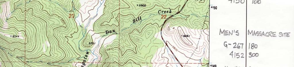
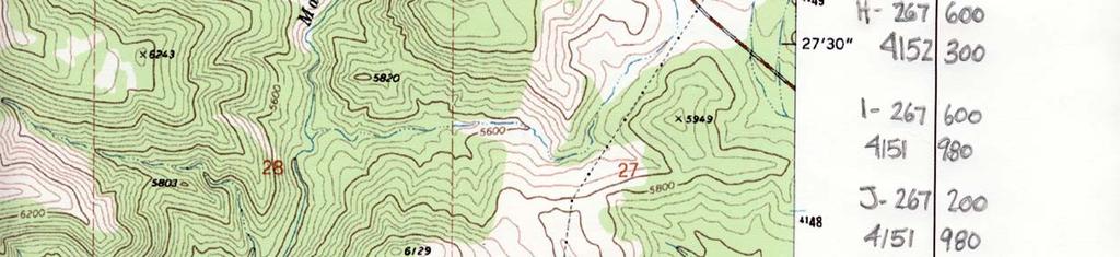

56
Street & Number: West of SR 18, approximately 3 miles North of Central Not for publication: City/Town: Central Vicinity: X
 Page 1 1. NAME OF PROPERTY Historic Name: Mountain Meadows Massacre Site Other Name/Site Number: 2. LOCATION Street & Number: West of SR 18, approximately 3 miles North of Central Not for publication:
Chapter 11, Section 1 Trails to the West. Pages
 Chapter 11, Section 1 Trails to the West Pages 345-349 Many Americans during the Jacksonian Era were restless, curious, and eager to be on the move. The American West drew a variety of settlers. Some looked
Map Exercise Routes West and Territory
 Routes to the West Unit Objective: examine the cause and effects of Independence Movements west & south of the United States; investigate and critique U.S. expansionism under the administrations of Van
Utah. Copyright 2010 LessonSnips
 Utah Utah is located in the middle of the American Southwest between Nevada on the west; Arizona to the south; Colorado to the east; and Idaho and Wyoming to the north. The corners of four states (Utah,
Jump Start. You have 5 minutes to study your Jackson notes for a short 7 question Quiz.
 Jump Start You have 5 minutes to study your Jackson notes for a short 7 question Quiz. All of my copies of the notes are posted on the white board for reference. Please DO NOT take them down. Manifest
The Americans (Survey)
") The Americans (Survey) Chapter 9: TELESCOPING THE TIMES Expanding Markets and Moving West CHAPTER OVERVIEW The economy of the United States grows, and so does the nation s territory, as settlers move west.
The Americans (Survey) Chapter 9: TELESCOPING THE TIMES Expanding Markets and Moving West CHAPTER OVERVIEW The economy of the United States grows, and so does the nation s territory, as settlers move west.
Oregon Country. Adams-Onís Treaty. Mountain Men. Kit Carson. Oregon Trail. Manifest Destiny
 Chapter 11 Section 1: Westward to the Pacific Oregon Country Adams-Onís Treaty Mountain Men Kit Carson Oregon Trail Manifest Destiny Chapter 11 Section 2: Independence for Texas Davy Crockett The area
Mexican-American War Act-It-Out
 Florida Act-It-Out Follow the narration below to create an act-it-out about Florida. When the narrator says Action! the actors will move, act, and speak as described. When the narrator says Audience! the
In the 1840s, westward expansion led Americans to acquire all lands from the Atlantic to Pacific in a movement called Manifest Destiny
 In the 1840s, westward expansion led Americans to acquire all lands from the Atlantic to Pacific in a movement called Manifest Destiny Obvious Future Americans flooded into the West for new economic opportunities
Manifest Destiny,
 Manifest Destiny, 1810 1853 Westward expansion has political, economic, and social effects on the development of the United States. Stephen Fuller Austin, 19thcentury American frontiersman and founder
Between the early 1830s and the mid 1850s, a new political party called the Whigs ran in opposition against the Democrat party of Andrew Jackson.
 Between the early 1830s and the mid 1850s, a new political party called the Whigs ran in opposition against the Democrat party of Andrew Jackson. They believed in congressional supremacy instead of presidential
*On your sticky note depict (draw) the following two words. Acquire. Expansion
 the following two words. Acquire. Expansion") *On your sticky note depict (draw) the following two words. Acquire Expansion The Northwest Ordinance of 1787 1. What did the Northwest Ordinance of 1787 establish? This act established the principles
*On your sticky note depict (draw) the following two words. Acquire Expansion The Northwest Ordinance of 1787 1. What did the Northwest Ordinance of 1787 establish? This act established the principles
Section 1 The Oregon Country: The U.S. was a nation that was destined to be a country that reached from coast to coast.
 Chapter 14 Manifest Destiny Section 1 The Oregon Country: The U.S. was a nation that was destined to be a country that reached from coast to coast. Settlers Move West: The Oregon Country included the present
Missouri. Copyright 2010 LessonSnips
 Missouri Missouri is located in the Midwest, surrounded by the states of Iowa to the north; Nebraska, Kansas and Oklahoma to the west; Arkansas to the south; and Illinois and Kentucky to the east. The
United States History. Robert Taggart
 United States History Robert Taggart Table of Contents To the Student.............................................. v Unit 1: Birth of a Nation Lesson 1: From Colonization to Independence...................
Manifest Destiny and Andrew Jackson
 Manifest Destiny and Andrew Jackson Study online at quizlet.com/_204f5a 1. 13 colonies 4. Andrew Jackson 2. 1849 The original states : Connecticut, Delaware, Georgia, Maryland, massachusetts, New jersey,
Chapter 7 - Manifest Destiny
 Chapter 7 - Manifest Destiny 1) By the time the Civil War began, more Americans lived west of the Appalachians than lived in states along the Atlantic coast 2) Many emigrants headed for California and
WESTWARD EXPANSION II. The Expansion
 WESTWARD EXPANSION II The Expansion GOALS: WHAT I NEED TO KNOW How did the Louisiana Purchase, Texas, the Alamo, the Oregon Trail, California Gold Rush, and development of mining towns help Westward Expansion
SETTLEMENTS TRANSPORTATION & MINING. Chapter 9 Utah Studies
 SETTLEMENTS TRANSPORTATION & MINING Chapter 9 Utah Studies HUNTSVILLE-1860 Seven families led by Jefferson Hunt established Huntsville in 1860. They found Shoshone living in the Ogden Valley and paid a
Mormon Trail, The. William Hill. Published by Utah State University Press. For additional information about this book
 Mormon Trail, The William Hill Published by Utah State University Press Hill, William. Mormon Trail, The: Yesterday and Today. Logan: Utah State University Press, 1996. Project MUSE., https://muse.jhu.edu/.
Westward Expansion. What did the United States look like before Westward Expansion?
 Westward Expansion What did the United States look like before Westward Expansion? In 1803, Thomas Jefferson, the third president of the United States, purchased 828,000 square miles from France. This
8th - CHAPTER 10 EXAM
 Multiple Choice 8th - CHAPTER 10 EXAM Identify the choice that best completes the statement or answers the question. 1. Astoria was a significant region in the Pacific Northwest at the beginning of the
Name: Class Period: Date:
 Name: Class Period: Date: Unit #2 Review E George Washington H Jay s Treaty D Pinckney s Treaty G Treaty of Greenville K Whiskey Rebellion B Marbury v. Madison A. The greatest U.S. victory in the War of
An Overview of U.S. Westward Expansion
 An Overview of U.S. Westward Expansion By History.com on 04.28.17 Word Count 1,231 Level MAX The first Fort Laramie as it looked before 1840. A painting from memory by Alfred Jacob Miller in 1858-60. Fort
Unit 3 Part 2. Analyze the movement toward greater democracy and its impact. Describe the personal and political qualities of Andrew Jackson.
 Unit 3 Part 2 Trace the settlement and development of the Spanish borderlands. Explain the concept of Manifest Destiny. Describe the causes and challenges of westward migration. Explain how Texas won independence
MANIFEST DESTINY Louisiana Territory
 Louisiana Territory 1. Southwest Santa Fe Trail- Independence, MO to Santa Fe, NM, 1 st attempt thru TX and Mexico William Becknell- developed trade route, caravan system - traded goods to settlers 2.
Expanding West. Trails to the West. The Texas Revolution. The Mexican-American War. The California Gold Rush. Section 1: Section 2: Section 3:
 Expanding West Section 1: Trails to the West Section 2: The Texas Revolution Section 3: The Mexican-American War Section 4: The California Gold Rush Section 1: Trails to the West Key Terms & People: John
(2) SIGNIFICANT THEMES AND HIGHLIGHTS
 SIGNIFICANT THEMES AND HIGHLIGHTS") 13 Moving West (1) CHAPTER OUTLINE Narcissa Whitman her husb Marcus, were among thouss of Americans who played a part in the movement into the trans-mississippi West between 1830-1865. The chapter also
13 Moving West (1) CHAPTER OUTLINE Narcissa Whitman her husb Marcus, were among thouss of Americans who played a part in the movement into the trans-mississippi West between 1830-1865. The chapter also
Territorial Utah and The Utah War. Chapter 9
 Territorial Utah and The Utah War Chapter 9 Mormon and Natives Interaction When Brigham Young and the Mormons arrived in Utah the Natives welcomed them. The Natives were excited to have the Mormons in
Manifest Destiny and Westward Expansion
 Manifest Destiny and Westward Expansion Van Buren, Harrison, and Tyler Martin Van Buren was the 8th President from 1837-1841 Indian Removal Amistad Case Diplomacy with Great Britain and Mexico over land
American Westward Expansion
 Chapter 9 Americans Head West In 1800 less than 400,000 settlers lived west of the Appalachian Mountains. By the beginning of the Civil War, more Americans lived west of the Appalachians than lived along
The Mormon Trail: In search of the promised land
 Name Period US History 8 Mr. Tripodi The Mormon Trail: In search of the promised land Directions: 1. Read the paragraph. 2. Present the paragraph a different way. Make meaning out of what you are reading
Doctrine & Covenants and Church History Study Squares
 Doctrine & Covenants and Church History Study Squares As you study the Doctrine and Covenants, use this book to record things you learn in each chapter. Pick a favorite doctrine or principle, something
Assessment: Life in the West
 Name Date Mastering the Content Circle the letter next to the best answer.. Assessment: Life in the West 1. Which of these led to the Lewis and Clark expedition in 1804? A. Monroe Doctrine B. Gadsden Purchase
Western Trails & Settlers
 Western Trails & Settlers Today, you will be able to: Identify selected racial, ethnic, and religious groups that settled in the US and reasons for immigration Westward Trails & Settlers Directions: 1.
Expanding West. Chapter 11 page 342
 Expanding West Chapter 11 page 342 Trails to the West Section 1 Americans Move West In the early 1800s, Americans pushed steadily westward, moving even beyond the territory of the United States Many of
Chapter 2: Historical Overview of Independence
 Chapter 2: Historical Overview of Independence In this chapter you will find: A Brief History of the HISTORICAL OVERVIEW OF INDEPENDENCE Photograph on cover page: Independence County Courthouse remodeled
Who were the Mormons and why did they decide to Head West?
 Who were the Mormons and why did they decide to Head West? Learning Objectives: To understand who the Mormons were and why they were unpopular in the East. To assess how successful their move West was
Today, you will be able to: Identify Explain
 Westward Expansion Today, you will be able to: Identify the major events of the Westward Expansion Era; Explain Manifest Destiny and westward growth of the nation Directions: 1. Write vocabulary words
Chapter 9. Utah s Struggle for Statehood
 Chapter 9 Utah s Struggle for Statehood Introduction In 1849, 2 years after first settling into Utah, Mormon leaders drew up a large region on a map. This new territory would be called the State of Deseret.
Chapter 9 Expanding Markets and Moving West
 Chapter 9 Expanding Markets and Moving West The Market Revolution factory system changed the lives of workers and consumers. People will stop growing and making things for their own survival and begin
Bell work. What do you think when you hear the term Manifest Destiny?
 Bell work What do you think when you hear the term Manifest Destiny? Manifest Destiny and the War with Mexico Essential Question How did the idea of Manifest Destiny affect the movement of Americans across
bk09c - Manifest Destiny ( )
") bk09c - Manifest Destiny (1800-1850) MULTIPLE CHOICE 1. In the 1820s, New Mexico, Texas, and California attracted expansionists because A the U.S. government had influence over Spain. B they were rich
bk09c - Manifest Destiny (1800-1850) MULTIPLE CHOICE 1. In the 1820s, New Mexico, Texas, and California attracted expansionists because A the U.S. government had influence over Spain. B they were rich
Activity Introduction Hey there, I d like to welcome you to today s lesson Defining and Settling Louisiana! It s gonna expand your mind for sure!
 Defining and Settling Louisiana H1092 Activity Introduction Hey there, I d like to welcome you to today s lesson Defining and Settling Louisiana! It s gonna expand your mind for sure! Video 1 Introduction
4. Why did the Mormons move from place to place in their early history? Describe some of the events and issues that led to this movement.
 Name Today s Date Test Date Hour Chapters 6 and 7 Study Guide Their Faces Towards Hope and Settling the Great Basin Notes A Journey for Religious Freedom (pg. 98-99) Chapter 6 1. What was the Great Awakening?
Territorial Utah and The Utah War. Chapter 9
 Territorial Utah and The Utah War Chapter 9 Nativists Many Americans alarmed at growing number of immigrants Nativists want America for the Americans Preserve country for native-born white citizens Favored
The Louisiana Territory Act-It-Out
 I N F O R M ATI O N MASTER A The Louisiana Territory Act-It-Out Follow the narration below to create an act-it-out about the Louisiana Territory. When your teacher says Action!, the actors will move, act,
Chapter 9 UTAH S STRUGGLE FOR STATEHOOD
 Chapter 9 UTAH S STRUGGLE FOR STATEHOOD Introduction In 1849, 2 years after first settling into Utah, Mormon leaders drew up a large region on a map. This new territory would be called the State of Deseret.
Chapter 7. Life in the New Nation ( )
") Chapter 7 Life in the New Nation (1783 1850) America: Pathways to the Present Chapter 7: Life in the New Nation (1783 1850) Section 1: Cultural, Social, and Religious Life Section 2: Trails to the West
Chapter 7 Life in the New Nation (1783 1850) America: Pathways to the Present Chapter 7: Life in the New Nation (1783 1850) Section 1: Cultural, Social, and Religious Life Section 2: Trails to the West
Name: 8 th Grade U.S. History. STAAR Review. Manifest Destiny
 8 th Grade U.S. History STAAR Review Manifest Destiny FORT BURROWS 2018 VOCABULARY Annexation - To take a piece of land and add it to existing territory. Cede - To give up Compromise - An agreement where
Exchange at the Presidio The Mormon Battalion Enters Tucson, 16 December 1846 El Presidio Plaza, Tucson, Pima County, Arizona
 Exchange at the Presidio The Mormon Battalion Enters Tucson, 16 December 1846 El Presidio Plaza, Tucson, Pima County, Arizona TRAIL SEGMENT 2. Main Command TRAIL DATE 16 Dec 1846 DEDICATION DATE 14 Dec
UTAH...THIS IS THE PLACE
 , Gary Francis Music- Gary Francis UTAH...THIS IS THE PLACE (The State Song of Utah) Utah! People working together Utah! What a great place to be. Blessed from Heaven above. It s the land that we love.
Chapter 5 Utah Studies
 Chapter 5 Utah Studies As the beaver trapping industry died out, many mountain men started sharing their stories of west with others. People were fascinated by the stories about California and the Oregon
Chapter 3: Many Flags over Iowa
 Chapter 3: Many Flags over Iowa CONTENT OBJECTIVES IOWA PAST TO PRSENT TEACHERS GUIDE Revised 3 rd Edition Following the completion of the readings and activities for this chapter, students will have acquired
Chapter 13 Westward Expansion ( ) (American Nation Textbook Pages )
 (American Nation Textbook Pages )") Chapter 13 Westward Expansion (1820-1860) (American Nation Textbook Pages 378-405) 1 1. Oregon Country In the spring of 1846 many people were on their way to the western frontier. As the nation grew many
Chapter 13 Westward Expansion (1820-1860) (American Nation Textbook Pages 378-405) 1 1. Oregon Country In the spring of 1846 many people were on their way to the western frontier. As the nation grew many
Mormon Trail, The. William Hill. Published by Utah State University Press. For additional information about this book
 Mormon Trail, The William Hill Published by Utah State University Press Hill, William. Mormon Trail, The: Yesterday and Today. Logan: Utah State University Press, 1996. Project MUSE., https://muse.jhu.edu/.
Section Preview. Manifest Destiny. Section1
 Section Preview As you read, look for: the concept of manifest destiny, the westward expansion of the United States, and vocabulary terms: manifest destiny, annex, and skirmish. Below: Revolting against
Manifest Destiny and U.S Westward Expansion
 Manifest Destiny and U.S Westward Expansion The phrase manifest destiny originated in the nineteenth century, yet the concept behind the phrase originated in the seventeenth century with the first European
Copyright History Matters 2015.
 Copyright History Matters 2015. Social Studies Name: Directions: Use the handout to complete the following timeline assignment. Task Overview Westward Expansion unfolded as a series of key events that
Early Settlers Fact Test 1. Name a mountain range beginning with R where you would find mountain men? 2. Which 2 US States were the early settlers
 Indians fact test 1. What n describes Indians way of life 2, Which dance involved piercing skin 3 What word means marriage to more than one wife 4. Which body part did Indians take after killing an enemy
Mormon Trail, The. William Hill. Published by Utah State University Press. For additional information about this book
 Mormon Trail, The William Hill Published by Utah State University Press Hill, William. Mormon Trail, The: Yesterday and Today. Logan: Utah State University Press, 1996. Project MUSE., https://muse.jhu.edu/.
Supplement to Chapter 17 Conflict and Change in the West
 Supplement to Chapter 17 Conflict and Change in the West 1865-1902 The Native American Though the Native American is portrayed as being a singular stereotype, they were diverse in culture and in lifestyles
The Great Encounter: American Indians Meet Explorers & Mountain Men
 Slide 1 CHAPTER 4 The Great Encounter: American Indians Meet Explorers & Mountain Men Slide 2 The Mood Just as different groups of Native American Indian people had displaced other groups who lived in
Life in the New Nation
 Life in the New Nation United States History Fall, 2014 Cultural, Social, Religious Life How and when did the new nation s identity take shape? Cultural advancement many tried to establish national character
Living In Territorial Utah: culture, business, transportation, and mining. Timeline. Schools in Utah Territory
 Slide 1 Living In Territorial Utah: culture, business, transportation, and mining Chapter 8 Slide 2 Timeline 1850 The University of Deseret (U of U) opens. Utah s first newspaper, the Deseret News, is
U.S. Territorial Acquisitions,
 G E O G R A P H Y C H A L L E N G E U.S. Territorial Acquisitions, 1803 1853 B R I T I S H 130 W C A N A D A E A T G R MO UN TA INS N UNITED STATES, 1800 IA N S P L A I N San Francisco Boston New York
CHAPTER 7. American Indian and Pioneers (Clash of Cultures)
") CHAPTER 7 American Indian and Pioneers (Clash of Cultures) Essential Question 14 One week after the Mormons moved, the Mormons watched a bad fight, Shoshones against the Utes. Why didn t they help stop
CHAPTER 7 American Indian and Pioneers (Clash of Cultures) Essential Question 14 One week after the Mormons moved, the Mormons watched a bad fight, Shoshones against the Utes. Why didn t they help stop
From the Archives: UTAH STATE HISTORICAL SOCIETY 300 Rio Grande Salt Lake City, UT (801)
") From the Archives: Sources 145 From the Archives: Sources UTAH STATE HISTORICAL SOCIETY 300 Rio Grande Salt Lake City, UT 84101-1182 (801) 533-3535 HOURS OF OPERATION 10 a.m.-5 p.m., Monday through Friday
From the Archives: Sources 145 From the Archives: Sources UTAH STATE HISTORICAL SOCIETY 300 Rio Grande Salt Lake City, UT 84101-1182 (801) 533-3535 HOURS OF OPERATION 10 a.m.-5 p.m., Monday through Friday
Manifest Destiny Unit Text Chapter 13
 Manifest Destiny Unit Text Chapter 13 8.58 Describe the concept of Manifest Destiny and its impact on the developing character of the American nation, including the purpose, challenges and economic incentives
Section 3: Expansion in Texas -In 1821 *Stephen F. Austin led the first of several groups of settlers to a fertile area along the Brazos River.
 Chapter 9: Expanding Markets and Moving West Section 1: The Market Revolution *Samuel F. B. Morse- built an electromagnetic telegraph that could send signals through copper wire. This established new communications
Westward Expansion & America s Manifest Destiny
 Westward Expansion & America s Manifest Destiny Manifest Destiny Term first coined by newspaper editor, John O Sullivan in 1845... the right of our manifest destiny to over spread and to possess the whole
Life in the New Nation ( )
") America: Pathways to the Present Chapter 7 Life in the New Nation (1783 1850) Copyright 2005 by Pearson Education, Inc., publishing as Prentice Hall, Upper Saddle River, New Jersey. All rights reserved.
America: Pathways to the Present Chapter 7 Life in the New Nation (1783 1850) Copyright 2005 by Pearson Education, Inc., publishing as Prentice Hall, Upper Saddle River, New Jersey. All rights reserved.
Major Indian White Conflicts U T A H H I S T O R Y C H A P T E R 7
 Major Indian White Conflicts U T A H H I S T O R Y C H A P T E R 7 Native Americans vs. Mormons: Conflicts happened over a period of time. They were sometimes violent, but were usually resolved peacefully.
From the colonial days forward, Americans had continued to move westward. At first, trails were found through the Appalachians as settlers began to
 From the colonial days forward, Americans had continued to move westward. At first, trails were found through the Appalachians as settlers began to move into the fertile lands stretching toward the Mississippi
M/J U. S. History EOC REVIEW M/J U. S. History
 COLONIZATION NAME 1. Compare the relationships of each of the following as to their impact on the colonization of North America and their impact on the lives of Native Americans as they sought an all water
Study Guide: Sunshine State Standards
 Ù Ç È É Ê Ë Ë Ë Ë Ë Ë Ë Ë Ë Ë Ë Ë Ë Ë Ë Ë Ë Ë Ë Ë Ë Ë Ë Ë Ë Ë Ë Ë Ë Ë Ë Ë Ë Ë Ë Ë Ë Ë Ë Ë Ë Ë Ë Ë Ë Ì È Í Ê Ë Ë Ë Ë Ë Ë Ë Ë Ë Ë Ë Ë Ë Ë Ë Ë Ë Ë Ë Ë Î Ï È Ð Ð Ë Ë Ë Ë Ë Ë Ë Ë Ë Ë Ë Ë Ë Ë Study Guide: Chapter
EXPANDING MARKETS & MOVING WEST C H AP T E R 9
 EXPANDING MARKETS & MOVING WEST C H AP T E R 9 MARKET REVOLUTION Becoming more industrialized, especially in the Northeast with textile mills, but also mining was beginning to pay big dividends Farmers
Final Study Guide. Name:
 1. What were the Rocky Mountains formed by? 2. What was the Great Basin formed by? 3. What region of Utah has Utah s national parks in it? 4. What created the smaller mountain ranges in Utah, like the
Technological changes create greater interaction and more economic diversity among the regions of the nation.
 SLIDE 1 Chapter 9 Expanding Markets and Moving West New technologies create links to new markets. Economic opportunity and manifest destiny encourage Americans to head west. The U.S. gains territory in
The Mormons and the Donner Party. BYU Studies copyright 1971
 The Mormons and the Donner Party The Mormons and the Donner Party Eugene E. Campbell A busload of tourists, enroute from San Francisco to Salt Lake City, had stopped at the large stone monument near Donner
A Territory in Turmoil
 A Territory in Turmoil Officials were sent to Utah and some did not want to be here Many came with Bi>er feelings toward the Mormons and some lea with the same. The Utah War 1857-58 The Utah War 1857-58
Chapter 7 Section 2. Crossing the Appalachians
 Chapter 7 Section 2 Crossing the Appalachians With a growing and youthful population, the United States needed space to expand. Young couples dreamed of creating a bright and secure future for themselves
What did Lewis & Clark Do, Anyway?
 What did Lewis & Clark Do, Anyway? Thomas Jefferson sent Meriwether Lewis and William Clark on a great expedition in May, 1804. They set out on a great journey across what was then the Louisiana Territory.
Chapter 8: Living in Territorial Utah. (Culture, Business, Transportation, and Mining)
") Chapter 8: Living in Territorial Utah (Culture, Business, Transportation, and Mining) Introduction When a new community was founded the first people slept in or under their wagons until a more permanent
Chapter 8: Living in Territorial Utah (Culture, Business, Transportation, and Mining) Introduction When a new community was founded the first people slept in or under their wagons until a more permanent
HIST 1301 Part Three. 13: An Age of Expansion
 HIST 1301 Part Three 13: An Age of Expansion Manifest Destiny Trails West A belief in Manifest Destiny led many Americans to go west in the early 1800s. 2 min. 51 sec. [It is] our manifest destiny to overspread
The Mormons and the Settlement of the West
 The Mormons and the Settlement of the West An Online Professional Development Seminar Elliott West Alumni Distinguished Professor of History University of Arkansas Research focuses on the American West
U.S. Territorial Acquisitions,
 Unit 5 Geography Challenge ANSWER KEY U.S. Territorial Acquisitions, 1803 1853 130 W BRITISH CANADA PACIFIC OCEAN W N S E 0 400 800 miles 0 400 800 kilometers Lambert Azimuthal Equal-Area Projection Gulf
CHAPTER 8 CREATING A REPUBLICAN CULTURE, APUSH Mr. Muller
 CHAPTER 8 CREATING A REPUBLICAN CULTURE, 1790-1820 APUSH Mr. Muller AIM: HOW DOES THE NATION BEGIN TO EXPAND? Do Now: A high and honorable feeling generally prevails, and the people begin to assume, more
Texas History 2013 Fall Semester Review
 Texas History 2013 Fall Semester Review #1 According to the colonization laws of 1825, a man who married a Mexican woman. Received extra A: B: land Was not allowed to colonize Had to learn C: D: Spanish
Chapter 13 Manifest Destiny
 Mountain Men and the Rendezvous Chapter 13.1 Trails West Mountain men like JedediahSmith and Jim Beckworth survived by being tough and resourceful. To obtain furs, mountain men roamed the Great Plains
Startling Story of the First Trip From Salt Lake to Los Angeles
 139 Startling Story of the First Trip From Salt Lake to Los Angeles Article from the Deseret Evening News, Saturday, 7 October 1905 Who first crossed the trail to Los Angeles from Salt Lake? The question
THE FIRST WHITE MEN IN UTAH
 THE FIRST WHITE MEN IN UTAH WORDS BY Sam and Gary Francis MUSIC- Sam Cardon Spanish explorers searched to find a way From Santa Fe, New Mexico on to California at Monterey. They traveled through Utah with
The United States Expands West. 1820s 1860s
 The United States Expands West 1820s 1860s President Martin van Buren - #8 Democrat (VP for Jackson s 2 nd term) In office 1837-1841 Promised to continue many of Jackson s policies Firmly opposed the American
Great Pioneer. Projects. Sample file. You Can Build Yourself. Rachel Dickinson
 Great Pioneer Projects You Can Build Yourself Rachel Dickinson Nomad Press A division of Nomad Communications 10 9 8 7 6 5 4 3 2 1 Copyright 2007 by Nomad Press All rights reserved. No part of this book
Mini-Unit Integrating ELA and Social Studies With Maps and Primary Source Documents
 Mini-Unit Integrating ELA and Social Studies With Maps and Primary Source Documents This picture, The Trail of Tears, was painted by Robert Lindneux in 1942. What do you see? Be specific. Trail of Tears
Wife of Anson Call
 A life sketch of Ann Mariah Bowen Call 1834 1924 Wife of Anson Call Ann Mariah Bowen Call was born January 3, 1834, in Bethany, Gennesse County, New York. In her early childhood she, with her parents,
Mormon Trail, The. William Hill. Published by Utah State University Press. For additional information about this book. Accessed 4 May :17 GMT
 Mormon Trail, The William Hill Published by Utah State University Press Hill, William. Mormon Trail, The: Yesterday and Today. Logan: Utah State University Press, 1996. Project MUSE., https://muse.jhu.edu/.
Transcontinental Railroad
 Name 1 Transcontinental Railroad Long Term Questions How have our leaders impacted the growth of the United States? (4.2.2) How did explorers and pioneers impact the growth of the United States? (4.2.1)
EMERY COUNTY PIONEER SETTLERS OF THE 19TH CENTURY
 EMERY COUNTY PIONEER SETTLERS OF THE 19TH CENTURY William Burgess, Jr. William Burgess Jr., like his father was a Utah pioneer of 1848 in the Brigham Young Company, under the direction of that intrepid
Chapter 9 Expanding Markets and Moving West
 Chapter 9 Expanding Markets and Moving West New technologies create links to new markets. Economic opportunity and manifest destiny encourage Americans to head west. The U.S. gains territory in a war with