METES AND BOUNDS DESCRIPTION OF A ACRE TRACT J. H. JONES SURVEY, A-26 BRYAN, BRAZOS COUNTY, TEXAS
|
|
|
- Jared Norton
- 6 years ago
- Views:
Transcription
1
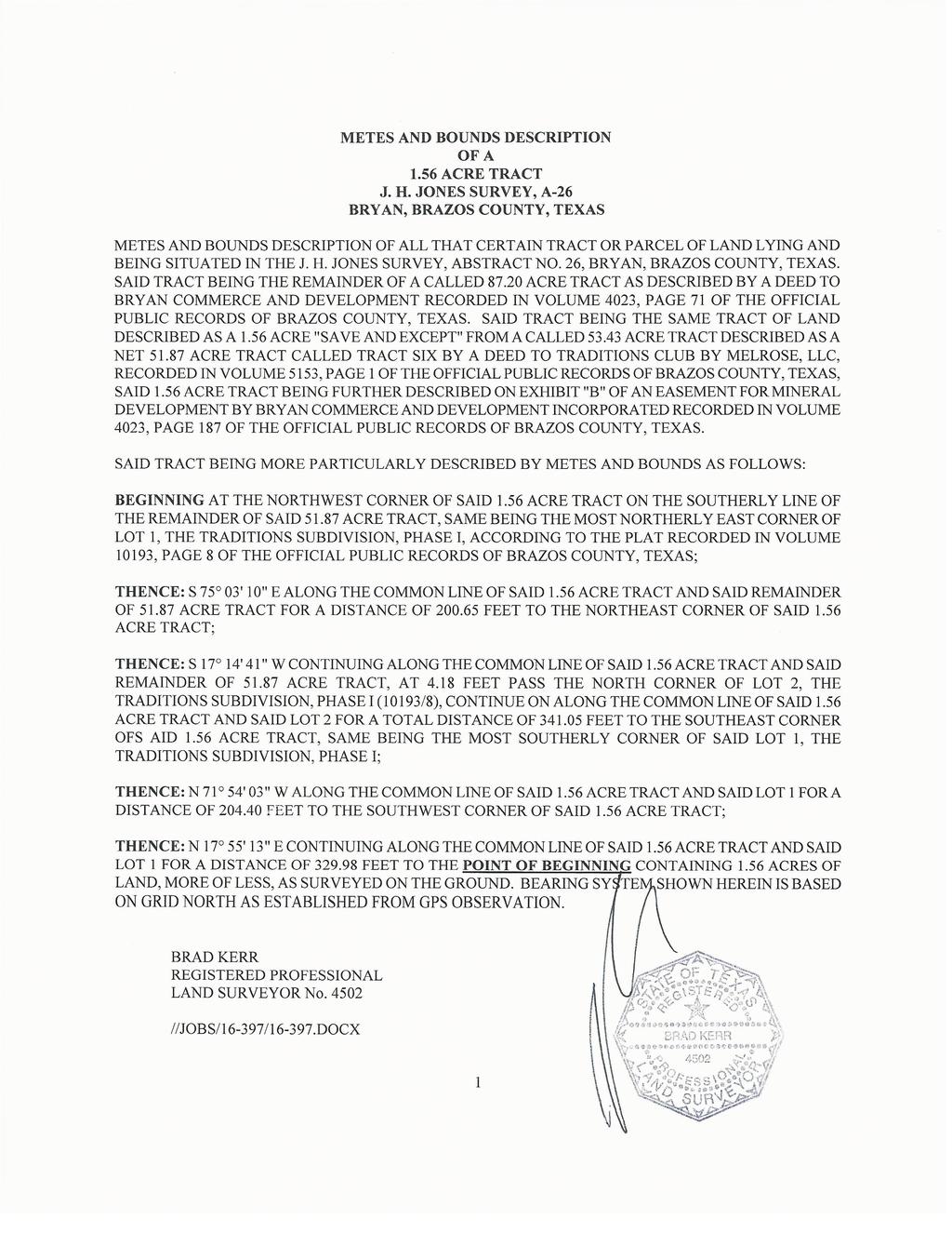
2 METES AND BOUNDS DESCRIPTION OF A ACRE TRACT J. H. JONES SURVEY, A-26 BRYAN, BRAZOS COUNTY, TEXAS METES AND BOUNDS DESCRIPTION OF ALL THAT CERTAIN TRACT OF LAND LYING AND BEING SITUATED IN THE J. H. JONES SURVEY, ABSTRACT NO. 26, BRYAN, BRAZOS COUNTY, TEXAS. SAID TRACT BEING A PORTION OF THE REMAINDER OF A CALLED ACRE TRACT AS DESCRIBED BY A DEED TO BRYAN COMMERCE AND DEVELOPMENT, INC. RECORDED IN VOLUME 4023, PAGE 91 OF THE OFFICIAL PUBLIC RECORDS OF BRAZOS COUNTY, TEXAS. SAID TRACT BEING MORE PARTICULARLY DESCRIBED BY METES AND BOUNDS AS FOLLOWS: BEGINNING AT THE MOST EASTERLY NORTH CORNER OF COMMON AREA I, THE TRADITIONS SUBDIVISION, PHASE 27, ACCORDING TO THE PLAT RECORDED IN VOLUME 12534, PAGE 210 OF THE OFFICIAL PUBLIC RECORDS OF BRAZOS COUNTY, TEXAS, BEING ON THE WEST LINE OF COMMON AREA 2, PHASE 27, MARKING A SOUTHEAST CORNER OF SAID REMAINDER OF ACRE TRACT; THENCE: W ALONG THE COMMON LINE OF SAID REMAINDER OF ACRE TRACT AND SAID COMMON AREA 1 FOR A DISTANCE OF FEET; THENCE: THROUGH SAID REMAINDER OF ACRE TRACT FOR THE FOLLOWING CALLS: N W FOR A DISTANCE OF FEET; W FOR A DISTANCE OF FEET; E FOR A DISTANCE OF FEET TO THE COMMON LINE OF SAID REMAINDER OF ACRE TRACT AND SAID COMMON AREA 1; THENCE: ALONG THE COMMON LINE OF SAID REMAINDER OF ACRE TRACT AND SAID COMMON AREA 1 FOR THE FOLLOWING CALLS: W FOR A DISTANCE OF FEET TO THE BEGINNING OF A CLOCKWISE CURVE HAVING A RADIUS OF FEET; ALONG SAID CURVE THROUGH A CENTRAL ANGLE OF FOR AN ARC DISTANCE OF FEET CHORD BEARS: N W FEET) TO A 1/2 INCH IRON ROD FOUND MARKiNG THE END OF SAID CURVE; N W FOR A DISTANCE OF FEET TO THE NORTHWEST CORNER OF THIS HEREIN DESCRIBED TRACT, FOR REFERENCE A 1/2 INCH IRON ROD FOUND ON THE COMMON LINE OF SAID REMAINDER OF ACRE TRACT AND SAID COMMON AREA 1 BEARS: N W FOR A DISTANCE OF FEET; THENCE: N E THROUGH SAID REMAINDER OF ACRE TRACT FOR A DISTANCE OF FEET TO THE WEST LINE OF SAID COMMON AREA 2 MARKING THE BEGINNING OF A COUNTERCLOCKWISE CURVE HAVING A RADIUS OF FEET; THENCE: ALONG THE COMMON LINE OF SAID REMAINDER OF ACRE TRACT AND SAID COMMON AREA 2 FOR THE FOLLOWING CALLS: ALONG SAID CURVE THROUGH A CENTRAL ANGLE OF FOR AN ARC DISTANCE OF FEET (CHORD BEARS: W FEET) TO THE END OF SAID CURVE; S E FOR A DISTANCE OF FEET TO THE POINT OF BEGINNING CONTAINING OF AN ACRE OF LAND, MORE OR LESS. BEARING SYSTEM SHOWN HEREIN IS BASED ~N GRID NORTH AS ESTABLISHED FROM GPS OBSERVATION. BRAD KERR REGISTERED PROFESSIONAL LAND SURVEYOR No //JOBS/I6-323/16-323A.DOCX 1
3
4
5
6 METES AND BOUNDS DESCRIPTION OFA 7.60 ACRE TRACT J. H. JONES SURVEY, A-26 COLLEGE STATION, BRAZOS COUNTY, TEXAS METES AND BOUNDS DESCRIPTION OF ALL THAT CERTAIN TRACT OR PARCEL OF LAND LYING AND BEING SITUATED IN THE J. H. JONES SURVEY, ABSTRACT NO. 26, COLLEGE STATION, BRAZOS COUNTY, TEXAS. SAID TRACT BEING ALL OF LOT 1, BLOCK 1, THE TRADITIONS SUBDIVISION, PHASE 23, ACCORDING TO THE PLAT RECORDED IN VOLUME 11293, PAGE 184 OF THE OFFICIAL PUBLIC RECORDS OF BRAZOS COUNTY, TEXAS. SAID TRACT BEING MORE PARTICULARLY DESCRIBED BY METES AND BOUNDS AS FOLLOWS: BEGINNING AT A 1/2 INCH IRON ROD FOUND ON THE NORTHEAST LINE OF BIOMEDICAL WAY (63 R.O.W.) MARKING THE SOUTH CORNER OF SAID LOT 1 AND THE WEST CORNER OF LOT 2, BLOCK 1; THENCE: ALONG THE NORTHEAST LINE OF BIOMEDICAL WAY FOR THE FOLLOWING CALLS: N W FOR A DISTANCE OF FEET TO THE BEGINNING OF A CLOCKWISE CURVE HAVING A RADIUS OF FEET; ALONG SAID CURVE THROUGH A CENTRAL ANGLE OF FOR AN ARC DISTANCE OF FEET (CHORD BEARS: N W FEET) TO THE END OF SAID CURVE; N W FOR A DISTANCE OF FEET TO THE BEGiNNING OF A COUNTERCLOCKWISE CURVE HAVING A RADIUS OF FEET; ALONG SAID CURVE THROUGH A CENTRAL ANGLE OF FOR AN ARC DISTANCE OF FEET (CHORD BEARS: N W FEET) TO THE END OF SAID CURVE; N W FOR A DISTANCE OF FEET TO THE BEGINNING OF A CLOCKWISE CURVE HAVING A RADIUS OF FEET; ALONG SAID CURVE THROUGH A CENTRAL ANGLE OF FOR AN ARC DISTANCE OF FEET (CHORD BEARS: N W FEET) 0 THE END OF SAID CURVE ON THE SOUTHEAST LINE OF HSC PARKWAY (120 R.O.W.); THENCE: N 41 51,48 E ALONG THE SOUTHEAST LINE OF HSC PARKWAY FORA DISTANCE OF FEET TO A /2 INCH IRON ROD FOUND MARKING THE NORTH CORNER OF SAID LOT 1 AND THE WEST CORNER OF THE GREENWAY COMMON AREA, THE TRADITIONS SUBDIVISION, PHASE 23; THENCE: ALONG THE COMMON LINE OF SAID LO 1 AND SAID COMMON AREA FOR THE FOLLOWING CALLS: S E FOR A DISTANCE OF FEET; S E FORA DISTANCE OF FEET; S E FORA DISTANCE OF FEET TO A ½ INCH IRON ROD FOUND MARKING THE COMMON CORNER OF SAID LOT 1 AND SAID LOT 2;
7 THENCE: S ~ 48 W ALONG THE COMMON LINE OF SAID COMMON LINE OF SAID LOT 1 AND SAID LOT 2 FOR A DISTANCE OF FEET TO THE POINT OF BEGINNING CONTAINING 7.60 ACRES OF LAND, MORE OF LESS, AS SURVEYED ON THE GROUND. BEARING SYSTEM SHOWN HEREIN IS BASED ON THE PLAT CALL BEARINGS OF THE TRADITIONS SUBDIVISION, PHASE 23, 11293/184. BRAD KERR REGISTERED PROFESSIONAL LAND SURVEYOR No //JOBS/ / DOCX 2
8
9 LOT 1, BLOCK 1, PHASE 101 METES AND BOUNDS DESCRIPTION OFA 8.60 ACRE TRACT J. H. JONES SURVEY, A-26 COLLEGE STATION, BRAZOS COUNTY, TEXAS METES AND BOUNDS DESCRIPTION OF ALL THAT CERTAIN TRACT OR PARCEL OF LAND LYING AND BEING SITUATED IN THE J. H. JONES SURVEY, ABSTRACT NO. 26, COLLEGE STATION, BRAZOS COUNTY, TEXAS. SAID TRACT BEING A PORTION OF THE REMAINDER OF A CALLED ACRE TRACT DESCRIBED AS EXHIBIT A BY A DEED TO BRYAN COMMERCE AND DEVELOPMENT, INC. RECORDED IN VOLUME 4023, PAGE 91 OF THE OFFICIAL PUBLIC RECORDS OF BRAZOS COUNTY, TEXAS. SAID TRACT BEING MORE PARTICULARLY DESCRIBED BY METES AND BOUNDS AS FOLLOWS: BEGINNING AT A 1/2 INCH IRON ROD FOUND ON THE SOUTHEAST LINE OF HSC PARKWAY (120 R.O.W.) MARKING THE WESTERLY CORNER OF SAID REMAINDER OF ACRE TRACT AND THE NORTH CORNER OF HE GREENWAY/COMMON AREA, THE TRADITIONS SUBDIVISION, PHASE 23, ACCORDING TO THE PLAT RECORDED IN VOLUME 11293, PAGE 184 OF THE OFFICIAL PUBLIC RECORDS OF BRAZOS COUNTY, TEXAS, SAID IRON ROD FOUND BEING IN A COUNTERCLOCKWISE CURVE HAVING A RADIUS OF FEET; THENCE: ALONG THE SOUTHEAST LINE OF HSC PARKWAY FOR THE FOLLOWING CALLS: ALONG SAID CURVE THROUGH A CENTRAL ANGLE OF FOR AN ARC DISTANCE OF FEET (CHORD BEARS: N E FEET) TO A V2 INCH IRON ROD FOUND MARKING THE END OF SAID CURVE; N E FOR A DISTANCE OF FEET TO A Y2 INCH IRON ROD FOUND; N E FOR A DISTANCE OF 6.32 FEET TO THE BEGINNING OF A CLOCKWISE CURVE HAVING A RADIUS OF FEET; THENCE: THROUGH SAID REMAINDER OF ACRE TRACT FOR THE FOLLOWING CALLS: ALONG AID CURVE THROUGH A CENTRAL ANGLE OF FOR AN ARC DISTANCE OF FEET (CHORD BEARS: N E FEET) TO THE END OF SAID CURVE; E FOR A DISTANCE OF FEET TO THE BEGINNING OF A COUNTERCLOCKWISE CURVE HAVING A RADIUS OF FEET; ALONG SAID CURVE THROUGH A CENTRAL ANGLE OF FOR AN ARC DISTANCE OF FEET (CHORD BEARS: S E FEET) TO THE END OF SAID CURVE; S E FOR A DISTANCE OF FEET TO THE BEGINNING OF A CLOCKWISE CURVE HAVING A RADIUS OF FEET; ALONG SAID CURVE THROUGH A CENTRAL ANGLE OF FOR AN ARC DISTANCE OF FEET (CHORD BEARS: S E FEET) TO THE END OF SAID CURVE; 1
10 LOT 1, BLOCK 1, PHASE 101 S E FORA DISTANCE OF FEET TO THE BEGINNING OF A CLOCKWISE CURVE HAVING A RADIUS OF FEET; ALONG SAID CURVE THROUGH A CENTRAL ANGLE OF FOR AN ARC DISTANCE OF FEET (CHORD BEARS: S E FEET) TO THE END OF SAID CURVE; S E FORA DISTANCE OF FEET; W FOR A DISTANCE OF FEET TO THE COMMON LINE OF SAID REMAiNDER OF ACRE TRACT AND SAID GREENWAY/COMMON AREA, THE TRADITIONS SUBDIVISION, PHASE 23; THENCE: ALONG THE COMMON LINE OF SAID REMAINDER OF ACRE TRACT AND SAID GREENWAY/COMMON AREA FOR THE FOLLOWING CALLS: N W FOR A DISTANCE OF FEET TO A 1/2 INCH IRON ROD FOUND; N W FOR A DISTANCE OF FEET TO A 1/2 INCH IRON ROD FOUND; N W FOR A DISTANCE OF FEET TO A /~ INCH IRON ROD FOUND; N W FOR A DISTANCE OF FEET TO A 1/2 INCH IRON ROD FOUND; N W FOR A DISTANCE OF FEET TO THE POINT OF BEGINNING CONTAINING 8.60 ACRES OF LAND, MORE OF LESS, AS SURVEYED ON THE GROUND FEBRUARY BEARING SYSTEM SHOWN HEREIN IS BASED ON GRID NORTH AS ESTABLISHED FROM GPS OBSERVATION. BRAD KERR REGISTERED PROFESSIONAL LAND SURVEYOR No //JOBS/ / B.DOCX 2
ORDINANCE
 ORDINANCE 770-2016-16 AN ORDINANCE AMENDING THE ZONING DISTRICT BOUNDARIES OF THE ZONING DISTRICT MAP OF THE CITY OF WEATHERFORD, TEXAS, CONCERNING CERTAIN LAND IDENTIFIED AS ±71.86 ACRES OF THE T. & P.
)OO. E7j. Code. a amended. the properti description in Section t I ORDINANCENO.
OO. E7j. Code. a amended. the properti description in Section t I ORDINANCENO.") )OO 8-15-13 ORDINANCENO. 7 semi I t I E7j An ordinance changing the ioning classification on the followmg property: BEING a tract of land in City Blocks 6574. 6575. 6576, 6577, and 6579 and all of Lot
)OO 8-15-13 ORDINANCENO. 7 semi I t I E7j An ordinance changing the ioning classification on the followmg property: BEING a tract of land in City Blocks 6574. 6575. 6576, 6577, and 6579 and all of Lot
L.L. CURRENT ZONING: R-10M RESIDENTIAL LOTS MIN LOT SIZE 2,500 SF 3 STORY BLDGS. HEIGHT ±40'-0" RETAIL A 5,000 SF 1 STORY BLDG.
 CU Z: - 6' 12' P 4 MP CU Z: -1M C UP 81117 CU Z: -1M L L Z: 1134 C 381 LCM U -2 C, 371 67861646 L - P L Z: 129 C LK PK Z U L 7, F 1 L 26'- ±4 F 8, FC @ F 16 5, 4'- F L P MX U C K P L L Z: 39 C L C L Z:
;\ND ELDRIDGE MEADOW SECTION 3
 ,!.,,~:...." " 1{ '\,",.~ SUPPLEMENTAL DECLARATION ;\ND ANNEXATION AGREEMENT ELDRIDGE MEADOW SECTION 3 Tills ANNEXATION OF PROPERTY INTO CHIMNEY HILL IV COMMUNITY ASSOCIATION, INC. ("Annexation Agreement")
GENERAL BUSINESS ITEMS:
 AGENDA LINDSTROM SPECIAL CITY COUNCIL MEETING THURSDAY, SEPTEMBER 27, 2018 4:30 P.M. Lindstrom City Hall 13292 Sylvan Ave., Lindstrom, MN CALL TO ORDER/PLEDGE: CALL OF ROLL: GENERAL BUSINESS ITEMS: 1.
RESCHEDULED REGULAR MEETING OF THE BOARD OF DIRECTORS OF THE CITY OF TEXARKANA, ARKANSAS SEPTEMBER 3, 2002
 RESCHEDULED REGULAR MEETING OF THE BOARD OF DIRECTORS OF THE CITY OF TEXARKANA, ARKANSAS SEPTEMBER 3, 2002 MEMBERS PRESENT: The Board of Directors of the City of Texarkana, Arkansas, convened in rescheduled
a. The Annexation Area is adjacent to and contiguous to the existing boundaries ofthe City of Jeffersontown; and,
 CITY OF JEFFERSONTOWN JEFFERSON COUNTY, KENTUCKY ORDINANCE NO. 1341, SERIES 2016 AN ORDINANCE ANNEXING TO THE CITY OF JEFFERSONTOWN A CERTAIN TRACT OF LAND IN THE COUNTY OF JEFFERSON, ADJOINING THE PRESENT
ORDINANCE NO WHEREAS, section of the Texas Local Government Code permits cities to reduce its extraterritorial jurisdiction (ETJ); and
; and") ORDINANCE NO. 57-10 AN ORDINANCE OF THE VILLAGE OF THE HILLS, TRAVIS COUNTY, TEXAS, RELEASING EXTRA TERRITORIAL JURISDICTION TO THE CITY OF LAKEWAY AND ACCEPTING AN AREA TO BE RELEASED BY THE CITY OF LAKEWAY
ORDINANCE NO. 57-10 AN ORDINANCE OF THE VILLAGE OF THE HILLS, TRAVIS COUNTY, TEXAS, RELEASING EXTRA TERRITORIAL JURISDICTION TO THE CITY OF LAKEWAY AND ACCEPTING AN AREA TO BE RELEASED BY THE CITY OF LAKEWAY
LEASE SCHEDULE Levi Leiter Estate Minerals Available State of Wyoming Note: All lands subject to withdrawal without notice LEGAL DESCRIPTION
 LEASE SCHEDULE Levi Leiter Estate Minerals Available State of Wyoming Note: All lands subject to withdrawal without notice LEGAL DESCRIPTION ACRES JOHNSON COUNTY, WYOMING (1,159.21 acres) T50N, R77W Sections
SECOND SUPPLEMENTAL TO DECLARATION OF COVENANTS, CONDITIONS, AND RESTRICTIONS STATE OF TEXAS KNOW ALL MEN BY THESE PRESENTS: COUNTY OF GRAYSON
 SECOND SUPPLEMENTAL TO DECLARATION OF COVENANTS, CONDITIONS, AND RESTRICTIONS STATE OF TEXAS KNOW ALL MEN BY THESE PRESENTS: COUNTY OF GRAYSON This First Supplemental to Declaration of Covenants, Conditions
aau REQUEST FOR COUNCIL ACTION Property Conveyance from the Utah Department of Transportation
 Council Meeting of February 8 2012 Agenda Item No REQUEST FOR COUNCIL ACTION SUBJECT SUMMARY Property Conveyance from the Utah Department of Transportation As a condition of a previous Resolution and Ordinance
FIRST AMENDMENT TO ENCROACHMENT LICENSE AGREEMENT LWDD EQUALIZER CANAL NO. 3~112 ~2 LWDD PROJECT NO. 03~6932D.04
 EXHIBIT "1", Page 1 of 9 WILL CALL #166 RETURN TO: LAKE WORTH DRAINAGE DISTRICT 13081 S. MILITARY TRAIL DELRAY BEACH, FL 3484-1105 PREPARED BY: MARK A. PERRY, P.A. 50 SE FOURTH A VENUE DELRAY BEACH, FL
S T A T E O F M I C H I G A N BOARD OF COMMISSIONERS OF THE COUNTY OF ALLEGAN. May 26, 2016
 143-798 S T A T E O F M I C H I G A N BOARD OF COMMISSIONERS OF THE COUNTY OF ALLEGAN May 26, 2016 BOARD OF COMMISSIONERS APPROVE PARTIAL RELEASE PROTECTIVE COVENANTS WHEREAS, on May 2, 2016, the Allegan
ORDINANCE NO , and of Chapter 51 of the Dallas City
 ORDINANCE NO. 16439 12/11/79 An Ordinance amending CHAPTER 51, "COMPREHENSIVE GENERAL ZONING ORDINANCE," of the Dallas City Code, as amended, by permitting the following described property, to-wit: Being
ORDINANCE NO. THE PEOPLE OF THE CITY OF LOS ANGELES DO ORDAIN AS FOLLOWS:
 ORDINANCE NO. 183420 An ordinance of the City of Los Angeles ("City") authorizing and providing for the transfer of certain City-owned real property located within the Porter Ranch area to Porter Ranch
FIRST CHRISTIAN CHURCH BOARD RESOLUTION TO MERGE
 [[The purpose of this resolution is to transfer the real property of Niles Congregational Church to Niles Discovery Church. This needs to be done at the final congregational meeting of Niles Congregational
CITY OF LOGAN ORDINANCE NO AN ORDINANCE VACATING PORTIONS OF RIGHT-OF-WAY COMMONLY KNOWN AS 1200 SOUTH
 CITY OF LOGAN ORDINANCE NO. 14-19 AN ORDINANCE VACATING PORTIONS OF RIGHT-OF-WAY COMMONLY KNOWN AS 1200 SOUTH WHEREAS, the City is desirous to realign the intersection of 1200 South and Highway 89-91 to
Sara Copeland, AICP, Community Development Director. Vacating Right-of-Way in the Armour Road Redevelopment Area
 MEMORANDUM TO: FROM: Mayor and City Council City Administrator Sara Copeland, AICP, Community Development Director DATE: April 4, 2017 RE: Vacating Right-of-Way in the Armour Road Redevelopment Area As
CAPTION HEADING: Quit Claim Deed between the City of Litchfield
 OFFICIAL RECORDS OF MARICOPA COUNTY RECORDER HELEN PURCELL 20150578363 08/ 10/ 2015 02: 48 ELECTRONIC RECORDING 2015Quit- 5-1- 1-- chagollaj WHEN RECORDED RETURN TO: CITY CLERK, City of Litchfield Park
2008R07557 * R * I llllll lllll lllll lllll lllllll Ill lllll lllll lllll lllll llll llllll llll llll. Recording Cover Sheet
 Recording Cover Sheet ORDINANCE NO. 2007-09-099 AN ORDINANCE VACATING A PORTION OF COLER AVENUE BETWEEN PARK STREET AND CHURCH STREET and PLAT MAP SHOWING PUBLIC RIGHT-OF-WAY VACATED I llllll lllll lllll
WHEREAS, the City of Taylor, Texas is a Home Rule City as defined by the TEXAS LOCAL GOVERNMENT CODE (hereinafter referred to as "LGC"); and
; and") ORDINANCE 2010-45 AN ORDINANCE OF THE CITY OF TAYLOR, TEXAS PROVIDING FOR THE ANNEXATION OF THE TRACT OF LAND HEREINAFTER MORE SPECIFICALLY DESCRIBED BY METES AND BOUNDS TO THE CITY OF TAYLOR, TEXAS FOR
ORDINANCE 2010-45 AN ORDINANCE OF THE CITY OF TAYLOR, TEXAS PROVIDING FOR THE ANNEXATION OF THE TRACT OF LAND HEREINAFTER MORE SPECIFICALLY DESCRIBED BY METES AND BOUNDS TO THE CITY OF TAYLOR, TEXAS FOR
AGENDA ITEM COVER SHEET
 AGENDA ITEM COVER SHEET Use this form when submitting items for the Town Council Agenda PUBLIC HEARING No. 05 Meeting Date: August 15, 2017 Requesting Department: Planning Presenter(s): Shelly Mayo, Planner
WHEREAS, the City Council has determined that the annexation is reasonable and necessary to the proper development of the City; and
 BILL NO. ORDINANCE NO. AN ORDINANCE ANNEXING CERAIN ADJACEN ERRIORY INO HE CIY OF WARRENSBURG, MISSOURI, LOCAED A 91 NW 10 ROAD IN HE 800 BLOCK OF WES GAY SREE ON HEN ORH SIDE OF WES GAY SREE WHEREAS,
Our Community Service. by William A. "Steve" Stephens. [Portions Taken from my report to the members of the Moffat Cemetery Assn.]
![Our Community Service. by William A. Steve Stephens. [Portions Taken from my report to the members of the Moffat Cemetery Assn.]](/thumbs/95/125400252.jpg "Our Community Service. by William A. Steve Stephens. [Portions Taken from my report to the members of the Moffat Cemetery Assn.]") Our Community Service by William A. "Steve" Stephens [Portions Taken from my report to the members of the Moffat Cemetery Assn.] We begin with some background. We became involved in the cemetery shortly
Our Community Service by William A. "Steve" Stephens [Portions Taken from my report to the members of the Moffat Cemetery Assn.] We begin with some background. We became involved in the cemetery shortly
May 15, 2018 ADMINISTRATIVE INTERPRETATION DECISION AND FINDINGS PLNZAD
 May 15, 2018 ADMINISTRATIVE INTERPRETATION DECISION AND FINDINGS PLNZAD2018-00262 REQUEST: A request for an administrative interpretation regarding the status of a property located at approximately 1935
BETWEEN ROBERT L. SMITH, of Roxbury, Delaware County and State. of New York, as Executor of the last Will and Testament of Mary A.
 DELAWARE COUNTY COPY OF A DEED ROBERT L. SMITH, Exr. of Last Will and Testament of Mary A. Smith, dec d. and ELLA ARMSTORNG SMITH -to- MICHAEL O HARE H. M. DeKay, County Clerk. THIS INDENTURE, Made the
CITY COUNCIL SPECIAL MEETING MONDAY, NOVEMBER 19, :30 P.M. COUNCIL CHAMBER, CITY HALL 2401 MARKET STREET, BAYTOWN, TEXAS AGENDA
 CITY OF BAYTOWN NOTICE OF MEETING CITY COUNCIL SPECIAL MEETING MONDAY, NOVEMBER 19, 2018 6:30 P.M. COUNCIL CHAMBER, CITY HALL 2401 MARKET STREET, BAYTOWN, TEXAS 77520 AGENDA CALL TO ORDER AND ANNOUNCEMENT
2009R23684 * R * Recording Cover Sheet
 Recording Cover Sheet ORDINANCE NO. 2009-06-070 AN ORDINANCE VACATING COLLEGE COURT MARYLAND DRIVE AND LINCOLN AVENUE) (BETWEEN (PLAT MAP SHOWING PUBLIC RIGHT-OF-WAY VACATED ATTACHED) I llllll lllll lllll
MINUTES OF A REGULAR MEETING OF THE VILLAGE OF NEW LENOX PLAN COMMISSION. Held in the New Lenox Village Hall, 1 Veterans Parkway
 CALL TO ORDER MINUTES OF A REGULAR MEETING OF THE VILLAGE OF NEW LENOX PLAN COMMISSION Held in the New Lenox Village Hall, 1 Veterans Parkway Tuesday, June 16, 2015 7:00 p.m. #15 6 B A regular meeting
WHEREAS, the Alleghany County School Board is vested with title to certain real
 BOUNDARY LINE AGREEMENT BETWEEN FALLING SPRING PRESBYTERIAN CHURCH AND THE ALLEGHANY COUNTY SCHOOL BOARD Prepared by and return to: R.W. Vaught, 355 W. Main Street, Covington, VA 24426 (VSB #17376) Title
S08A1608. WALKER et al. v. SAPELO ISLAND HERITAGE. AUTHORITY et al. In 2006, Jonathan Walker and Linda Woods, on behalf of themselves
 Final Copy 285 Ga. 194 S08A1608. WALKER et al. v. SAPELO ISLAND HERITAGE AUTHORITY et al. Hines, Justice. In 2006, Jonathan Walker and Linda Woods, on behalf of themselves and the similarly situated heirs
City Council Agenda Item #10_ Meeting of June 27, Resolution approving the final plat of LEGACY OAKS 3 rd ADDITION
 City Council Agenda Item #10_ Meeting of June 27, 2016 Brief Description Resolution approving the final plat of LEGACY OAKS 3 rd ADDITION Recommendation Adopt the resolution approving the request Introduction
Treaty signing over Flamborough to the Crown, August 21 st, 1797 (source: Burlington Historical Society)
") Treaty signing over Flamborough to the Crown, August 21 st, 1797 (source: Burlington Historical Society) Transcription of Page One: To Whom all these Presents may Come, Greeting // Whereas we the Principal
Treaty signing over Flamborough to the Crown, August 21 st, 1797 (source: Burlington Historical Society) Transcription of Page One: To Whom all these Presents may Come, Greeting // Whereas we the Principal
MINUTES OF THE CITY OF BURLINGTON CITY COUNCIL MEETING MAY 2, 2017
 MINUTES OF THE CITY OF BURLINGTON CITY COUNCIL MEETING MAY 2, 2017 The City Council of the City of Burlington held a regularly scheduled meeting in the Council Chamber, Municipal Building, 425 South Lexington
Fallacies of the Warren Commission Solution
 Fallacies of the Warren Commission Solution by Thomas Purvis from his unpublished work, There Is No Magic (published with special permission) Altered Evidence By utilizing the services of a Registered
HP-35s Calculator Program Compute Horizontal Curve Values given only 2 Parameters
 Program for HP35s Calculator Page 1 HP-35s Calculator Program Compute Horizontal Curve Values given only 2 Parameters Author: This program is based on a program written by Dr. Bill Hazelton (http://www.wollindina.com/hp-35s/hp-35s_curves_1a.pdf).
Department of Planning & Development Services
 Department of Planning & Development Services S T A F F R E P O R T August 27, 2014 CASE NO: PROJECT: EXECUTIVE SUMMARY: DETAILS: ZA14-023 Preliminary Plat for Silver Ridge Addition Phase III The applicant
MINUTES OF THE MEETING OF THE OTTER TAIL COUNTY BOARD OF ADJUSTMENT Thursday, August 14, 2014
 MINUTES OF THE MEETING OF THE OTTER TAIL COUNTY BOARD OF ADJUSTMENT Thursday, August 14, 2014 The Otter Tail County Board of Adjustment met Thursday, August 14, 2014, with the following persons in attendance:
ACKNOWLEDGEMENT OF RECEIPT OF NOTICE OF MEETING OF THE MAYOR AND CITY COUNCIL OF THE CITY OF DAVID CITY, NEBRASKA
 ACKNOWLEDGEMENT OF RECEIPT OF NOTICE OF MEETING OF THE MAYOR AND CITY COUNCIL OF THE CITY OF DAVID CITY, NEBRASKA The undersigned members of the governing body of the City of David City, Nebraska, hereby
Bradford County Law Journal
 Bradford County Law Journal ISSN 1077-5250 Vol. 5 Tuesday, August 13, 2013 No. 450 The Court: The Honorable Maureen T. Beirne, President Judge Editors: Albert C. Ondrey, Esquire, Chairman Daniel J. Barrett,
Boone County Commission Minutes 1 December December Session of the December Adjourned Term. Boone County Government Center Commission Chambers
 TERM OF COMMISSION: PLACE OF MEETING: PRESENT WERE: December Session of the December Adjourned Term Boone County Government Center Commission Chambers Presiding Commissioner Don Stamper District I Commissioner
N o. 31. Witness our hands this 7 th cay of may 1813 William Long. Joseph Barrow
 N o. 31 State of N o. Carolina } February Term A.D 1813 William Long, William Standen.. Perq s County Court } & William Creacy with the County Surveyor was then and there appointed to divide the Land of
Bradford County Law Journal
 Bradford County Law Journal ISSN 1077-5250 Vol. 5 Tuesday, August 6, 2013 No. 449 The Court: The Honorable Maureen T. Beirne, President Judge Editors: Albert C. Ondrey, Esquire, Chairman Daniel J. Barrett,
AMENDMENTS ARE SHOWN IN LEGISLATIVE FORMAT Text to be added is underlined Text to be deleted is [BRACKETED, CAPITALIZE]
![AMENDMENTS ARE SHOWN IN LEGISLATIVE FORMAT Text to be added is underlined Text to be deleted is [BRACKETED, CAPITALIZE]](/thumbs/80/82344426.jpg "AMENDMENTS ARE SHOWN IN LEGISLATIVE FORMAT Text to be added is underlined Text to be deleted is [BRACKETED, CAPITALIZE]") 1 By: Karl Kassel, Mayor 2 Introduced: June 14, 2018 3 4 s FAIRBANKS NORTH STAR BOROUGH 6 ~ ORDINANCE NO. 2018 1,6 s 9 AN ORDINANCE PROVIDING FOR THE SALE OF REAL PROPERTY to ACQUIRED THROUGH TAX FORECLOSURE
1 By: Karl Kassel, Mayor 2 Introduced: June 14, 2018 3 4 s FAIRBANKS NORTH STAR BOROUGH 6 ~ ORDINANCE NO. 2018 1,6 s 9 AN ORDINANCE PROVIDING FOR THE SALE OF REAL PROPERTY to ACQUIRED THROUGH TAX FORECLOSURE
L.~"' / ~~. :. \y;...-.
 lo. ". ' ~ : i :~:-. ~ :...:).....""'........... --:-- L.~"' / ~~. :. \y;......-...,,....,.. :... - ~- 1 :...,.:., '.....,.1...... :; -... ; ' ~ 4-130 Skf,tcli Map of :M'EC'l(L'E9'{'B'll'l(fj CO'l19'{PY,
 LAND GRANT DOCUMENT THOMAS ETHRIDGE, ROBERT CRANTON. January 9, 1832 WILLIAM THE FOURTH, by the Grace of God, of the United Kingdom of Great- Britain and Ireland, King, Defender of the Faith, and of the
REGULAR MEETING OF THE BOARD OF DIRECTORS OF THE CITY OF TEXARKANA, ARKANSAS MARCH 5, 2012
 REGULAR MEETING OF THE BOARD OF DIRECTORS OF THE CITY OF TEXARKANA, ARKANSAS MARCH 5, 2012 MEMBERS PRESENT: The Board of Directors of the City of Texarkana, Arkansas, convened in regular session at 6:30
Genealogy and NORTH CAROLINA Counties
 1 Genealogy and NORTH CAROLINA Counties An ancestor blessed with longevity could have been born in Rowan County in 1753. married in Burke County in 1778, fathered children in the counties of Burke and
Glade District, Oglethorpe County, Georgia Location: end of Pea Ridge Road, N W
 Glade District, Oglethorpe County, Georgia Location: end of Pea Ridge Road, N 34 00 05 W 83 02 40 Research and narrative by descendants: Mr. Glenn M. Paul and Dr. Michael M. Black Buried in this cemetery
THE LATE GREAT PUGET SOUND MERIDIAN. Washington State s Own Principal Meridian. by Denny DeMeyer
 THE LATE GREAT PUGET SOUND MERIDIAN. Washington State s Own Principal Meridian by Denny DeMeyer Pausing briefly in a clearing in the forest while ascending a ridge just south of Bellingham, the surveyors
Copyright 2016 by Gary Boden and the Exeter Historical Association
 The Horn Heap Among the landmarks of Exeter, there s a nearly forgotten one with a strange alliterative name. It s called the Horn Heap and its story goes back to the very earliest days of the Rhode Island
Old Sandy Baptist Church Graveyard
 Old Sandy Baptist Church Graveyard By Dave Hallemann This original church cemetery is located in T41 R4 Survey 2018 in what was at one time called the Upper Sandy Settlement off Highway 21. It was visited
E.C. JORDAN & CO. Civil Engineers and Land Surveyors, No. 184 MIDDLE STREET. Portland, Me., Jan 16 th 1878
 E.C. JORDAN & CO. Civil Engineers and Land Surveyors, No. 184 MIDDLE STREET Surveys made for the proposed Railroads, Waterworks, Mill Dams, and Storage Reservoirs, surveys of Counties, Towns, House Lots,
HISTORIC SITE FORM - HISTORIC SITES INVENTORY PARK CITY MUNICIPAL CORPORATION (10-08)
") 1 IDENTIFICATION HISTORIC SITE FORM - HISTORIC SITES INVENTORY PARK CITY MUNICIPAL CORPORATION (10-08) Name of Property: St. Mary of the Assumption Catholic Church & School Address: 121 PARK AVE AKA: City,
1 IDENTIFICATION HISTORIC SITE FORM - HISTORIC SITES INVENTORY PARK CITY MUNICIPAL CORPORATION (10-08) Name of Property: St. Mary of the Assumption Catholic Church & School Address: 121 PARK AVE AKA: City,
CITY OF LOGAN ORDINANCE NO
 CITY OF LOGAN ORDINANCE NO. 16-01 Ent 1141562 Bk 1883 Pg 61 Date: 8-Feb-2016 11:52 AM Fee $.00 Cache- County., UT Michael 6leed, Rec. - Filed By KLG For L06AH CITY AN ORDINANCE VACATING PUBLIC RIGHTS-OF-WAY
REGULAR MEETING OF THE BOARD OF DIRECTORS OF THE CITY OF TEXARKANA, ARKANSAS SEPTEMBER 17, 2012
 REGULAR MEETING OF THE BOARD OF DIRECTORS OF THE CITY OF TEXARKANA, ARKANSAS SEPTEMBER 17, 2012 MEMBERS PRESENT: The Board of Directors of the City of Texarkana, Arkansas, convened in regular session at
Part 1: Abijah Fitch as owner/occupant of property at the corner of Genesee and Washington Streets later known as the Auburn Female Seminary.
 1 Abijah Fitch Residence Research Tanya Warren, with the assistance of Bernie Corcoran June 2005 Objective: To understand the significance of the Washington and Genesee Sts. area properties of Abijah Fitch,
ADAMS COMMUNITY REINVESTMENT AREA (CRA)
") ADAMS COMMUNITY REINVESTMENT AREA (CRA) - Proposed Draft Plan Set or Not Set Public Hearing for January 9, 2018 The Board will consider setting a public hearing on the Adams Community Reinvestment Area
ADAMS COMMUNITY REINVESTMENT AREA (CRA) - Proposed Draft Plan Set or Not Set Public Hearing for January 9, 2018 The Board will consider setting a public hearing on the Adams Community Reinvestment Area
sw 668PA485 CITY OF MONTICELLO n U y tqt ` PIATT COUNTY, ILLINOIS ORDINANCE NO
 sw 668PA485 STATE Qf ILLINOIS COUNWOF PIATT: 33S779 Filed r rocurd in d d C ounty CITY OF MONTICELLO 4.0. 116116n U y tqt ` Cto k Aa. m. PIATT COUNTY, ILLINOIS the L on and recor(wi in F3nij1 in ORDINANCE
Proceedings of the KANE COUNTY BOARD KANE COUNTY, ILLINOIS
 Proceedings of the KANE COUNTY BOARD KANE COUNTY, ILLINOIS January 10, 2012 TABLE OF CONTENTS COUNTY BOARD MEETING January 10, 2012 MINUTE APPROVAL Special Board Meeting December 7, 2011... 654 Regular
TRUSTEE S SALE. Publish in the Warren County Record April 18, 25, May 2 and 9, TRUSTEE S SALE. obtained will be used for that purpose.
 Page 8C warrencountyrecord.com Thursday, April 25, 2013 PUBLIC S For default under the terms of the Deed of Trust executed by Edward Spreckelmeyer and Dana Spreckelmeyer, husband and wife, as joint tenants,
City of Round Rock Regular City Council Meeting May 10, 2012
 The Round Rock City Council met in Regular Session on Thursday,, in the Round Rock City Council Chambers located in City Hall at 221 E. Main Street, Round Rock, Texas. CALL SESSION TO ORDER 7:00 P.M. called
MINUTES BOX ELDER COUNTY PLANNING COMMISSION MAY 19, 2005
 MINUTES BOX ELDER COUNTY PLANNING COMMISSION MAY 19, 2005 The Board of Planning Commissioners of Box Elder County, Utah met in the County Commission Chambers at 7:00 p.m. The following members were present
From Thomas Penn and Richard Penn, Proprietaries, incorporating the Trustees
 CHARTER From Thomas Penn and Richard Penn, Proprietaries, incorporating the Trustees. 1764. THOMAS PENN AND RICHARD PENN, ESQS., true and absolute Proprietaries and Governors in Chief of the Counties of
A section of a corner post, two of the horizontal cross members, and a piece of planking in their original positions. Note the doweled joints and the
 A section of a corner post, two of the horizontal cross members, and a piece of planking in their original positions. Note the doweled joints and the angle at which the corner post is cut. The piece of
RESCHEDULED REGULAR MEETING OF THE BOARD OF DIRECTORS OF THE CITY OF TEXARKANA, ARKANSAS JANUARY 17, 2006
 RESCHEDULED REGULAR MEETING OF THE BOARD OF DIRECTORS OF THE CITY OF TEXARKANA, ARKANSAS JANUARY 17, 2006 MEMBERS PRESENT: The Board of Directors of the City of Texarkana, Arkansas, convened in rescheduled
Ccourtesy my of Nnauva. nauvw Restor restoration arim ufim. inc la
 Ccourtesy my of Nnauva nauvw Restor restoration arim ufim alim inc la 408 notes and comments PLATTING THE CITY BEAUTIFUL A historical AND archaeological GLIMPSE OF NAUVOO STREETS donald L enders in the
MINUTES OF THE PUBLIC HEARING OF THE PLANNING COMMISSION OF GARDEN CITY, UTAH
 MINUTES OF THE PUBLIC HEARING OF THE PLANNING COMMISSION OF GARDEN CITY, UTAH The Garden City Planning Commission held a Public Hearing on Thursday, August 27, 2009 at the Garden City Lakeview Center located
Planning and Zoning Staff Report Corp. of Presiding Bishop LDS Church - PH
 Planning and Zoning Staff Report Corp. of Presiding Bishop LDS Church - Hearing Date: February 1, 2018 Development Services Department Applicant/Property Owner: Corp of the Presiding Bishop LDS Church
Allie Brooks Dwight Johnson Linda Borgman Doris Lockhart Karon Epps Jeffrey Tanner Ted Greene. Mark Fountain
 Minutes Regular Meeting of the Florence County Planning Commission Tuesday, July 24, 2018 at 6:00 p.m. County Complex, Room 803 180 N. Irby St., Florence, South Carolina 29501 The Florence County Planning
David Taylor, Karl Kreis, Mark Miller, Terry Witt, Jim Soule, Mike Suttles, Jihad Hillany, Bill Delozier, Mimi Kulp, others.
 MINUTES OF THE CITY OF PIGEON FORGE PLANNING COMMISSION AND BOARD OF ZONING APPEALS TUESDAY JUNE 26, 2012, 3:00 P.M. CITY HALL, PIGEON FORGE, TENNESSEE MEMBERS PRESENT MEMBERS ABSENT Bill Bradley, Chairman
The minutes of the meeting October 25, 2011 were approved on a motion by Commissioner Young. Commissioner Harrell seconded and all voted in favor.
 MINUTES OF THE CITY OF PIGEON FORGE PLANNING COMMISSION AND BOARD OF ZONING APPEALS TUESDAY DECEMBER 13, 2011, 3:00 P.M. CITY HALL, PIGEON FORGE, TENNESSEE MEMBERS PRESENT MEMBERS ABSENT Bill Bradley,
City of Dublin Pre-Council 5:00pm Council 5:30pm Council Meetings
 City of Dublin Pre-Council 5:00pm Council 5:30pm Council Meetings Council Meeting Schedule August 04, 2016: The agenda includes the following: 1. Approval of July 21, 2016 City Council Meeting Minutes.
Properties Exempt from Property Taxation
 TOWN OF CRESTON BYLAW NO. 1847 A Bylaw to exempt certain properties from taxation for the years 2017, 2018 and 2019. WHEREAS the Community Charter provides that Council may, by a bylaw adopted prior to
RESCHEDULED MEETING OF THE BOARD OF DIRECTORS OF THE CITY OF TEXARKANA, ARKANSAS JULY 5, 2006
 RESCHEDULED MEETING OF THE BOARD OF DIRECTORS OF THE CITY OF TEXARKANA, ARKANSAS JULY 5, 2006 MEMBERS PRESENT: The Board of Directors of the City of Texarkana, Arkansas, convened in rescheduled regular
THE EXACT SITE OF FORT WASHINGTON AND DANIEL DRAKE'S ERROR
 THE EXACT SITE OF FORT WASHINGTON AND DANIEL DRAKE'S ERROR by ARTHUR G. KING, M.D. The establishment of Fort Washington in 1789 has been described as the greatest single event in Cincinnati history. The
Fox River Bridge Crossings EIS and Section 4(f) Evaluation Process
 Evaluation Process") T-Bill T-Bill Fox River Bridges Commission 1990 - Formation of the Fox River Bridge Advisory Committee consisting of representatives from townships, municipalities and counties near the Fox River January
T-Bill T-Bill Fox River Bridges Commission 1990 - Formation of the Fox River Bridge Advisory Committee consisting of representatives from townships, municipalities and counties near the Fox River January
A Brief History of Pioneer Cemetery by Douglas Shepard, 2012
 A Brief History of Pioneer Cemetery by Douglas Shepard, 2012 The first death in the new Canadaway community was that of six-year old Hannah Woodcock killed by a felled tree in the dense woods just south
City of Davenport Commission Minutes of November 14, 2016
 Minutes of the Regular Meeting of the City Commission of the City of Davenport, Florida, held Monday, November 14, 2016 at 7:30 p.m. in the Commission Room after having been properly advertised with the
MEADOW SPRINGS FRONT 9 HOMEOWNERS ASSOCIATION Resolution Proposed Division of Association
 I MEADOW SPRINGS FRONT 9 HOMEOWNERS ASSOCIATION Resolution 2015 001 Proposed Division of Association WHEREAS, the owners of lots in the subdivisions of Meadow Springs Nos. 1, 2 and 3, and Fairway Five
Bradford County Law Journal
 Bradford County Law Journal ISSN 1077-5250 Vol. 8 Towanda, PA Tuesday, September 13, 2016 No. 37 The Court: Editors: The Honorable Maureen T. Beirne, President Judge The Honorable Evan S. Williams, III,
Fromme Farm. Henry Elrod
 Fromme Farm By Henry Elrod Boerne, Texas January 8, 2013 Copyright Henry Elrod 2013 Fromme Farm Ever wondered where you live? Sure, you know your address, but what about the history of the place? The land
Bradford County Law Journal
 Bradford County Law Journal ISSN 1077-5250 Vol. 8 Towanda, PA Tuesday, September 6, 2016 No. 36 The Court: Editors: The Honorable Maureen T. Beirne, President Judge The Honorable Evan S. Williams, III,
CALLED MEETING OF THE BOARD OF DIRECTORS OF THE CITY OF TEXARKANA, ARKANSAS MARCH 20, 2013
 CALLED MEETING OF THE BOARD OF DIRECTORS OF THE CITY OF TEXARKANA, ARKANSAS MARCH 20, 2013 MEMBERS PRESENT: The Board of Directors of the City of Texarkana, Arkansas, convened in called session at 3:34
N o. 11. Test John Wood Clk
 N o. 11 State of No. Carolina } August Term A. D. 1810 Perquimans County Court } Ordered that Robert Parker Jesse Newby, Gabriel Newby, Joseph Park & Caleb Elliott with Levi Munden Surveyor divide the
Born 1: November 01, 1746 in: Stafford County, Virginia Born 2: November 01, 1746 in: Overwharton Parrish, Stafford County, Virginia
 Husband: Charles Yelton Born 1: November 01, 1746 Born 2: November 01, 1746 in: Overwharton Parrish, Stafford County, Virginia Married: May 03, 1769 Died: July 02, 1817 in: Bourbon County, Kentucky Father:
Circuit Court, D. Iowa
 YesWeScan: The FEDERAL CASES Case No. 1,142. [5 Dill. 549.] 1 BAYLISS V. POTTAWATTAMIE COUNTY. Circuit Court, D. Iowa. 1878. DEDICATION OF PUBLIC SQUARE IOWA STATUTE ESTOPPEL. The public square in the
ADDENDUM. Chain of Title. Tax Map 144, Parcel A
 Chain of Title Tax Map 144, Parcel A HB 1:618 April 18, 1868 JB10:323 March 12, 1900 NLP 7684:913 June 12, 1990 VJ 14547:444 February 26, 2001 Jane P. Williams to Trustees of the African Methodist Episcopal
MINUTES PITTSBURG PLANNING COMMISSION
 MINUTES OF THE REGULAR MEETING OF THE PITTSBURG PLANNING COMMISSION December 11, 2001 A regular meeting of the Pittsburg Planning Commission was called to order by Chairperson Holmes at 7:30 P.M. on Tuesday,
THE WELLINGTONS OF TRAPELO ROAD by Elizabeth Castner 1
 THE WELLINGTONS OF TRAPELO ROAD by Elizabeth Castner 1 Roger Wellington was in Watertown as early as 1636. He lived first in the eastern part of the town, his homestall being mostly in Mt. Auburn but was
MINUTES OF MEETING HOOVER PLANNING AND ZONING COMMISSION
 MINUTES OF MEETING HOOVER PLANNING AND ZONING COMMISSION Date: Time: 5:30 PM Place: Hoover Municipal Center Present: Mr. Mike Wood, Chairman Mr. Ron Harris Ms. Mari Morrison Mr. Kelly Bakane Mr. Allen
2008 SURVEY OF INDIANA COUNTY SURVEYORS
 THE COUNTY SURVEYOR: 2008 SURVEY OF INDIANA COUNTY SURVEYORS 1. Are you a Registered Land Surveyor or Professional Engineer? a. REGISTERED LS b. PE c. BOTH d. NEITHER 2. Is your position as County Surveyor
Ware Family Graveyard
 Ware Family Graveyard By Dave Hallemann This family graveyard is located through a beautiful secluded valley. This cemetery was located by Dave Hallemann and Carole Goggin in November 2007. 38 o 18 54.5
HISTORIC SITE FORM - HISTORIC SITES INVENTORY PARK CITY MUNICIPAL CORPORATION (10-08)
") 1 IDENTIFICATION HISTORIC SITE FORM - HISTORIC SITES INVENTORY PARK CITY MUNICIPAL CORPORATION (10-08) Name of Property: St. John's Swedish Lutheran Church Address: 323 Park Ave AKA: City, County: Park
1 IDENTIFICATION HISTORIC SITE FORM - HISTORIC SITES INVENTORY PARK CITY MUNICIPAL CORPORATION (10-08) Name of Property: St. John's Swedish Lutheran Church Address: 323 Park Ave AKA: City, County: Park
"Father of Brownwood"
 from; THE PROMISED LAND A HISTORY OF BROWN COUNTY, TEXAS by James C. White "Father of Brownwood" GREENLEAF FISK is a name that is engraved indelibly upon the tablets of Brown County's history, and is known
aare+e MINUTES ROANOKE CITY COUNCIL SPECIAL MEETING MAY 16, 2017 CITY HALL COUNCIL CHAMBERS 108 S. OAK STREET 7: 00 P. M.
 Mo aare+e Dion Jones, Council Member Roanoke Kirby Smith, Council Member Brian Darby, Council Member Steve Heath, Council Member Holly Gray- McPherson, Mayor Pro- Tern Carl E. Gierisch, Jr., Mayor Angie
Weddle CREP Aerial Map
 Weddle CREP Aerial Map R DR OD D R OLD O JESW D AS R ME HO OM TH IO N N AT I AL P KE IE RR CA CT 2.59ac 17.41ac PI OLD NATIONAL KE CREP Contract Easement The parcel lines shown on this map are derived
WHAT WE KNOW ABOUT JONATHAN BURLESON RECEIVED FROM JOE RAPER
 Inherit the Land: Jim Crow Meets Miss Maggie s Will, by former Charlotte Observer reporter Gene Stowe A courtroom battle over ancestral Burleson land in Union County is at the heart of a new book, Inherit
Town of Northumberland Planning Board Minutes Monday, July 16, :00 pm Page 1 of 6 Approved by Planning Board with corrections
 Page 1 of 6 Present: Lofgren Patricia Bryant, Chairperson, James Heber, Susan Martindale, Kevin Pumiglia, Joseph Kowalewski and CJ Absent: Brit Basinger, Vice-Chairperson, Jeff King and Wayne Durr Town
PROCEEDINGS OF THE TERREBONNE PARISH COUNCIL IN SPECIAL SESSION JULY 24, 2017
 PROCEEDINGS OF THE TERREBONNE PARISH COUNCIL IN SPECIAL SESSION JULY 24, 2017 The Chairman, Dirk J. Guidry, called the meeting to order at 5:32 p.m., in the Terrebonne Parish Council Meeting Room for the