Gila Valley Irrigation Ditrht Safford, Arizona
|
|
|
- Myles Emery Bryan
- 6 years ago
- Views:
Transcription

1 Gila Valley Irrigation Ditrht Safford, Arizona

2 Gila Valley Irrigation Ditrkft Safford, Arizona


3 Aerial Photo, Gila Valley Near Saford


4 / (3 May 3, Mr. P. G. Spilsbury, President, Arizona Industrial Congress, Phoenix, Arizona. Dear Sir: Pursuant to your request for an economic survey of lands comprising the Gila Valley Irrigation District, the principal office of which is at Safford, Arizona, there is submitted for your consideration the attached report. Certain data has been taken from reports made by Frank H. Olmsted, who submitted a report in 1917 on flood control and prevention of further erosion of the banks of the Gila for the Secretary of the Interior, and W. R. Parkhill, Federal Land Bank Appraiser for the Federal Land Bank at Berkeley, under date of Noveinber, Acknowledgment is also made to Mr. Hiram Weach for his version of the early settlement ; Mr. J. W. Wright. County Agricultural Agent, for crop report and yields ; Mr. J. P. Condrey, Secretary of the Graham County Chamber of Commerce, for his untiring efforts in making it possible to procure data pertaining to the population, schools and taxable wealth; and to the President, Secretary and Board of Directors of the District for their support which makes this report possible. Yours very truly, P. J. LYNCH, (Mem. AM. SOC. C. E.)


5 OFFICERS OF THE DISTRICT: Gila Valley Irrigation District President Wm. Ellsworth Secretary J. M.. Wilson BOARD OF DIRECTORS Richard G. Layton S. S. Marshall Milton Hines LEGAL ADVISORS Kibbey, Bennett, Gust, Smith and Lyman ENG INEER W. R. Elliott CANAL COMPANIES Union Canal Curtis Kingston Sunflower Brown Union Extension Tourness S outhv ill e Dodge Ft. Thomas Nevada Graham Oregon Layton Layton Extension Michelena San Jose San Jose Extension Safford San Jose Mont ezuma


6 STATISTICS Irrigable area 40,000 acres Now irrigated 32,000 acres Number of farms 890 Average size of farm 36 acres Population of District 14,500 Population of farms 4,450 Annual gross value of crops produced for past 8 years $ 2,050,000 Value of livestock, including sheep, goats, and cattle, poultry and dairy products Estimated valuation of irrigated land, including improvements Annual charge per acre for all water delivered to land, which includes cost of operation and maintenance and betterments $ 3,350,000 13,000,000 $1.50 The canal companies have expended over $400,000 on diversion dams and canals, and these works stand to-day at the mercy of the Gila River when in flood $400, 000 It is unnecessary to provide drainage at this time, as underlying the rich soil is a layer of coarse gravel which permits a return flow of 50% of the water to the river, There is no bonded or other indebtedness against the District.


7 LOCATION: The Gila Valley Irrigation District in Graham County, Arizona, embraces a narrow strip of land approximately2miles in width by 35 miles in length, through which the Gila River winds its way to the lower elevations. HISTORY: Some 50 years after the discovery of America by Columbus, Jesuit priests from Mexico explored the valley and found an irrigation system that was evidently constructed long before the advent of this expedition, which proved that ancient people had attained an advanced degree of civilization in their effort to augment a water supply that nature had not provided. At this time no evidence remained to identify the character of these people. The land had reverted to the desert, but the outline of the canal system still remained. This system was utilized in a small way by Mexicans, who, through the religious influence of the priests, were on rather friendly terms with the Indians. The land north of the Gila River was ceded to the United States Government by Mexico after the war of The area south of the river to the Mexican border was acquired by the Gadsden Purchase in SETTLEMENT AND DEVELOPMENT BY THE WHITE PEOPLE: It was not until 1860 that white trappers from Utah and Colorado, in their quest for beaver fur, entered the valley and spread the information on their return to their native states of the wonderful productivity of the soil. Rugged and hardy men from the Mormon settlement in Salt Lake City established a small settlement near what is now called the town of Solomonville. A greater influx of the members of this faith came in Due to the unfriendly attitude of the Indians, it necessarily followed


8 that the early settlers congregated in a small community to protect their lives. During the next 10-year period little new development was constructed. The beginning of the early eighties saw the Mormons entering in larger bodies, and abriskperiod of construction followed during the next 20 years. IRRIGATED AREA AND SYSTEM: Parallel to the river on both sides is an area of rich soil classified as Maricopa loam that approximates 45,000 acres, 40,000 of which are susceptible of irrigation if suitable works were constructed in the river. There are at present 32,000 acres intensely cultivated and receiving water from 11 separate brush dams in the river, supplying water to 13 independent canal companies. The canal system consists of approximately 200 miles of canals and laterals. Each canal company operates and maintains its own system and assessments are levied and collected by the individual canals after the debt is incurred. WATER SUPPLY: The water shed of the Gila River and its tributaries embraces an area nearly 12,000 square miles, or nearly 6,000 square miles larger than the Salt and Tonto watersheds combined. Snow covered areas on Graham and Gila mountains insure a. constant runoff, as the mountains attain an elevation well over 11,000feet. It is true that during the months of July, August and September there is not sufficient flow of water in the river to provide the necessary water supply during these critical months. The soil survey report of the Solomonville area made in 1904 discusses in a general way the effect this shortage of water has on crops and quoting from the above report, ''The water of the Gila River caused large


9 quantities of sediment and some alkali salts,'' and further states that a chemical analysis of a sample of water taken from the head of the Montezuma canal contained 75 parts of total solids per 100,000, of which calcium sulphate and calcium chloride were less thanhaif the total solids. ''The alluvial sediments are of considerable importance as a fertilizer, as they contain a high percentage of organic and mineral plant nutriments.'' VALUE OF LAND $300 PER ACRE: Partially quoting from report by the engineer appraiser of the Berkeley Federal Land Bank: ''With the classification of the various canal systems as to water supply construction and drainage, it is entirely feasible to make a good comparative estimate of the value of stock under the various systems. It has already been shown that the sale price of stock as claimed is notably not a very true index of the value of stock. It is comparatively easy to place a conservative average value on good farming lands in any community, as there are many sales of such property.'' ''A fair price for well improved farms in the upper end of the Gila Valley, where drainage and construction conditions are most favorable and canals have a Class Il-A supply, is $225 per acre when considering crop production and proper normal values over a period of years.'' With alfalfa at $20 a ton, and ten tons to the acre production, together with an assured permanent water supply, this land is easily worth $300 per acre based on production. ORGANIZATION OF GILA VALLEY IRRIGATION CO.,: It was not until September 8, 1923, that the 13 canal companies agreed to combine all companies and organize an irrigation district under the session laws of the state of Arizona of 1919 and All lands had been acquired under the Homestead law


10 or Desert Act. Water rights were adjudicated by the Arizona state water commissioner and filed with the state. Patents to these lands were granted by the United States. IMPROVEMENT AND UNIT OF OWNERSHIP: The Gila Valley Irrigation District is the largest irrigation project in Arizona, exclusive of the Salt River Valley lands. The early history of the pioneer settlers of the Salt River Valley closely follows that of the Gila settlers save there was no unfriendly interference by the Indians in the Salt River Valley. The thriving towns of Pima, Thatcher, Central, Safford, Solomonville, Fort Thomas and Geronimo grace the valley with paved streets, domestic water supply and electrical distribution, that is only surpassed by communities of much larger population and many years older. Exclusive of the towns, the district shows anappraised valuation of $11,600,000 with improvements totaling $4,500,000, which included houses, barns, silos and farm implements. The livestock industry has an appraised valuation of $2,500,000. The average crop valuation estimates from 1920 show gross return annually of $2,100,000. Eight hundred eighty-five individual farms make an average holding of 36 acres per holding, which is less acreage per unit ownership than that stated by the Salt River project in POPULATION: The entire population of the district including the towns is 14,500 and one-third of this population belongs to the Mormon faith. This religious sect has erected and maintains 13 churches. Schools accommodate an average daily attendance of 2,600 pupils, and Gila College at Thatcher, a non-sectarian institution sponsored by the Mormons, has an enrollment of 300 students.


11 The people who pioneered this valley had to combat the floods of the Gila River coupled with the treacherous activity of the Indians, and much praise is due them for their undaunted courage and perseverence under conditions that would easily have turned back, or exterminated, a less courageous spirit. Mr. Hiram Weach, the oldest pioneer in the Valley, tells a tragic story of his life. Mr. Weach settled near Thatcher in 1869 on the choicest land then in the valley, 160 acres near the stream bed of the Gila, which at that time he describes as a meandering stream of about 140 feet in width, heavily timbered with large cottonwood and willow trees. These trees were cut to provide homes for the early pioneers and shelter for cattle. Floods in the river gradually took his entire 160 acres until today not one acre of his original homestead remains to be cultivated. The kindly old man related this tale with no feeling of animosity toward nature, but rather conveyed a humility that bespoke a faith in the Divine Providence that all things are for the best. His story is but one of many, as it was a constant battle in an attempt to keep the river in its banks during floods. The cutting of these trees removed the barrier which permitted an increased velocity, washing away a channel which is today 2,000 feet wide. With an average gradient of 26 feet to the mile and the channel well defined, this entire valley is subj ect to destruction with a return of a wet year similar to The stream bed today occupies nearly one-half of the entire area of the valley and all this has been done in about five wet years. One flood of January, 1916, washed away nearly 1,200 acres. This was determined by a plane table survey of the Indian Service Department.


12 MARKETS: From an economic standpoint the Upper Gila Valley is highly important, as it has definite markets at either end which are dependent on its agricultural products. The cities of Globe and Miami, employ-. ing thousands of people in the mining industry, and with an estimated population of 19,600, are the outlet for the products of the lower valley. The upper valley serves the towns of Morenci and Clifton, with a population of 7,000. The towns of the valley also supply the outlying ranges, which are used for cattle and sheep. Splendid highways lead from both ends of the valley to these markets. RECOMMENDATION: A survey should be made at once to determine the most strategic points for a dam, or series of dams, to control the flood menace. An investigation should be made to provide storage of sufficient quantity in conjunction with the flood control.


13 CROP YIELD: COTTON--2 bales per acre when water available, maximum yield. WHEAT-4,400 pounds per acre. ALFALFATen tons per acre. A quantity yield that demands a 20 per cent higher price than any alfalfa raised in the Southwest, due to its exceptionally tender fiber and heavy leaf. BARLEY-4,500 pounds per acre. CORN-4,300 pounds per acre. BEANSi, 200 pounds per acre. These are the principal crops raised in the valley.


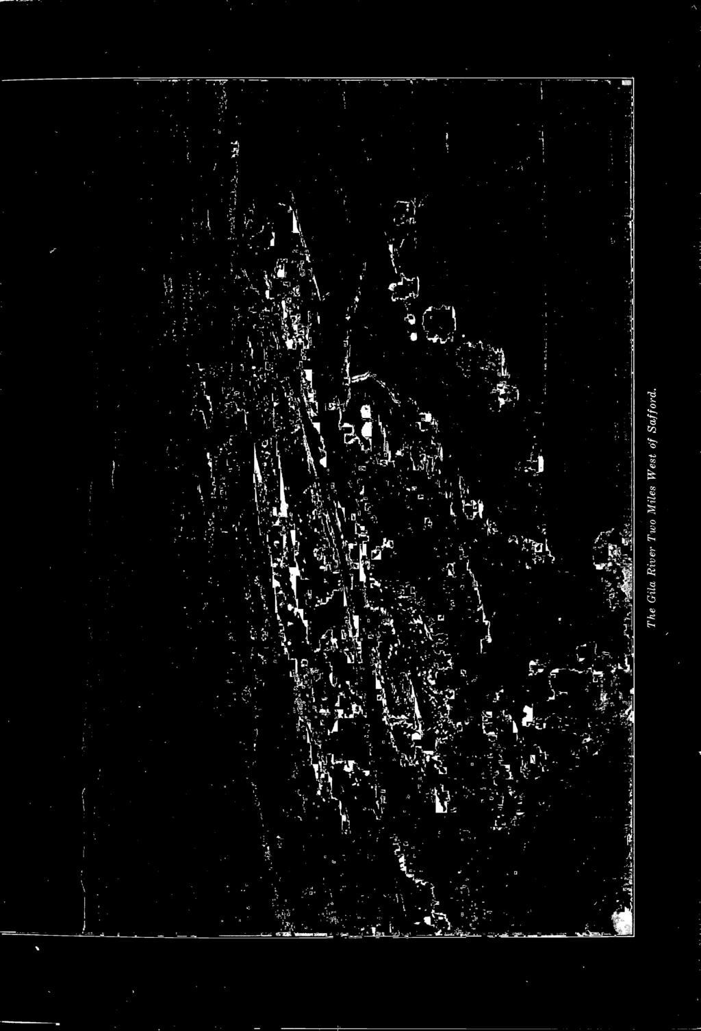
14 The Gila Ri'er Two Miles West of Saffod.


15 fiijh School and Grammar School, Saffoid. High School and Grade School at Thatcher School at Soiornonville

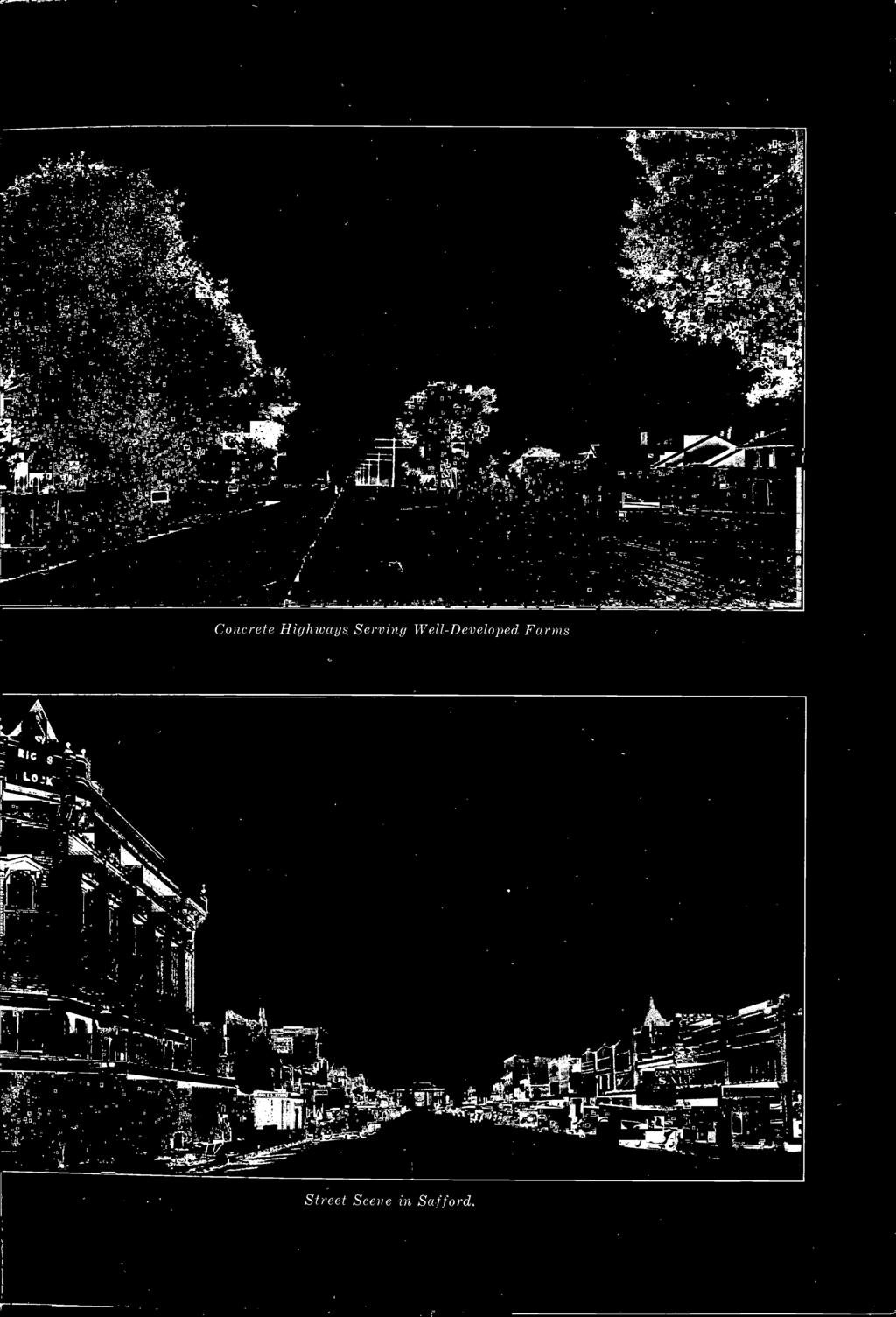
16 Concrete Highways Serving Well-Developed Farms Street Scene in Soffoid.


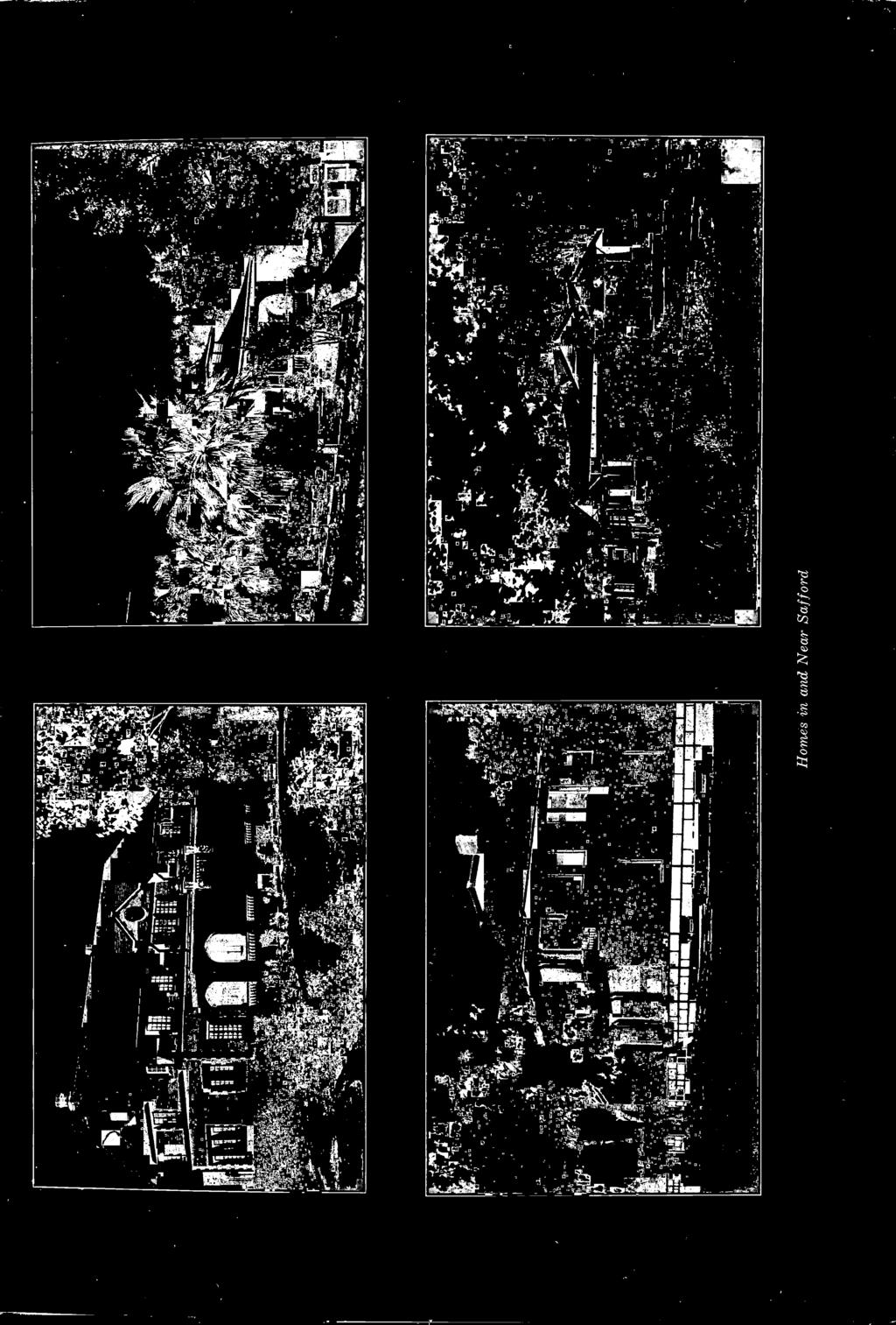
17 Homes in and Near Saf ford


18 Chnrch of Latter Day Saints, Thatcher. Methodist Church, Saffoid


19 Sheep Grazing Near Suffoid Southern Pacific StatioR, Sufford. Industry in Saffoid. Typical Giain Field.


20 Giaharn County Court House, Safford Gila Junior College, Thatcher.
Green fields stretching for some 40 miles along the Upper Gila River in
 CALAMITY ON THE CANALS: Entreprenurial Failure, Legal Quagmires, And Natural Disasters On The Graham County Irrigation Canals, 1895-1993 By George A. Platz Green fields stretching for some 40 miles along
Chapter 3: Removal as a Solution to the Water Crisis?
 Chapter 3: Removal as a Solution to the Water Crisis? In April 1863, Arizona Superintendent of Indian Affairs Charles Poston informed the commissioner of Indian affairs that his most important job was
Western Trails & Settlers
 Western Trails & Settlers Today, you will be able to: Identify selected racial, ethnic, and religious groups that settled in the US and reasons for immigration Westward Trails & Settlers Directions: 1.
The. Lytle R anch Preserve
 The Lytle R anch Preserve Mission Statement The Lytle Ranch Preserve is a remarkable desert laboratory located at the convergence of the Great Basin, Colorado Plateau, and Mojave Desert biogeographical
Khirbet Al Malih profile
 Khirbet Al Malih profile Produced by The Applied Research Institute - Jerusalem In cooperation with Funded by February, 2006 This document has been produced with the financial assistance of the European
Assessment: Life in the West
 Name Date Mastering the Content Circle the letter next to the best answer.. Assessment: Life in the West 1. Which of these led to the Lewis and Clark expedition in 1804? A. Monroe Doctrine B. Gadsden Purchase
Exchange at the Presidio The Mormon Battalion Enters Tucson, 16 December 1846 El Presidio Plaza, Tucson, Pima County, Arizona
 Exchange at the Presidio The Mormon Battalion Enters Tucson, 16 December 1846 El Presidio Plaza, Tucson, Pima County, Arizona TRAIL SEGMENT 2. Main Command TRAIL DATE 16 Dec 1846 DEDICATION DATE 14 Dec
Today, you will be able to: Identify Explain
 Westward Expansion Today, you will be able to: Identify the major events of the Westward Expansion Era; Explain Manifest Destiny and westward growth of the nation Directions: 1. Write vocabulary words
Mesa s Beginning. The Jones (Lehi) Company
 Company") Mesa s Beginning The Jones (Lehi) Company 1875 In late 1876 Mormon Church officials asked Daniel Webster Jones to lead a colonizing party south into Mexico. Jones stated he did not want the responsibility
Mesa s Beginning The Jones (Lehi) Company 1875 In late 1876 Mormon Church officials asked Daniel Webster Jones to lead a colonizing party south into Mexico. Jones stated he did not want the responsibility
Copyright History Matters 2015.
 Copyright History Matters 2015. Social Studies Name: Directions: Use the handout to complete the following timeline assignment. Task Overview Westward Expansion unfolded as a series of key events that
In the 1840s, westward expansion led Americans to acquire all lands from the Atlantic to Pacific in a movement called Manifest Destiny
 In the 1840s, westward expansion led Americans to acquire all lands from the Atlantic to Pacific in a movement called Manifest Destiny Obvious Future Americans flooded into the West for new economic opportunities
Chapter 4 MOUNTAIN MEN
 Chapter 4 MOUNTAIN MEN Jedediah Smith Ethnicity: American Company: Ashley-Henry Company Location: All over Utah Accomplishments: Leader among trappers First to travel the length and width of Utah Proved
The Americans (Survey)
") The Americans (Survey) Chapter 9: TELESCOPING THE TIMES Expanding Markets and Moving West CHAPTER OVERVIEW The economy of the United States grows, and so does the nation s territory, as settlers move west.
The Americans (Survey) Chapter 9: TELESCOPING THE TIMES Expanding Markets and Moving West CHAPTER OVERVIEW The economy of the United States grows, and so does the nation s territory, as settlers move west.
Between the early 1830s and the mid 1850s, a new political party called the Whigs ran in opposition against the Democrat party of Andrew Jackson.
 Between the early 1830s and the mid 1850s, a new political party called the Whigs ran in opposition against the Democrat party of Andrew Jackson. They believed in congressional supremacy instead of presidential
Chapter 11, Section 1 Trails to the West. Pages
 Chapter 11, Section 1 Trails to the West Pages 345-349 Many Americans during the Jacksonian Era were restless, curious, and eager to be on the move. The American West drew a variety of settlers. Some looked
Oregon Country. Adams-Onís Treaty. Mountain Men. Kit Carson. Oregon Trail. Manifest Destiny
 Chapter 11 Section 1: Westward to the Pacific Oregon Country Adams-Onís Treaty Mountain Men Kit Carson Oregon Trail Manifest Destiny Chapter 11 Section 2: Independence for Texas Davy Crockett The area
Utah. Copyright 2010 LessonSnips
 Utah Utah is located in the middle of the American Southwest between Nevada on the west; Arizona to the south; Colorado to the east; and Idaho and Wyoming to the north. The corners of four states (Utah,
8th - CHAPTER 10 EXAM
 Multiple Choice 8th - CHAPTER 10 EXAM Identify the choice that best completes the statement or answers the question. 1. Astoria was a significant region in the Pacific Northwest at the beginning of the
Chapter 9 Expanding Markets and Moving West
 Chapter 9 Expanding Markets and Moving West The Market Revolution factory system changed the lives of workers and consumers. People will stop growing and making things for their own survival and begin
Dear Sir and Father, We treated them as such, and then waited to see what they would do.
 MEMORIAL TO SIR WILFRID LAURIER, PREMIER OF THE DOMINION OF CANADA FROM THE CHIEFS OF THE SHUSWAP, OKANAGAN AND COUTEAU TRIBES OF BRITISH COLUMBIA. PRESENTED AT KAMLOOPS, B.C. AUGUST 25, 1910 Dear Sir
Khirbet Zanuta Profile
 Khirbet Zanuta Profile Prepared by The Applied Research Institute - Jerusalem Funded by Spanish Cooperation Azahar program 2009 0 Acknowledgments ARIJ hereby expresses its deep gratitude to the Spanish
PRE-TEST: Mormon Pioneers in Arizona
 PRE-TEST: Mormon Pioneers in Arizona True or False: 1. The Church of the Latter Day Saints is the largest religious group in Arizona. 2. Maricopa County has the largest percentage of Mormons in the state
Expanding West. Chapter 11 page 342
 Expanding West Chapter 11 page 342 Trails to the West Section 1 Americans Move West In the early 1800s, Americans pushed steadily westward, moving even beyond the territory of the United States Many of
Mexican-American War Act-It-Out
 Florida Act-It-Out Follow the narration below to create an act-it-out about Florida. When the narrator says Action! the actors will move, act, and speak as described. When the narrator says Audience! the
(2) SIGNIFICANT THEMES AND HIGHLIGHTS
 SIGNIFICANT THEMES AND HIGHLIGHTS") 13 Moving West (1) CHAPTER OUTLINE Narcissa Whitman her husb Marcus, were among thouss of Americans who played a part in the movement into the trans-mississippi West between 1830-1865. The chapter also
13 Moving West (1) CHAPTER OUTLINE Narcissa Whitman her husb Marcus, were among thouss of Americans who played a part in the movement into the trans-mississippi West between 1830-1865. The chapter also
Expanding West. Trails to the West. The Texas Revolution. The Mexican-American War. The California Gold Rush. Section 1: Section 2: Section 3:
 Expanding West Section 1: Trails to the West Section 2: The Texas Revolution Section 3: The Mexican-American War Section 4: The California Gold Rush Section 1: Trails to the West Key Terms & People: John
Final Study Guide. Name:
 1. What were the Rocky Mountains formed by? 2. What was the Great Basin formed by? 3. What region of Utah has Utah s national parks in it? 4. What created the smaller mountain ranges in Utah, like the
IDAHO'S UPPER SNAKE RIVER BASIN
 IDAHO'S UPPER SNAKE RIVER BASIN Eagle Rock s (Idaho Falls) Wooden Taylor Toll Bridge in Background and first Railroad Bridge. 1808, It is believed that the first white man to enter the Upper Snake River
SJAFCA SPECIAL BOARD MEETING SEPTEMBER 11, 2017
 SJAFCA SPECIAL BOARD MEETING SEPTEMBER 11, 2017 Mormon Channel History In the early 1900 s the U.S. Army Corps of Engineers constructed a dam across Mormon Slough upstream of Gillis Road and excavated
Planning and Zoning Staff Report Corp. of Presiding Bishop LDS Church - PH
 Planning and Zoning Staff Report Corp. of Presiding Bishop LDS Church - Hearing Date: February 1, 2018 Development Services Department Applicant/Property Owner: Corp of the Presiding Bishop LDS Church
Full name, James Kelvin Henness and I m from Pinal County, Casa Grande, Arizona. Q. So you are a native Arizonan, when did your family come here?
 Interview with Jim Henness Intro (Q): I am Pam Stevenson doing the interview and today is Tuesday, August 3, 2004, and we are here in Phoenix at the SRP Studio at 27th Street and Washington. I will let
Great Pioneer. Projects. Sample file. You Can Build Yourself. Rachel Dickinson
 Great Pioneer Projects You Can Build Yourself Rachel Dickinson Nomad Press A division of Nomad Communications 10 9 8 7 6 5 4 3 2 1 Copyright 2007 by Nomad Press All rights reserved. No part of this book
THE PURPOSE OF THE COMPREHENSIVE PLAN
 I. INTRODUCTION Hereinafter, no action of the community affecting public facilities identified in the comprehensive plan shall be determined until the local commission has reviewed and found it to be substantially
CHAPTER 7. American Indian and Pioneers (Clash of Cultures)
") CHAPTER 7 American Indian and Pioneers (Clash of Cultures) Essential Question 14 One week after the Mormons moved, the Mormons watched a bad fight, Shoshones against the Utes. Why didn t they help stop
CHAPTER 7 American Indian and Pioneers (Clash of Cultures) Essential Question 14 One week after the Mormons moved, the Mormons watched a bad fight, Shoshones against the Utes. Why didn t they help stop
Journey through Time: Arizona, From Territory to Statehood
 Journey through Time: Arizona, From Territory to Statehood What s Your Role? You will be given the name of a person or group who were important to Arizona s early history. Through their eyes, you will
UTAH...THIS IS THE PLACE
 , Gary Francis Music- Gary Francis UTAH...THIS IS THE PLACE (The State Song of Utah) Utah! People working together Utah! What a great place to be. Blessed from Heaven above. It s the land that we love.
*On your sticky note depict (draw) the following two words. Acquire. Expansion
 the following two words. Acquire. Expansion") *On your sticky note depict (draw) the following two words. Acquire Expansion The Northwest Ordinance of 1787 1. What did the Northwest Ordinance of 1787 establish? This act established the principles
*On your sticky note depict (draw) the following two words. Acquire Expansion The Northwest Ordinance of 1787 1. What did the Northwest Ordinance of 1787 establish? This act established the principles
Johnston Farm & Indian Agency. Field Trip Guide
 Johnston Farm & Indian Agency Field Trip Guide Table of Contents Introduction to Field Trip Guide 2 Mission Statement and Schools 3 Objectives and Methods 4 Activities Outline 5 Orientation Information
Church Based Development Project Proposal
 Church Based Development Project Proposal Chipako Community, Zambia Project Background Bright Hope has been working in partnership with Samfya Community of Care Providers (SCCP) in the town of Samfya,
My name is Karen Friesen. My husband, and I and our 2 children, own and
 October 25, 2010 Mr. Chairman, Honorable Members, My name is Karen Friesen. My husband, and I and our 2 children, own and operate a family farm near Niverville. I would like to try to explain to you how
It was near this spot that J. D. Lee operated his ferry across the Colorado. Photo Paul Fretheim
 It was near this spot that J. D. Lee operated his ferry across the Colorado. Photo Paul Fretheim CLICK IN IMAGE TO OPEN A 360 PANO OF THIS LOCATION. Topo Map: Glen Canyon Dam; Coordinates: 36 52 N - 111
Utah Settlement and Mining
 Utah Settlement and Mining Pioneers Enter the Valley July 24, 1847 2 Mormon Holiday Pioneer Day July 24 This is when Brigham Young entered the valley. !! Famous words: THIS IS THE PLACE This is the right
Chapter II: Environmental Setting
 Section 1. Regional Profiles Chapter II: Environmental Setting The Oneida Lake watershed is situated within the Oswego-Seneca-Oneida Rivers Drainage Basin that drains to Lake Ontario, through the Gulf
NOVEMBER 2017 LESSON, ARTIFACT, AND MUSIC. November 2017 DUP Lesson Cove Fort Ellen Taylor Jeppson
 NOVEMBER 2017 LESSON, ARTIFACT, AND MUSIC November 2017 DUP Lesson Cove Fort Ellen Taylor Jeppson The great Mormon pioneer migration to the West began in 1847 when the pioneers made their way to the Salt
Major Indian White Conflicts U T A H H I S T O R Y C H A P T E R 7
 Major Indian White Conflicts U T A H H I S T O R Y C H A P T E R 7 Native Americans vs. Mormons: Conflicts happened over a period of time. They were sometimes violent, but were usually resolved peacefully.
Bell work. What do you think when you hear the term Manifest Destiny?
 Bell work What do you think when you hear the term Manifest Destiny? Manifest Destiny and the War with Mexico Essential Question How did the idea of Manifest Destiny affect the movement of Americans across
The Great Encounter: American Indians Meet Explorers & Mountain Men
 Slide 1 CHAPTER 4 The Great Encounter: American Indians Meet Explorers & Mountain Men Slide 2 The Mood Just as different groups of Native American Indian people had displaced other groups who lived in
Manifest Destiny and Andrew Jackson
 Manifest Destiny and Andrew Jackson Study online at quizlet.com/_204f5a 1. 13 colonies 4. Andrew Jackson 2. 1849 The original states : Connecticut, Delaware, Georgia, Maryland, massachusetts, New jersey,
Chapter 13 Westward Expansion ( ) (American Nation Textbook Pages )
 (American Nation Textbook Pages )") Chapter 13 Westward Expansion (1820-1860) (American Nation Textbook Pages 378-405) 1 1. Oregon Country In the spring of 1846 many people were on their way to the western frontier. As the nation grew many
Chapter 13 Westward Expansion (1820-1860) (American Nation Textbook Pages 378-405) 1 1. Oregon Country In the spring of 1846 many people were on their way to the western frontier. As the nation grew many
MANIFEST DESTINY Louisiana Territory
 Louisiana Territory 1. Southwest Santa Fe Trail- Independence, MO to Santa Fe, NM, 1 st attempt thru TX and Mexico William Becknell- developed trade route, caravan system - traded goods to settlers 2.
AREA OVERVIEW WELLSVILLE AREA
 7877 US 89 WELLSVILLE UT 84339 Exclusively Marketed by: OFFERING MEMORANDUM BEGIN This statement with the information it contains is given with the understanding that negotiations relating to the purchase,
(29) Brooke Smith Was a Builder
 Brooke Smith Was a Builder") Continuation of; THE PROMISED LAND A HISTORY OF BROWN COUNTY, TEXAS by James C. White (29) Brooke Smith Was a Builder BROOKE SMITH came to Brownwood February 8, 1876, at the age of 23. He died here in
Continuation of; THE PROMISED LAND A HISTORY OF BROWN COUNTY, TEXAS by James C. White (29) Brooke Smith Was a Builder BROOKE SMITH came to Brownwood February 8, 1876, at the age of 23. He died here in
Section 3: Expansion in Texas -In 1821 *Stephen F. Austin led the first of several groups of settlers to a fertile area along the Brazos River.
 Chapter 9: Expanding Markets and Moving West Section 1: The Market Revolution *Samuel F. B. Morse- built an electromagnetic telegraph that could send signals through copper wire. This established new communications
Map Exercise Routes West and Territory
 Routes to the West Unit Objective: examine the cause and effects of Independence Movements west & south of the United States; investigate and critique U.S. expansionism under the administrations of Van
THE FIRST WHITE MEN IN UTAH
 THE FIRST WHITE MEN IN UTAH WORDS BY Sam and Gary Francis MUSIC- Sam Cardon Spanish explorers searched to find a way From Santa Fe, New Mexico on to California at Monterey. They traveled through Utah with
Chapter 5 Colonization and the Empresarios
 Lone Star: The Story of Texas Chapter 5 Colonization and the Empresarios (1821-1836) Copyright 2003 by Pearson Education, Inc., publishing as Prentice Hall, Upper Saddle River, NJ. All rights reserved.
An Overview of U.S. Westward Expansion
 An Overview of U.S. Westward Expansion By History.com on 04.28.17 Word Count 1,231 Level MAX The first Fort Laramie as it looked before 1840. A painting from memory by Alfred Jacob Miller in 1858-60. Fort
Historian ISDUP LIBRARY REMINDERS
 10 Daughters of the Future Keepers of the Past Historian Objective: Perpetuate the names and achievements of the men, women, and children who were the pioneers in founding this commonwealth, by preserving
Austin Douglas Allen Papers,
 Overview of the Collection Title Austin Douglas Allen Papers Dates 1946-1997 (inclusive) 1946 1997 Quantity 11 boxes, (5 Linear Feet) Collection Number USU_COLL MSS 382 Summary This collection contains
Ch. 5-6 Utah Pioneers
 Ch. 5-6 Utah Pioneers History of Utah Immigration Spanish Explorers (late 1700s) Mountain Men (early 1800s-1840) Mormon Pioneers (1847-1890) Workers for Railroad and Mines (1890s-1920) Hispanics looking
Manifest Destiny and Westward Expansion
 Manifest Destiny and Westward Expansion Van Buren, Harrison, and Tyler Martin Van Buren was the 8th President from 1837-1841 Indian Removal Amistad Case Diplomacy with Great Britain and Mexico over land
ALABAMA REGISTER OF LANDMARKS & HERITAGE NOMINATION FORM. Historic Name: and/or Common Name:
 ALABAMA REGISTER OF LANDMARKS & HERITAGE NOMINATION FORM 1. NAME OF PROPERTY Historic Name: and/or Common Name: Preferred name for Certificate: Historic Name or Common Name 2. LOCATION Street & Number:
How did the Transcontinental Railroad Change Utah s Economy?
 How did the Transcontinental Railroad Change Utah s Economy? GRADE 4 How did the Transcontinental Railroad Change Utah s Economy? By Rebecca Kirkman Summary Students will read about how the railroad changed
Section 1 The Oregon Country: The U.S. was a nation that was destined to be a country that reached from coast to coast.
 Chapter 14 Manifest Destiny Section 1 The Oregon Country: The U.S. was a nation that was destined to be a country that reached from coast to coast. Settlers Move West: The Oregon Country included the present
Comal Settlement CONTEXT
 Comal Settlement CONTEXT Comal, Texas (now an annexed portion of Schertz, Texas) sits amidst land through which traverses the El Camino Real de los Tejas Historic National Trail System (AKA: Kings Highway
2. The Cowboy tradition. 3. Mining Industry. 3. Life on the Plains. 4. Facts, myths and legends
 1. Settlement of the Great Plains, 1860 to 1890 Homestead Act of 1862 Great Plains Indians Conflicts with Indians U.S. Indian Policy Treaties and Reservations Dawes Act of 1887--- Americanize Indians Indian
From the Archives: UTAH STATE HISTORICAL SOCIETY 300 Rio Grande Salt Lake City, UT (801)
") From the Archives: Sources 145 From the Archives: Sources UTAH STATE HISTORICAL SOCIETY 300 Rio Grande Salt Lake City, UT 84101-1182 (801) 533-3535 HOURS OF OPERATION 10 a.m.-5 p.m., Monday through Friday
From the Archives: Sources 145 From the Archives: Sources UTAH STATE HISTORICAL SOCIETY 300 Rio Grande Salt Lake City, UT 84101-1182 (801) 533-3535 HOURS OF OPERATION 10 a.m.-5 p.m., Monday through Friday
THE ALLEY SHOPS PORTFOLIO SALE
 THE 1326-1330 & 1420-1426 REISTERSTOWN ROAD, PIKESVILLE, MD 21208 Gilbert R. Trout 443.921.9332 gtrout@troutdaniel.com Table Of Contents Conidentiality & Disclaimer All materials and information received
Who were the Mountain Men?
 Mountain Men Who were the Mountain Men? Inspired by the adventures of Lewis and Clark, thousands of explorers and fur trappers roamed the American Rocky Mountains from about 1810 to the early 1840s. Today
Chapter 13 Manifest Destiny
 Mountain Men and the Rendezvous Chapter 13.1 Trails West Mountain men like JedediahSmith and Jim Beckworth survived by being tough and resourceful. To obtain furs, mountain men roamed the Great Plains
Name: 8 th Grade U.S. History. STAAR Review. Manifest Destiny
 8 th Grade U.S. History STAAR Review Manifest Destiny FORT BURROWS 2018 VOCABULARY Annexation - To take a piece of land and add it to existing territory. Cede - To give up Compromise - An agreement where
7-1: Austin Establishes a Colony. Created By Mrs. Phillips
 7-1: Austin Establishes a Colony Created By Mrs. Phillips Moses Austin Paves the Way Moses Austin was the first Anglo American to get permission from Spain to bring American settlers to Texas. He lost
BR: D4. What pattern can you see in the landscape in Utah that is from the early Mormon Colonizing days? Explain:
 BR: D4 What pattern can you see in the landscape in Utah that is from the early Mormon Colonizing days? Explain: Utah Studies Settling the Great Basin Ch. 7.2 Mormon / Latter-Day Saint Towns Gathering
Mormon Trail, The. William Hill. Published by Utah State University Press. For additional information about this book
 Mormon Trail, The William Hill Published by Utah State University Press Hill, William. Mormon Trail, The: Yesterday and Today. Logan: Utah State University Press, 1996. Project MUSE., https://muse.jhu.edu/.
Early Settlers Fact Test 1. Name a mountain range beginning with R where you would find mountain men? 2. Which 2 US States were the early settlers
 Indians fact test 1. What n describes Indians way of life 2, Which dance involved piercing skin 3 What word means marriage to more than one wife 4. Which body part did Indians take after killing an enemy
SETTLEMENTS TRANSPORTATION & MINING. Chapter 9 Utah Studies
 SETTLEMENTS TRANSPORTATION & MINING Chapter 9 Utah Studies HUNTSVILLE-1860 Seven families led by Jefferson Hunt established Huntsville in 1860. They found Shoshone living in the Ogden Valley and paid a
Missouri. Copyright 2010 LessonSnips
 Missouri Missouri is located in the Midwest, surrounded by the states of Iowa to the north; Nebraska, Kansas and Oklahoma to the west; Arkansas to the south; and Illinois and Kentucky to the east. The
Chapter 8: Living in Territorial Utah. (Culture, Business, Transportation, and Mining)
") Chapter 8: Living in Territorial Utah (Culture, Business, Transportation, and Mining) Introduction When a new community was founded the first people slept in or under their wagons until a more permanent
Chapter 8: Living in Territorial Utah (Culture, Business, Transportation, and Mining) Introduction When a new community was founded the first people slept in or under their wagons until a more permanent
In March of 1853, the United States Congress made public lands in California subject to
 1 In March of 1853, the United States Congress made public lands in California subject to Federal preemption laws. Government land was public land. Mormon leaders selected eight groups to survey the land
Chapter 5 Utah Studies
 Chapter 5 Utah Studies As the beaver trapping industry died out, many mountain men started sharing their stories of west with others. People were fascinated by the stories about California and the Oregon
SETTLEMENT AND GROWTH OF THE GILA VALLEY IN GRAHAM COUNTY AS A MORMON COLONY 1879 TO "by. Oran A. Williams. A Thesis
 SETTLEMENT AND GROWTH OF THE GILA VALLEY IN GRAHAM COUNTY AS A MORMON COLONY 1879 TO 1900 "by Oran A. Williams A Thesis 'submitted to the faculty of the Department of History in partial fulfillment of
United States History. Robert Taggart
 United States History Robert Taggart Table of Contents To the Student.............................................. v Unit 1: Birth of a Nation Lesson 1: From Colonization to Independence...................
Study Guide: Sunshine State Standards
 Ù Ç È É Ê Ë Ë Ë Ë Ë Ë Ë Ë Ë Ë Ë Ë Ë Ë Ë Ë Ë Ë Ë Ë Ë Ë Ë Ë Ë Ë Ë Ë Ë Ë Ë Ë Ë Ë Ë Ë Ë Ë Ë Ë Ë Ë Ë Ë Ë Ì È Í Ê Ë Ë Ë Ë Ë Ë Ë Ë Ë Ë Ë Ë Ë Ë Ë Ë Ë Ë Ë Ë Î Ï È Ð Ð Ë Ë Ë Ë Ë Ë Ë Ë Ë Ë Ë Ë Ë Ë Study Guide: Chapter
Manifest Destiny,
 Manifest Destiny, 1810 1853 Westward expansion has political, economic, and social effects on the development of the United States. Stephen Fuller Austin, 19thcentury American frontiersman and founder
Deseret News / Manti, Utah / Marriott, J. Willard / Snow College
 Brigham Young University BYU ScholarsArchive All Faculty Publications 2000 Deseret News / Manti, Utah / Marriott, J. Willard / Snow College J. Michael Hunter Brigham Young University - Provo, mike_hunter@byu.edu
Fanny Cropper Powell Camp Heritage Hall 4365 South 4000 West, Deseret, Utah 84624
 Fanny Cropper Powell Camp Heritage Hall 4365 South 4000 West, Deseret, Utah 84624 Stove The stove is out of John and Musetta Western home that was next door to our Heritage Hall. They were married in 1892,
Bradley Rymph IN THE FOOTSTEPS OF OUR ANCESTORS
 IN THE FOOTSTEPS OF OUR ANCESTORS RESTLESS PIONEERS Samuel Wilson King (1827 1905) & Margaret Taylor Gerrard (1831 1892) / Albert James Rymph (1851 1926) & Luella Maria King (1861 1949) Bradley Rymph The
AGRICULTURE ADVISORY COMMITTEE
 AGRICULTURE ADVISORY COMMITTEE The Indian River County (IRC) Agriculture Advisory Committee (AAC) met at 2:00 P.M. on Thursday, October 27, 2011 in the County Administration Building B, Conference Room
Name: Class Period: Date:
 Name: Class Period: Date: Unit #2 Review E George Washington H Jay s Treaty D Pinckney s Treaty G Treaty of Greenville K Whiskey Rebellion B Marbury v. Madison A. The greatest U.S. victory in the War of
NOTES AND DOCUMENTS. SPENCER ARMSTRONG TO ABRAHAM SHANKLIN, August 15,16,1864 [A.L.S.] COBB RIVER P.O. WASECA COUNTY MINN.^
![NOTES AND DOCUMENTS. SPENCER ARMSTRONG TO ABRAHAM SHANKLIN, August 15,16,1864 [A.L.S.] COBB RIVER P.O. WASECA COUNTY MINN.^](/thumbs/94/120337734.jpg "NOTES AND DOCUMENTS. SPENCER ARMSTRONG TO ABRAHAM SHANKLIN, August 15,16,1864 [A.L.S.] COBB RIVER P.O. WASECA COUNTY MINN.^") NOTES AND DOCUMENTS PROMOTING SETTLEMENT IN THE SIXTIES The following letter was written In 1864 by Spencer Armstrong, who emigrated from Indiana and settled In northern Faribault County, Minnesota, to
NOTES AND DOCUMENTS PROMOTING SETTLEMENT IN THE SIXTIES The following letter was written In 1864 by Spencer Armstrong, who emigrated from Indiana and settled In northern Faribault County, Minnesota, to
Listing 502 descendants for 8 generations.
 Posterity of Mary Vance Polly (Young) Lee (1812 1877) Compiled by Lorraine (Richardson) Manderscheid Web site with listings of John Doyle Lee s wives and descendants http://www.wadhome.org/lee/edition_1
Who were the Mormons and why did they decide to Head West?
 Who were the Mormons and why did they decide to Head West? Learning Objectives: To understand who the Mormons were and why they were unpopular in the East. To assess how successful their move West was
Activity Introduction Hey there, I d like to welcome you to today s lesson Defining and Settling Louisiana! It s gonna expand your mind for sure!
 Defining and Settling Louisiana H1092 Activity Introduction Hey there, I d like to welcome you to today s lesson Defining and Settling Louisiana! It s gonna expand your mind for sure! Video 1 Introduction
Father of a Prophet. Andrew Kimball. Edward L. Kimball with research by Spencer W. Kimball. BYU Studies Provo, Utah
 Father of a Prophet Andrew Kimball Edward L. Kimball with research by Spencer W. Kimball BYU Studies Provo, Utah This volume is part of the BYU Studies series Biographies in Latter-day Saint History Other
Supreme Court of the United States
 No. ================================================================ In The Supreme Court of the United States --------------------------------- --------------------------------- PHELPS DODGE CORPORATION,
WRAPPED ROUND FARMING. David Smith of Bagley Grange.
 WRAPPED ROUND FARMING. David Smith of Bagley Grange. It became very obvious in preliminary discussions with David that his living memories covered a very broad canvas. The Smith family are connected to
St. Thomas, Nevada, Visual Field Guide Lake Mead NRA Visual Field Guide
 St. Thomas, Nevada, Visual Field Guide Lake Mead NRA St. Thomas, Visual Field Guide Nevada Explore the ruins of a real western town once underneath Lake Mead. Table of Contents 1 Cover 2 Table of Contents
Chapter 3: Many Flags over Iowa
 Chapter 3: Many Flags over Iowa CONTENT OBJECTIVES IOWA PAST TO PRSENT TEACHERS GUIDE Revised 3 rd Edition Following the completion of the readings and activities for this chapter, students will have acquired
Shared on QualifyGate.com
 SAIL Exam General Awareness 1. Which of the following is not a rabi crop? (a) Wheat (b) Barley (c) Jute (d) Rapeseed 2. Blue Revolution is associated with (a) Fish (b) Milk (c) flower (d) Litmus 3. Study
Technological changes create greater interaction and more economic diversity among the regions of the nation.
 SLIDE 1 Chapter 9 Expanding Markets and Moving West New technologies create links to new markets. Economic opportunity and manifest destiny encourage Americans to head west. The U.S. gains territory in